Mézériat
Commune in Auvergne-Rhône-Alpes, France
You can help expand this article with text translated from the corresponding article in French. (December 2008) Click [show] for important translation instructions.
- View a machine-translated version of the French article.
- Machine translation, like DeepL or Google Translate, is a useful starting point for translations, but translators must revise errors as necessary and confirm that the translation is accurate, rather than simply copy-pasting machine-translated text into the English Wikipedia.
- Do not translate text that appears unreliable or low-quality. If possible, verify the text with references provided in the foreign-language article.
- You must provide copyright attribution in the edit summary accompanying your translation by providing an interlanguage link to the source of your translation. A model attribution edit summary is
Content in this edit is translated from the existing French Wikipedia article at [[:fr:Mézériat]]; see its history for attribution. - You may also add the template
{{Translated|fr|Mézériat}}to the talk page. - For more guidance, see Wikipedia:Translation.
Commune in Auvergne-Rhône-Alpes, France
Mézériat | ||
|---|---|---|
Commune | ||
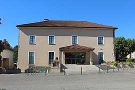 Town hall | ||
Location of Mézériat  | ||
(2020–2026) Guy Dupuit[1] | | |
| Area 1 | 19.17 km2 (7.40 sq mi) | |
| Population (2021)[2] | 2,192 | |
| • Density | 110/km2 (300/sq mi) | |
| Time zone | UTC+01:00 (CET) | |
| • Summer (DST) | UTC+02:00 (CEST) | |
| INSEE/Postal code | 01246 /01660 | |
| Elevation | 189–223 m (620–732 ft) | |
| 1 French Land Register data, which excludes lakes, ponds, glaciers > 1 km2 (0.386 sq mi or 247 acres) and river estuaries. | ||
Mézériat (French pronunciation: [mezeʁja]; Arpitan: Mesèriê) is a commune in the Ain department in eastern France.
Geography
The Veyle flows west through the southern part of the commune, crosses the village, then flows southwest and forms part of the commune's southwestern border. Mézériat station has rail connections to Bourg-en-Bresse, Ambérieu-en-Bugey and Mâcon.
Population
|
| ||||||||||||||||||||||||||||||||||||||||||||||||||||||||||||||||||||||||||||||||||||||||||||||||||||||||||||||||||
| Source: EHESS[3] and INSEE (1968-2017)[4] | |||||||||||||||||||||||||||||||||||||||||||||||||||||||||||||||||||||||||||||||||||||||||||||||||||||||||||||||||||
See also
References
- ^ "Répertoire national des élus: les maires" (in French). data.gouv.fr, Plateforme ouverte des données publiques françaises. 13 September 2022. Archived from the original on 28 June 2020. Retrieved 6 May 2024.
- ^ "Populations légales 2021". The National Institute of Statistics and Economic Studies. 28 December 2023.
- ^ Des villages de Cassini aux communes d'aujourd'hui: Commune data sheet Mézériat, EHESS (in French).
- ^ Population en historique depuis 1968 Archived 2 September 2022 at the Wayback Machine, INSEE
External links
Wikimedia Commons has media related to Mézériat.
- Mézériat website
- v
- t
- e
 Communes of the Ain department
- L'Abergement-Clémenciat
- L'Abergement-de-Varey
- Ambérieu-en-Bugey
- Ambérieux-en-Dombes
- Ambléon
- Ambronay
- Ambutrix
- Andert-et-Condon
- Anglefort
- Apremont
- Aranc
- Arandas
- Arbent
- Arbigny
- Arboys en Bugey
- Argis
- Armix
- Ars-sur-Formans
- Artemare
- Arvière-en-Valromey
- Asnières-sur-Saône
- Attignat
- Bâgé-Dommartin
- Bâgé-le-Châtel
- Balan
- Baneins
- Béard-Géovreissiat
- Beaupont
- Beauregard
- Béligneux
- Belleysubpr
- Belleydoux
- Bellignat
- Bénonces
- Bény
- Béréziat
- Bettant
- Bey
- Beynost
- Billiat
- Birieux
- Biziat
- Blyes
- Bohas-Meyriat-Rignat
- La Boisse
- Boissey
- Bolozon
- Bouligneux
- Bourg-en-Bressepref
- Bourg-Saint-Christophe
- Boyeux-Saint-Jérôme
- Boz
- Brégnier-Cordon
- Brénod
- Brens
- Bresse Vallons
- Bressolles
- Brion
- Briord
- Buellas
- La Burbanche
- Ceignes
- Cerdon
- Certines
- Cessy
- Ceyzériat
- Ceyzérieu
- Chalamont
- Chaleins
- Chaley
- Challes-la-Montagne
- Challex
- Champagne-en-Valromey
- Champdor-Corcelles
- Champfromier
- Chanay
- Chaneins
- Chanoz-Châtenay
- La Chapelle-du-Châtelard
- Charix
- Charnoz-sur-Ain
- Château-Gaillard
- Châtenay
- Châtillon-la-Palud
- Châtillon-sur-Chalaronne
- Chavannes-sur-Reyssouze
- Chaveyriat
- Chazey-Bons
- Chazey-sur-Ain
- Cheignieu-la-Balme
- Chevillard
- Chevroux
- Chevry
- Chézery-Forens
- Civrieux
- Cize
- Cleyzieu
- Coligny
- Collonges
- Colomieu
- Conand
- Condamine
- Condeissiat
- Confort
- Confrançon
- Contrevoz
- Conzieu
- Corbonod
- Corlier
- Cormoranche-sur-Saône
- Cormoz
- Corveissiat
- Courmangoux
- Courtes
- Crans
- Cressin-Rochefort
- Crottet
- Crozet
- Cruzilles-lès-Mépillat
- Culoz-Béon
- Curciat-Dongalon
- Curtafond
- Cuzieu
- Dagneux
- Divonne-les-Bains
- Dompierre-sur-Chalaronne
- Dompierre-sur-Veyle
- Domsure
- Dortan
- Douvres
- Drom
- Druillat
- Échallon
- Échenevex
- Évosges
- Faramans
- Fareins
- Farges
- Feillens
- Ferney-Voltaire
- Flaxieu
- Foissiat
- Francheleins
- Frans
- Garnerans
- Genouilleux
- Géovreisset
- Gexsubpr
- Giron
- Gorrevod
- Grand-Corent
- Grièges
- Grilly
- Groissiat
- Groslée-Saint-Benoît
- Guéreins
- Hautecourt-Romanèche
- Haut Valromey
- Illiat
- Injoux-Génissiat
- Innimond
- Izenave
- Izernore
- Izieu
- Jassans-Riottier
- Jasseron
- Jayat
- Journans
- Joyeux
- Jujurieux
- Labalme
- Lagnieu
- Laiz
- Lantenay
- Lapeyrouse
- Lavours
- Léaz
- Lélex
- Lent
- Lescheroux
- Leyment
- Leyssard
- Lhuis
- Lompnas
- Loyettes
- Lurcy
- Magnieu
- Maillat
- Malafretaz
- Mantenay-Montlin
- Manziat
- Marboz
- Marchamp
- Marignieu
- Marlieux
- Marsonnas
- Martignat
- Massieux
- Massignieu-de-Rives
- Matafelon-Granges
- Meillonnas
- Mérignat
- Messimy-sur-Saône
- Meximieux
- Mézériat
- Mijoux
- Mionnay
- Miribel
- Misérieux
- Mogneneins
- Montagnat
- Montagnieu
- Montanges
- Montceaux
- Montcet
- Le Montellier
- Monthieux
- Montluel
- Montmerle-sur-Saône
- Montracol
- Montréal-la-Cluse
- Montrevel-en-Bresse
- Murs-et-Gélignieux
- Nantuasubpr
- Neuville-les-Dames
- Neuville-sur-Ain
- Les Neyrolles
- Neyron
- Niévroz
- Nivigne et Suran
- Nivollet-Montgriffon
- Nurieux-Volognat
- Oncieu
- Ordonnaz
- Ornex
- Outriaz
- Oyonnax
- Ozan
- Parcieux
- Parves-et-Nattages
- Péron
- Péronnas
- Pérouges
- Perrex
- Peyriat
- Peyrieu
- Peyzieux-sur-Saône
- Pirajoux
- Pizay
- Plagne
- Le Plantay
- Plateau d'Hauteville
- Le Poizat-Lalleyriat
- Polliat
- Pollieu
- Poncin
- Pont-d'Ain
- Pont-de-Vaux
- Pont-de-Veyle
- Port
- Pougny
- Pouillat
- Prémeyzel
- Prémillieu
- Prévessin-Moëns
- Priay
- Ramasse
- Rancé
- Relevant
- Replonges
- Revonnas
- Reyrieux
- Reyssouze
- Rignieux-le-Franc
- Romans
- Rossillon
- Ruffieu
- Saint-Alban
- Saint-André-de-Bâgé
- Saint-André-de-Corcy
- Saint-André-d'Huiriat
- Saint-André-le-Bouchoux
- Saint-André-sur-Vieux-Jonc
- Saint-Bénigne
- Saint-Bernard
- Saint-Cyr-sur-Menthon
- Saint-Denis-en-Bugey
- Saint-Denis-lès-Bourg
- Saint-Didier-d'Aussiat
- Saint-Didier-de-Formans
- Saint-Didier-sur-Chalaronne
- Sainte-Croix
- Sainte-Euphémie
- Sainte-Julie
- Saint-Éloi
- Sainte-Olive
- Saint-Étienne-du-Bois
- Saint-Étienne-sur-Chalaronne
- Saint-Étienne-sur-Reyssouze
- Saint-Genis-Pouilly
- Saint-Genis-sur-Menthon
- Saint-Georges-sur-Renon
- Saint-Germain-de-Joux
- Saint-Germain-les-Paroisses
- Saint-Germain-sur-Renon
- Saint-Jean-de-Gonville
- Saint-Jean-de-Niost
- Saint-Jean-de-Thurigneux
- Saint-Jean-le-Vieux
- Saint-Jean-sur-Reyssouze
- Saint-Jean-sur-Veyle
- Saint-Julien-sur-Reyssouze
- Saint-Julien-sur-Veyle
- Saint-Just
- Saint-Laurent-sur-Saône
- Saint-Marcel
- Saint-Martin-de-Bavel
- Saint-Martin-du-Frêne
- Saint-Martin-du-Mont
- Saint-Martin-le-Châtel
- Saint-Maurice-de-Beynost
- Saint-Maurice-de-Gourdans
- Saint-Maurice-de-Rémens
- Saint-Nizier-le-Bouchoux
- Saint-Nizier-le-Désert
- Saint-Paul-de-Varax
- Saint-Rambert-en-Bugey
- Saint-Rémy
- Saint-Sorlin-en-Bugey
- Saint-Sulpice
- Saint-Trivier-de-Courtes
- Saint-Trivier-sur-Moignans
- Saint-Vulbas
- Salavre
- Samognat
- Sandrans
- Sault-Brénaz
- Sauverny
- Savigneux
- Ségny
- Seillonnaz
- Sergy
- Sermoyer
- Serrières-de-Briord
- Serrières-sur-Ain
- Servas
- Servignat
- Seyssel
- Simandre-sur-Suran
- Sonthonnax-la-Montagne
- Souclin
- Sulignat
- Surjoux-Lhopital
- Talissieu
- Tenay
- Thil
- Thoiry
- Thoissey
- Torcieu
- Tossiat
- Toussieux
- Tramoyes
- La Tranclière
- Trévoux
- Valeins
- Val-Revermont
- Valromey-sur-Séran
- Valserhône
- Vandeins
- Varambon
- Vaux-en-Bugey
- Verjon
- Vernoux
- Versailleux
- Versonnex
- Vesancy
- Vescours
- Vésines
- Vieu-d'Izenave
- Villars-les-Dombes
- Villebois
- Villemotier
- Villeneuve
- Villereversure
- Villes
- Villette-sur-Ain
- Villieu-Loyes-Mollon
- Viriat
- Virieu-le-Grand
- Virignin
- Vongnes
- Vonnas
- pref: prefecture
- subpr: subprefecture
| Authority control databases: Geographic |
|
|---|
 | This Ain geographical article is a stub. You can help Wikipedia by expanding it. |
- v
- t
- e


