County Harris, Texas
| Harris County, Texas | |
|---|---|
 Harris County Civil Courthouse | |
 Lokasi di negara bagian Texas | |
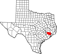
 Lokasi negara bagian Texas di Amerika Serikat | |
| Didirikan | December 22, 1836 |
| Seat | Houston |
| Wilayah | |
| • Keseluruhan | 1.778 sq mi (4.605 km2) |
| • Daratan | 1.729 sq mi (4.478 km2) |
| • Perairan | 49 sq mi (127 km2), 2.75% |
| Populasi | |
| • (2010) | 4.092.459 |
| • Kepadatan | 2.367/sq mi (914/km²) |
| Situs web | www |
County Harris adalah county yang terletak di negara bagian Texas, Amerika Serikat. Jumlah penduduk pada tahun 2010 sebesar 4.092.459 jiwa.
Jalan utama
|
|


Pranala luar
- Harris County government's website
- The Handbook of Texas Online: Harris County
- Account of the early days of Harris County, 1824 - 1838 from Indian Wars and Pioneers of Texas by John Henry Brown, hosted by The Portal to Texas History
- Harris County local event listings
- CPS in Harris County
- Harris County Fire Marshal's Office
- Harris County Housing Authority Website
- Accepted design illustration of Court House from the University of Houston Digital Library (1920-1924)[pranala nonaktif permanen]
 | Waller County | Montgomery County | Liberty County | |
 | Chambers County | |||
| ||||
 | ||||
| Fort Bend County | Brazoria County | Galveston County |

Templat:Harris County, Texas
 Negara bagian Texas Negara bagian Texas | |
|---|---|
Austin (ibu kota) | |
| Topik |
|
| Region |
|
| Wilayah metro |
|
| County |
|
 | Artikel bertopik geografi atau tempat Amerika Serikat ini adalah sebuah rintisan. Anda dapat membantu Wikipedia dengan mengembangkannya. |
- l
- b
- s


