Thirlmere Lakes National Park
Protected area in New South Wales, Australia
34°13′32″S 150°32′19″E / 34.22556°S 150.53861°E / -34.22556; 150.53861New South Wales
The Thirlmere Lakes National Park is a protected national park that is located in the Macarthur region of New South Wales, in eastern Australia. The 629-hectare (1,550-acre) national park is situated approximately 70 kilometres (43 mi) southwest of the Sydney central business district, and just to the west of Thirlmere. It was gazetted in 1972 as Thirlmere Lakes State Park, before being subsequently reclassified as a national park.[2]
History
The national park is one of the eight protected areas that, in 2000, was inscribed to form part of the UNESCO World Heritage–listed Greater Blue Mountains Area.[3] The Thirlmere Lakes National Park is the most south–easterly and the smallest of the eight protected areas within the World Heritage Site.[1]
Crisis
Two of the lakes have dried out since the mid 1980s due to removal of groundwater in the region secondary to coal mining at the Tahmoor Colliery.[4] The local community is investigating plans to revive the lakes, which might take decades otherwise.[5]
Features
The main feature of the park are the lakes, thought to have formed around 15 million years ago by geological activity, the land lifting and largely cutting them off from the local river system. Their outflow is reduced to the small Blue Gum Creek, which flows west into the Little River in the adjacent Nattai National Park to the west.[2]
The lakes and their environs contain an unusual and diverse array of flora and fauna. It contains the rare freshwater sponge Radiospongilla sceptroides,[6] and is notable for an absence of freshwater snails.[2] The lakes contain the rare watershield (Brasenia schreberi) and are lined with rare species such as the grey sedge (Lepironia articulata) and the wooly frogsmouth lily (Philydrum lanuginosum). The habitat provides a home for the otherwise scarce Australasian bittern (Botaurus poiciloptilus), and migratory Latham's snipe Gallinago hardwickii.[6]
The habitat around the lakes is open sclerophyll forest, the dominant trees being rough-barked apple (Angophora floribunda) nearby and sydney peppermint (Eucalyptus piperita) and red bloodwood (Corymbia gummifera) on elevated areas. The understory species include many familiar sydney sandstone flora such as members of the genera Banksia, Acacia, pea flowers, and the New South Wales waratah (Telopea speciosissima)[2]
Climate
| Thirlmere Lakes National Park | ||||||||||||||||||||||||||||||||||||||||||||||||||||||||||||
|---|---|---|---|---|---|---|---|---|---|---|---|---|---|---|---|---|---|---|---|---|---|---|---|---|---|---|---|---|---|---|---|---|---|---|---|---|---|---|---|---|---|---|---|---|---|---|---|---|---|---|---|---|---|---|---|---|---|---|---|---|
| Climate chart (explanation) | ||||||||||||||||||||||||||||||||||||||||||||||||||||||||||||
| ||||||||||||||||||||||||||||||||||||||||||||||||||||||||||||
| ||||||||||||||||||||||||||||||||||||||||||||||||||||||||||||
Gallery
Photos of Thirlmere Lakes National Park
-
 Thirlmere Lake in Thirlmere Lakes National Park
 -
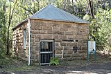 Pumphouse supplying water for steam trains at Couridjah Station
 -
 The five lakes in Thirlmere Lakes National Park
 -
 Ford in Thirlmere Lakes National Park


See also
 New South Wales portal
 Environment portal


References
- ^ a b c "Thirlmere Lakes National Park: Park management". Office of Environment and Heritage. Government of New South Wales. Retrieved 26 May 2011.
- ^ a b c d Wright, Peter (1996). National Parks of Southern NSW. Rosebery, NSW: Bridge Printery. pp. 36–37. ISBN 0-9587590-1-4.
- ^ "Greater Blue Mountains Area". World Heritage List. UNESCO. 2014. Retrieved 31 August 2014.
- ^ Miskelly, Greg (29 May 2016). "Thirlmere Lakes: Coal mining to blame for damage to World Heritage area, new reports say". ABC News. Retrieved 29 August 2016.
- ^ Miskelly, Greg (30 May 2016). "Thirlmere Lakes: CLocals push for action to stop World Heritage area drying out". ABC News. Retrieved 29 August 2016.
- ^ a b "Thirlmere Lakes National Park: New Plan of Management" (PDF). NSW National Parks and Wildlife Service (PDF). Government of New South Wales. November 1997. ISBN 0-7310-7619-2.
- ^ "NASA Earth Observations: Population Density". "NASA/SEDAC". Retrieved 30 January 2016.
External links
- "Thirlmere Lakes National Park" (PDF) (PDF Map). NSW National Parks and Wildlife Service. Government of New South Wales. December 2007.
 Thirlmere Lakes National Park travel guide from Wikivoyage
- v
- t
- e
- Abercrombie
- Breelong
- Capertee
- Conimbla
- Coolah Tops
- Drillwarrina
- Gardens of Stone
- Garrawilla
- Goobang
- Goulburn
- Kanangra-Boyd
- Lachlan Valley
- Marrangaroo
- Nangar
- Popran
- Turon
- Warrumbungle
- Weddin Mountains
- Wollemi
- Brindingabba
- Culgoa
- Gundabooka
- Kalyarr
- Kemendok
- Kinchega
- Koonaburra
- Mallee Cliffs
- Mungo
- Mutawintji
- Narriearra Caryapundy Swamp
- Paroo-Darling
- Sturt
- Toorale
- Yanga
- Barakee
- Barrington Tops
- Belford
- Ben Halls Gap
- Biriwal Bulga
- Booti Booti
- Bouddi
- Brisbane Water
- Coolah Tops
- Coorabakh
- Crawney Pass
- Crowdy Bay
- Dharug
- Gir-um-bit
- Goulburn River
- Gin-Doo-Ee
- Hunter Wetlands
- Karuah
- Middle Brother
- Mount Royal
- Myall Lakes
- Saltwater
- Scone Mountain
- Tapin Tops
- Tilligerry
- Towarri
- Tomaree
- Wallarah
- Wallingat
- Watagans
- Werakata
- Woko
- Wollemi
- Wyrrabalong
- Yengo
- Bald Rock
- Barool
- Basket Swamp
- Boonoo Boonoo
- Ben Halls Gap
- Burral Yurrul
- Butterleaf
- Capoompeta
- Carrai
- Cascade
- Cataract
- Cathedral Rock
- Coolah Tops
- Cottan-Bimbang
- Couradda
- Crawney Pass
- Cunnawarra
- Dowe
- Gibraltar Range
- Guy Fawkes River
- Indwarra
- Kings Plain
- Koreelah
- Kwiambal
- Maryland
- Mount Clunie
- Mount Kaputar
- Mount Nothofagus
- Mummel Gulf
- New England
- Nowendoc
- Nullamanna
- Nymboida
- Oxley Wild Rivers
- Single
- Timbarra
- Tooloom
- Towarri
- Warra
- Warrabah
- Washpool
- Watsons Creek
- Werrikimbe
- Arakwal
- Bago Bluff
- Bellinger River
- Bindarri
- Biriwal Bulga
- Bongil Bongil
- Border Ranges
- Broadwater
- Bundjalung
- Bungawalbin
- Carrai
- Chaelundi
- Cottan-Bimbang
- Crowdy Bay
- Dooragan
- Dorrigo
- Dunggir
- Fortis Creek
- Gibraltar Range
- Goonengerry
- Guy Fawkes River
- Hat Head
- Junuy Juluum
- Kumbatine
- Limeburners Creek
- Mallanganee
- Maria
- Mebbin
- Middle Brother
- Mooball
- Mount Jerusalem
- Mount Nothofagus
- Mount Pikapene
- New England
- Nightcap
- Nymboi-Binderay
- Nymboida
- Ramornie
- Richmond Range
- Sea Acres
- Toonumber
- Ulidarra
- Washpool
- Werrikimbe
- Willi Willi
- Wollumbin
- Yabbra
- Yarrahapinni Wetlands
- Yarriabini
- Yuraygir
- Benambra
- Brindabella
- Cocoparra
- Jimberoo
- Jindalee
- Kalyarr
- Kosciuszko
- Lachlan Valley
- Livingstone
- Minjary
- Murray Valley
- Murrumbidgee Valley
- Oolambeyan
- Willandra
- Woomargama
- Yanga
- Abercrombie
- Bangadilly
- Beowa
- Biamanga
- Blue Mountains
- Bournda
- Brindabella
- Budawang
- Budderoo
- Clyde River
- Deua
- Eurobodalla
- Gourock
- Gulaga
- Kooraban
- Kosciuszko
- Mares Forest
- Macquarie Pass
- Mimosa Rocks
- Monga
- Morton
- Mount Imlay
- Murramarang
- Nattai
- South East Forests
- Tallaganda
- Tarlo River
- Wadbilliga
- Yanununbeyan
- Berowra Valley
- Blue Mountains
- Cattai
- Dharawal
- Dharug
- Garigal
- Georges River
- Heathcote
- Kamay Botany Bay
- Kanangra-Boyd
- Ku-ring-gai Chase
- Lane Cove
- Malabar Headland
- Marramarra
- Nattai
- Royal
- Scheyville
- Sydney Harbour
- Thirlmere Lakes
- Wollemi
- Yengo


