Marramarra National Park
Protected area in New South Wales, Australia
33°31′30″S 151°03′28″E / 33.52500°S 151.05778°E / -33.52500; 151.05778New South Wales
Marramarra National Park is a protected national park that is located in the Hawkesbury region of northwestern Sydney, New South Wales, in eastern Australia. The 11,785-hectare (29,120-acre) national park is situated approximately 40 kilometres (25 mi) northwest of the Sydney central business district.
Description
The park is bounded by the Hawkesbury River in the north; Berowra Creek in the east; and private land to the south and west. The national park may be accessed from Wisemans Ferry via the Old Northern Road or from Hornsby via the Galston Road through the Galston Gorge.[2]
The park is administered by Ku-ring-gai Chase National Park. It offers bushwalkers a wide range of environments, from the mangrove communities along Marramarra Creek to the drier, sclerophyll scrub along the ridges. Access is provided predominantly by fire trails and service roads, frequently alongside power lines, with no dedicated walking tracks.
Marramarra was a traditional area for the Aboriginal people of Darug. There are still places that testify to their traditional life here. Rock engravings, cave art, grinding grooves, scarred trees and other stone arrangements are part of this national park.[3]
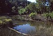
Gallery
-
 Cobah Creek
 -
 View of the Hawkesbury River from the northern ridges of the national park
 -
 A hut in Big Bay
 -
 View of Mangrove Creek from the northern part of the national park
 -
 Ruins along the northern ridge of the national park, parallel to the Hawkesbury River


Bibliography
- Treks in New South Wales, Neil Paton (Kangaroo Press) 1986, ISBN 0-86417-079-3
See also
 New South Wales portal
 environment portal


References
- ^ a b "Marramarra National Park: Park management". Office of Environment and Heritage. Government of New South Wales. Retrieved 5 October 2014.
- ^ "Marramarra National Park". Office of Environment and Heritage. Government of New South Wales. Retrieved 5 October 2014.
- ^ "Marramarra National Park | Learn more". NSW National Parks. Retrieved 21 October 2021.
Wikimedia Commons has media related to Marramarra National Park.
External links
- "Marramarra National Park, Muogamarra National Park and Maroota Historic Site: Plan of management". NSW National Parks & Wildlife Service (PDF). Government of New South Wales. 14 December 1998. ISBN 0-7310-7694-X.
- "Marramarra National Park". NSW National Parks & Wildlife Service (Map). Government of New South Wales. Archived from the original on 6 October 2014.
- "Marramarra National Park". Office of Environment and Heritage. Government of New South Wales.
- "Marramarra National Park". NSW National Parks & Wildlife Service. Government of New South Wales.
- "Trail rides in Marramarra National Park". Northern Beaches Mountain Biking Group.
- Niall Clugston (Hornsby Shire Library) (2008). "Marramarra National Park". Dictionary of Sydney. Retrieved 28 September 2015. [CC-By-SA]
- v
- t
- e
- Abercrombie
- Breelong
- Capertee
- Conimbla
- Coolah Tops
- Drillwarrina
- Gardens of Stone
- Garrawilla
- Goobang
- Goulburn
- Kanangra-Boyd
- Lachlan Valley
- Marrangaroo
- Nangar
- Popran
- Turon
- Warrumbungle
- Weddin Mountains
- Wollemi
- Brindingabba
- Culgoa
- Gundabooka
- Kalyarr
- Kemendok
- Kinchega
- Koonaburra
- Mallee Cliffs
- Mungo
- Mutawintji
- Narriearra Caryapundy Swamp
- Paroo-Darling
- Sturt
- Toorale
- Yanga
- Barakee
- Barrington Tops
- Belford
- Ben Halls Gap
- Biriwal Bulga
- Booti Booti
- Bouddi
- Brisbane Water
- Coolah Tops
- Coorabakh
- Crawney Pass
- Crowdy Bay
- Dharug
- Gir-um-bit
- Goulburn River
- Gin-Doo-Ee
- Hunter Wetlands
- Karuah
- Middle Brother
- Mount Royal
- Myall Lakes
- Saltwater
- Scone Mountain
- Tapin Tops
- Tilligerry
- Towarri
- Tomaree
- Wallarah
- Wallingat
- Watagans
- Werakata
- Woko
- Wollemi
- Wyrrabalong
- Yengo
- Bald Rock
- Barool
- Basket Swamp
- Boonoo Boonoo
- Ben Halls Gap
- Burral Yurrul
- Butterleaf
- Capoompeta
- Carrai
- Cascade
- Cataract
- Cathedral Rock
- Coolah Tops
- Cottan-Bimbang
- Couradda
- Crawney Pass
- Cunnawarra
- Dowe
- Gibraltar Range
- Guy Fawkes River
- Indwarra
- Kings Plain
- Koreelah
- Kwiambal
- Maryland
- Mount Clunie
- Mount Kaputar
- Mount Nothofagus
- Mummel Gulf
- New England
- Nowendoc
- Nullamanna
- Nymboida
- Oxley Wild Rivers
- Single
- Timbarra
- Tooloom
- Towarri
- Warra
- Warrabah
- Washpool
- Watsons Creek
- Werrikimbe
- Arakwal
- Bago Bluff
- Bellinger River
- Bindarri
- Biriwal Bulga
- Bongil Bongil
- Border Ranges
- Broadwater
- Bundjalung
- Bungawalbin
- Carrai
- Chaelundi
- Cottan-Bimbang
- Crowdy Bay
- Dooragan
- Dorrigo
- Dunggir
- Fortis Creek
- Gibraltar Range
- Goonengerry
- Guy Fawkes River
- Hat Head
- Junuy Juluum
- Kumbatine
- Limeburners Creek
- Mallanganee
- Maria
- Mebbin
- Middle Brother
- Mooball
- Mount Jerusalem
- Mount Nothofagus
- Mount Pikapene
- New England
- Nightcap
- Nymboi-Binderay
- Nymboida
- Ramornie
- Richmond Range
- Sea Acres
- Toonumber
- Ulidarra
- Washpool
- Werrikimbe
- Willi Willi
- Wollumbin
- Yabbra
- Yarrahapinni Wetlands
- Yarriabini
- Yuraygir
- Benambra
- Brindabella
- Cocoparra
- Jimberoo
- Jindalee
- Kalyarr
- Kosciuszko
- Lachlan Valley
- Livingstone
- Minjary
- Murray Valley
- Murrumbidgee Valley
- Oolambeyan
- Willandra
- Woomargama
- Yanga
- Abercrombie
- Bangadilly
- Beowa
- Biamanga
- Blue Mountains
- Bournda
- Brindabella
- Budawang
- Budderoo
- Clyde River
- Deua
- Eurobodalla
- Gourock
- Gulaga
- Kooraban
- Kosciuszko
- Mares Forest
- Macquarie Pass
- Mimosa Rocks
- Monga
- Morton
- Mount Imlay
- Murramarang
- Nattai
- South East Forests
- Tallaganda
- Tarlo River
- Wadbilliga
- Yanununbeyan
Hawkesbury River region, New South Wales, Australia | |||||||||
|---|---|---|---|---|---|---|---|---|---|
| Islands | |||||||||
| National parks and nature reserves |
| ||||||||
| European explorers of the region | |||||||||
| Bridges and ferries |
| ||||||||
| Adjoining rivers, bays, reservoirs, and creeks |
| ||||||||
| Local government areas |
| ||||||||
| Education |
| ||||||||
| Major attractions | |||||||||
| |||||||||

 | This New South Wales protected areas related article is a stub. You can help Wikipedia by expanding it. |
- v
- t
- e


