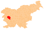
Potok, Idrija
Place in Inner Carniola, Slovenia
45°58′52.69″N 14°7′42.79″E / 45.9813028°N 14.1285528°E / 45.9813028; 14.1285528 Slovenia
 (2002)
Potok (pronounced [ˈpɔːtɔk]) is a small settlement in the hills east of Idrija in the traditional Inner Carniola region.[2] It include the hamlet of Mravljišče west of the main village center.
Name

The name of the settlement literally means 'creek, stream'. Jakopnik Creek, which eventually feeds the Poljane Sora River, flows through the village.
References
External links
 Media related to Potok, Idrija at Wikimedia Commons
- Potok on Geopedia
- v
- t
- e
Municipality of Idrija
Administrative seat: Idrija
| Current |
|
|---|---|
| Former |

- Črni Vrh Observatory
- Holy Trinity Church
- Gewerkenegg Castle
- Idrija Lace School
- Idrija Mine
- Idrija Museum
- Idrijca River
- Kenda Manor
- Mary on the Rock Parish Church
- St. Joseph's Parish Church
- Vojko's Plaque
- Wild Lake


