Javornik, Idrija
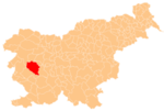
Place in Inner Carniola, Slovenia
45°53′36.97″N 14°4′29.63″E / 45.8936028°N 14.0748972°E / 45.8936028; 14.0748972 Slovenia
 (2014)
Javornik (pronounced [ˈjaːʋɔɾnik]) is a small dispersed settlement on the slopes of Javornik Hill south of Črni Vrh in the Municipality of Idrija[2] in the traditional Inner Carniola region of Slovenia.[3] Its remoteness and high elevation have resulted in people moving away from their farms, and there is only a single resident in the settlement.
References
External links
- Javornik on Geopedia
- v
- t
- e
Municipality of Idrija
Administrative seat: Idrija
| Current |
|
|---|---|
| Former |
- Črni Vrh Observatory
- Holy Trinity Church
- Gewerkenegg Castle
- Idrija Lace School
- Idrija Mine
- Idrija Museum
- Idrijca River
- Kenda Manor
- Mary on the Rock Parish Church
- St. Joseph's Parish Church
- Vojko's Plaque
- Wild Lake


