Jiangchuan, Yuxi
District in Yunnan, People's Republic of China
Jiangchuan 江川区 | |
|---|---|
District | |
 A sculpture in Jiangchuan | |
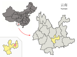 Location of Jiangchuan (pink) and Yuxi Prefecture (yellow) within Yunnan province of China | |
| Country | People's Republic of China |
| Province | Yunnan |
| Prefecture-level city | Yuxi |
| Area | |
| • Total | 850 km2 (330 sq mi) |
| Population (2000) | |
| • Total | 260,000 |
| • Density | 310/km2 (790/sq mi) |
| Time zone | UTC+8 (CST) |
| Postal code | 652600 |
| Area code | 0877 |
| Website | www |
Jiangchuan District (Chinese: 江川区; pinyin: Jiāngchuān Qū) is located in Yuxi, Yunnan, China.
The district is known for its Gantangjing Paleolithic sites which contains traces of the use of fire, presence of prehistoric carnivorous fauna.[1]
Administrative divisions
Jiangchuan District has 1 subdistrict, 4 towns, 1 township and 1 ethnic township.[2]
- 1 subdistrict
- Dajie (大街街道)
- 4 towns
|
|
- 1 township
- Xiongguan (雄关乡)
- 1 ethnic township
- Anhua Yi (安化彝族乡)
Climate
| Climate data for Jiangchuan (1991–2020 normals, extremes 1981–2010) | |||||||||||||
|---|---|---|---|---|---|---|---|---|---|---|---|---|---|
| Month | Jan | Feb | Mar | Apr | May | Jun | Jul | Aug | Sep | Oct | Nov | Dec | Year |
| Record high °C (°F) | 23.8 (74.8) | 26.2 (79.2) | 29.6 (85.3) | 31.5 (88.7) | 32.7 (90.9) | 32.2 (90.0) | 32.1 (89.8) | 31.0 (87.8) | 31.8 (89.2) | 28.2 (82.8) | 26.4 (79.5) | 24.6 (76.3) | 32.7 (90.9) |
| Mean daily maximum °C (°F) | 17.5 (63.5) | 19.7 (67.5) | 23.1 (73.6) | 25.9 (78.6) | 26.5 (79.7) | 26.5 (79.7) | 26.0 (78.8) | 26.1 (79.0) | 24.7 (76.5) | 22.4 (72.3) | 20.0 (68.0) | 17.2 (63.0) | 23.0 (73.4) |
| Daily mean °C (°F) | 9.3 (48.7) | 11.3 (52.3) | 15.0 (59.0) | 18.5 (65.3) | 20.6 (69.1) | 21.5 (70.7) | 21.1 (70.0) | 20.7 (69.3) | 19.4 (66.9) | 16.9 (62.4) | 12.9 (55.2) | 9.7 (49.5) | 16.4 (61.5) |
| Mean daily minimum °C (°F) | 3.6 (38.5) | 4.8 (40.6) | 8.0 (46.4) | 11.9 (53.4) | 15.8 (60.4) | 17.9 (64.2) | 17.9 (64.2) | 17.3 (63.1) | 16.0 (60.8) | 13.5 (56.3) | 8.3 (46.9) | 4.8 (40.6) | 11.7 (53.0) |
| Record low °C (°F) | −4.0 (24.8) | −1.9 (28.6) | −2.3 (27.9) | 2.1 (35.8) | 6.8 (44.2) | 11.3 (52.3) | 12.6 (54.7) | 11.5 (52.7) | 7.6 (45.7) | 4.9 (40.8) | −1.9 (28.6) | −5.9 (21.4) | −5.9 (21.4) |
| Average precipitation mm (inches) | 25.0 (0.98) | 14.5 (0.57) | 18.8 (0.74) | 32.7 (1.29) | 81.0 (3.19) | 142.6 (5.61) | 156.0 (6.14) | 147.8 (5.82) | 92.7 (3.65) | 61.0 (2.40) | 32.9 (1.30) | 16.1 (0.63) | 821.1 (32.32) |
| Average precipitation days (≥ 0.1 mm) | 4.7 | 3.6 | 4.9 | 7.5 | 10.9 | 15.0 | 19.4 | 17.9 | 13.2 | 10.8 | 4.9 | 4.2 | 117 |
| Average snowy days | 0.4 | 0.1 | 0.1 | 0 | 0 | 0 | 0 | 0 | 0 | 0 | 0 | 0.1 | 0.7 |
| Average relative humidity (%) | 72 | 65 | 58 | 58 | 65 | 76 | 80 | 80 | 79 | 79 | 76 | 76 | 72 |
| Mean monthly sunshine hours | 222.0 | 223.2 | 247.2 | 246.1 | 215.9 | 144.8 | 118.8 | 135.4 | 121.1 | 134.0 | 189.0 | 194.8 | 2,192.3 |
| Percent possible sunshine | 66 | 70 | 66 | 64 | 52 | 35 | 29 | 34 | 33 | 38 | 58 | 59 | 50 |
| Source: China Meteorological Administration[3][4] | |||||||||||||
References
- ^ Fire-using remains found in Gantangjing Paleolithic site in Yunnan, 2016.
- ^ "国家统计局" (in Chinese). National Bureau of Statistics of the People's Republic of China. Retrieved 2021-12-07.
- ^ 中国气象数据网 – WeatherBk Data (in Simplified Chinese). China Meteorological Administration. Retrieved 20 September 2023.
- ^ 中国气象数据网 (in Simplified Chinese). China Meteorological Administration. Retrieved 20 September 2023.
External links
- Jiangchuan Official Website
- v
- t
- e
| Kunming | |
|---|---|
| Qujing | |
| Yuxi | |
| Baoshan | |
| Zhaotong | |
| Lijiang | |
| Pu'er | |
| Lincang |
| Chuxiong | |
|---|---|
| Honghe | |
| Wenshan | |
| Xishuangbanna | |
| Dali | |
| Dehong | |
| Nujiang | |
| Dêqên |
Authority control databases | |
|---|---|
| International |
|
| National |
|
24°19′04″N 102°45′11″E / 24.31778°N 102.75306°E / 24.31778; 102.75306
 | This Yunnan location article is a stub. You can help Wikipedia by expanding it. |
- v
- t
- e


