Mile City
County-level city in Yunnan, People's Republic of China
Mile 24°24′15″N 103°26′34″E / 24.40417°N 103.44278°E / 24.40417; 103.44278 | |
|---|---|
| Country | People's Republic of China |
| Province | Yunnan |
| Prefecture | Honghe |
| Area | |
| • County-level city | 4,004 km2 (1,546 sq mi) |
| Highest elevation | 2,315 m (7,595 ft) |
| Lowest elevation | 862 m (2,828 ft) |
| Population (2021) | |
| • County-level city | 570,100 |
| • Density | 140/km2 (370/sq mi) |
| • Rural (2005)[1] | 433,500 |
| Postal code | 652300 |
| Area code | 0873 |
| Website | www |
Wikimedia Commons has media related to Mile_City.
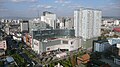
Mile (Chinese: 弥勒市; pinyin: Mílè Shì; [mǐlɤ̂ ʂî]; Hani language: Miqleiq Siif; Yi: ꂱꇍꏃ) is a county-level city located in Honghe Hani and Yi Autonomous Prefecture, Yunnan province, China.[2] It is named after the Maitreya Buddha, for which there was a temple located on a nearby mountain,[3] making it the only city in China named after The Buddha.[4] It is a center for sugar and tobacco production in Yunnan.[1]
History
Mile has been known since at least 116 BC in written history. In 1290 it was established as a prefecture and in 1770 as a county.[1]
It is the birthplace of Ming dynasty politician Yang Shengwu (杨绳武), Qing dynasty merchant Wang Chi (zh:王炽) and Republic era general Zhang Chong and mathematician Xiong Qinglai.[5]
In 2014, Mile County was upgraded as a county level city.[4]
Administrative divisions
At present, Mile City has 10 towns and 2 townships.[6]
- 10 towns
|
|
- 2 townships
- Wushan (五山乡)
- Jiangbian (江边乡)
Demographics
Mile has a population of 570,100 as of 2021, including 44.9% ethnic minorities.[5]
Ethnic groups
The Mile County Gazetteer 弥勒县志 (1987:689-699) reports the following Yi subgroups.
- Axi 阿细 (Xishan Yi)[7]
- Azhe 阿哲: in Wushan 五山, Xunjian 巡检, and Jianbian 江边 districts
- Awu 阿乌: 8,710 persons as of 1984
- Black Yi 黑彝: in Wushan 五山, Xishan 西山, and Dongshan 东山 districts
- Large Black Yi 大黑彝 subgroup (autonym: Nasubo 纳苏波)
- Small Black Yi 小黑彝 subgroup
- Sani 撒尼 (autonym: Sanibo 撒尼波)
- White Yi 白彝
- Nasubo 纳苏波 subgroup: in Dongshan 东山 and Xinshao 新哨 districts
- White Yi 白彝 subgroup: in Xier District 西二区
- Gebo 葛波 (exonym: Guzu 古族)
The local Yi people have a ceremony to worship their fire god once a year.[8]
Climate
| Climate data for Mile (1991–2020 normals, extremes 1981–2010) | |||||||||||||
|---|---|---|---|---|---|---|---|---|---|---|---|---|---|
| Month | Jan | Feb | Mar | Apr | May | Jun | Jul | Aug | Sep | Oct | Nov | Dec | Year |
| Record high °C (°F) | 27.0 (80.6) | 29.6 (85.3) | 32.2 (90.0) | 35.0 (95.0) | 35.8 (96.4) | 34.1 (93.4) | 33.5 (92.3) | 32.4 (90.3) | 33.2 (91.8) | 30.5 (86.9) | 28.5 (83.3) | 26.0 (78.8) | 35.8 (96.4) |
| Mean daily maximum °C (°F) | 18.1 (64.6) | 20.9 (69.6) | 25.0 (77.0) | 27.9 (82.2) | 28.5 (83.3) | 27.9 (82.2) | 27.4 (81.3) | 27.5 (81.5) | 26.5 (79.7) | 23.7 (74.7) | 21.1 (70.0) | 17.7 (63.9) | 24.3 (75.8) |
| Daily mean °C (°F) | 10.3 (50.5) | 12.5 (54.5) | 16.4 (61.5) | 20.0 (68.0) | 22.2 (72.0) | 22.9 (73.2) | 22.6 (72.7) | 22.2 (72.0) | 20.9 (69.6) | 18.2 (64.8) | 14.2 (57.6) | 10.7 (51.3) | 17.8 (64.0) |
| Mean daily minimum °C (°F) | 4.7 (40.5) | 6.0 (42.8) | 9.5 (49.1) | 13.3 (55.9) | 17.1 (62.8) | 19.3 (66.7) | 19.3 (66.7) | 18.7 (65.7) | 17.2 (63.0) | 14.6 (58.3) | 9.4 (48.9) | 5.8 (42.4) | 12.9 (55.2) |
| Record low °C (°F) | −2.9 (26.8) | −2.8 (27.0) | −3.9 (25.0) | 4.4 (39.9) | 4.8 (40.6) | 12.7 (54.9) | 13.8 (56.8) | 12.4 (54.3) | 8.7 (47.7) | 4.7 (40.5) | −1.9 (28.6) | −4.6 (23.7) | −4.6 (23.7) |
| Average precipitation mm (inches) | 26.2 (1.03) | 15.4 (0.61) | 22.2 (0.87) | 34.3 (1.35) | 95.3 (3.75) | 173.2 (6.82) | 187.4 (7.38) | 137.3 (5.41) | 92.2 (3.63) | 73.6 (2.90) | 32.3 (1.27) | 16.0 (0.63) | 905.4 (35.65) |
| Average precipitation days (≥ 0.1 mm) | 5.4 | 4.7 | 5.2 | 7.2 | 12.2 | 15.5 | 18.7 | 17.7 | 13.1 | 12.2 | 5.8 | 4.5 | 122.2 |
| Average snowy days | 0.7 | 0.3 | 0 | 0 | 0 | 0 | 0 | 0 | 0 | 0 | 0 | 0.1 | 1.1 |
| Average relative humidity (%) | 73 | 65 | 60 | 59 | 65 | 76 | 81 | 81 | 78 | 78 | 76 | 76 | 72 |
| Mean monthly sunshine hours | 166.8 | 178.1 | 207.7 | 214.0 | 196.5 | 141.2 | 131.2 | 146.9 | 131.7 | 126.5 | 160.8 | 148.5 | 1,949.9 |
| Percent possible sunshine | 50 | 56 | 56 | 56 | 48 | 35 | 32 | 37 | 36 | 36 | 49 | 45 | 45 |
| Source: China Meteorological Administration[9][10] | |||||||||||||
References
- ^ a b c d "弥勒县概况".
- ^ 弥勒县志 (in Chinese). 云南人民出版社. 1987.
- ^ 网易 (2021-01-25). "我国唯一以佛命名的城市-云南弥勒(图)". www.163.com. Retrieved 2021-11-30.
- ^ a b 严建著 (2018-07-01). 一路走来 (in Chinese). Beijing Book Co. Inc. ISBN 978-7-5482-3344-2.
- ^ a b "弥勒市情简介". 2021-07-05.
- ^ "国家统计局" (in Chinese). National Bureau of Statistics of the People's Republic of China. Retrieved 2021-12-07.
- ^ 杜玉亭著 (2015-06-01). 杜玉亭学术文选 (in Chinese). Beijing Book Co. Inc. ISBN 978-7-5482-1850-0.
- ^ 邢毅编著 (2015-04-01). 云南民族建筑 (in Chinese). Beijing Book Co. Inc. ISBN 978-7-5482-2227-9.
- ^ 中国气象数据网 – WeatherBk Data (in Simplified Chinese). China Meteorological Administration. Retrieved 20 September 2023.
- ^ 中国气象数据网 (in Simplified Chinese). China Meteorological Administration. Retrieved 20 September 2023.
External links
- Mile County
Largest cities in Yunnan Source: China Urban Construction Statistical Yearbook 2018 Urban Population and Urban Temporary Population | |||||||||||||||||||||||||||||||||||||||||||||||||||||||||||||||||||||||
|---|---|---|---|---|---|---|---|---|---|---|---|---|---|---|---|---|---|---|---|---|---|---|---|---|---|---|---|---|---|---|---|---|---|---|---|---|---|---|---|---|---|---|---|---|---|---|---|---|---|---|---|---|---|---|---|---|---|---|---|---|---|---|---|---|---|---|---|---|---|---|---|
| |||||||||||||||||||||||||||||||||||||||||||||||||||||||||||||||||||||||


 | This Yunnan location article is a stub. You can help Wikipedia by expanding it. |
- v
- t
- e


