Chikusa-ku, Nagoya
Ward in Japan
Chikusa  Flag | |
|---|---|
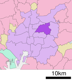 Location of Chikusa-ku in Nagoya | |
| 35°10′12″N 136°58′01″E / 35.17000°N 136.96694°E / 35.17000; 136.96694 | |
| Country | Japan |
| Region | Tōkai region Chūbu region |
| Prefecture | Aichi |
| Area | |
| • Total | 18.18 km2 (7.02 sq mi) |
| Population (October 1, 2019) | |
| • Total | 165,863 |
| • Density | 9,100/km2 (24,000/sq mi) |
| Time zone | UTC+9 (Japan Standard Time) |
| - Tree | Flowering Dogwood |
| - Flower | Hydrangea[1] |
| Phone number | 052-762-3111 |
| Address | 8-37 Kakuōzan-dōri, Chikusa-ku, Nagoya-shi, Aichi-ken 464-8644 |
| Website | www |


Chikusa (千種区, Chikusa-ku) is one of the 16 wards of the city of Nagoya in Aichi Prefecture, Japan. As of 1 October 2019, the ward had an estimated population of 165,863 and a population density of 9,123 persons per km². The total area was 18.18 km².
Geography
Chikusa Ward is located in northeastern Nagoya city.
Surrounding municipalities
History
The town of Chikusa and the village of Higashiyama in Aichi District were annexed by the city of Nagoya on August 22, 1921, becoming part of Higashi Ward. Chikusa Ward was established in 1937. On April 5, 1955 the neighboring village of Idaka was merged into Chikusa Ward.
Education
- Nagoya University
- Nagoya City University – Kita-Chikusa Campus
- Sugiyama Jogakuen University
- Aichi Gakuin University – Chikusa Campus
- Aichi Shukutoku University – Chikusa Campus
- Aichi Institute of Technology – Chikusa Campus
Transportation
Rail
- JR Central – Chūō Main Line
- Nagoya Municipal Subway – Higashiyama Line
- Nagoya Municipal Subway – Sakura-dōri Line
- Imaike -Fukiage
- Nagoya Municipal Subway – Meijō Line
- Chayagasaka - Jiyūgaoka - Motoyama - Nagoya Daigaku
Highways
- Route 2 (Nagoya Expressway)
- Japan National Route 153
Local attractions
- Nagoya University Museum
- Furukawa Air Museum
- Heiwa Park
- Higashiyama Sky Tower
- Higashiyama Zoo and Botanical Gardens
- Shiroyama Hachimangū
- Tōgan-ji
- Nittai-ji
- Yōki-sō villa and garden
Noted people
- Masahiro Andoh – musician
- Miki Ando – professional figure skater
- Yasutaro Koide – supercentenarian
- Yukihiko Tsutsumi – television and film director
- Keiko Toda – voice actress
References
- ^ 千種区の概要 (in Japanese). Nagoya City. 1 October 2007. Archived from the original on 4 February 2011. Retrieved 7 January 2011.
External links
![]() Media related to Chikusa-ku, Nagoya at Wikimedia Commons
Media related to Chikusa-ku, Nagoya at Wikimedia Commons
- Official website (in Japanese)
- General information (in Japanese)


Authority control databases | |
|---|---|
| International |
|
| National |
|
| Geographic |
|


