Ama District
District located in Aichi Prefecture, Japan
You can help expand this article with text translated from the corresponding article in Japanese. (April 2023) Click [show] for important translation instructions.
- View a machine-translated version of the Japanese article.
- Machine translation, like DeepL or Google Translate, is a useful starting point for translations, but translators must revise errors as necessary and confirm that the translation is accurate, rather than simply copy-pasting machine-translated text into the English Wikipedia.
- Consider adding a topic to this template: there are already 3,700 articles in the main category, and specifying
|topic=will aid in categorization. - Do not translate text that appears unreliable or low-quality. If possible, verify the text with references provided in the foreign-language article.
- You must provide copyright attribution in the edit summary accompanying your translation by providing an interlanguage link to the source of your translation. A model attribution edit summary is
Content in this edit is translated from the existing Japanese Wikipedia article at [[:ja:海部郡 (愛知県)]]; see its history for attribution. - You may also add the template
{{Translated|ja|海部郡 (愛知県)}}to the talk page. - For more guidance, see Wikipedia:Translation.

Ama (海部郡, Ama-gun) is a district located in Aichi Prefecture, Japan.
As of October 1, 2019, the district has an estimated population of 74,009 with a density of 1,846 persons per km2. The total area is 40.09 km2.
Municipalities
The district consists of two towns and one village:
History
This list is incomplete; you can help by adding missing items. (April 2023) |
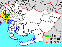
* yellow - areas formerly within the district borders during the early Meiji period
- Ōharu-machi
- Kanie-machi
- Tobishima-mura

District Timeline
Recent mergers
- On April 1, 2005 - The towns of Saya and Saori, and the villages of Hachikai and Tatsuta were merged into the expanded city of Aisai.
- On April 1, 2006 - The former town of Yatomi absorbed the village of Jūshiyama to form the city of Yatomi.
- On March 22, 2010 - The towns of Shippō, Jimokuji and Miwa were merged to form the city of Ama.[1]
Notes
- ^ a b Classified as a town.
- ^ Classified as a village.
References
- ^ 矢野恒太記念会 (2021-12-01). データでみる県勢2022: 日本国勢図会地域統計版 (in Japanese). 矢野恒太記念会. p. 504. ISBN 978-4-87549-347-1.


Authority control databases | |
|---|---|
| International |
|
| National |
|
35°05′41″N 136°47′37″E / 35.094858°N 136.793633°E / 35.094858; 136.793633
 | This Aichi Prefecture location article is a stub. You can help Wikipedia by expanding it. |
- v
- t
- e


