Aoste
| Aost Aoste | |
|---|---|
|
| |
| Osnovni podaci | |
| Država |  Francuska Francuska |
| Region | Rona-Alpi |
| Departman | Isère |
| Okrug | La Tur di Pen |
| Kanton | Šanov |
| Stanovništvo | |
| Stanovništvo (2011-01-01) | 2.751[1] |
| Gustina stanovništva | 280,14 st./km² |
| Geografija | |
| Koordinate | 45°35′21″N 5°36′34″E / 45.5891666666667°N 5.60944444444444°E / 45.5891666666667; 5.60944444444444 |
| Vremenska zona | UTC+1, ljeti UTC+2 |
| Nadmorska visina | 226 m |
| Površina | 9,82 km² |
  Aost Aost (Francuske) | |
| Ostali podaci | |
| Poštanski kod | 38490 |
| INSEE kod | 38012 |
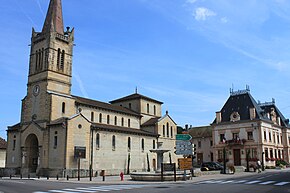
Aost (fr. Aoste) je naselje i opština u istočnoj Francuskoj u regionu Rona-Alpi, u departmanu Izer koja pripada prefekturi La Tur di Pen.
Po podacima iz 1999. godine u opštini je živelo 1715 stanovnika, a gustina naseljenosti je iznosila 174 stanovnika/km². Opština se prostire na površini od 9,82 km². Nalazi se na srednjoj nadmorskoj visini od 226 metara (maksimalnoj 256 m, a minimalnoj 207 m).
Demografija
| 1962. | 1968. | 1975. | 1982. | 1990. | 1999. | 2011. |
|---|---|---|---|---|---|---|
| 1.182 | 1.248 | 1.328 | 1.537 | 1.548 | 1.715 | 2.751 |
- Grafik promene broja stanovnika u toku poslednjih godina

Vidi još
- Departmani Francuske
- Spisak departmana Francuske po gustini naseljenosti
- Spisak departmana Francuske po površini
- Spisak departmana Francuske po broju stanovnika
- Spisak opština u departmanu Izer
Reference
- ↑ „National Institute of Statistics and Economic Studies”.
Literatura
- Alexandra Hughes, Alex Hughes, Keith A Reader, Keith Reader, ur. (2001). Encyclopedia of Contemporary French Culture (Routledge; Routledge World Reference edition izd.). ISBN 0415263549.
- Robb, Graham (2008). The Discovery of France: A Historical Geography. W. W. Norton & Company. ISBN 0393333647.
- Ardagh, John (1991). France (Cultural Atlas of izd.). Facts on File. ISBN 081602619X.
- Jones, Colin (1999). The Cambridge Illustrated History of France (Cambridge Illustrated Histories izd.). Cambridge University Press. ISBN 0521669928.
- Sowerwine, Charles (2009). France since 1870: Culture, Society and the Making of the Republic (2nd izd.). Palgrave Macmillan. ISBN 0230573398.
- Roberts, William J. (2004). France: A Reference Guide from the Renaissance to the Present (European Nations) (European Nations izd.). Facts on File. ISBN 0816044732.
Vanjske veze
- Baza podataka: Insee (fr)
- Aost na stranici Nacionalnog geografskog instituta Francuske (fr)
- Aost na stranici organizacije INSEE (fr)
- Najbliža naselja (kilometraža, pravac i koordinate)[mrtav link] (fr)
- Položaj mesta Aost na mapi Francuske (sa osnovnim podacima o mestu)[mrtav link] (fr)
- Plan naselja Aost na mapi (Mapquest)
- p
- r
- u
Izer
Albenc • Agnin • Adrets • Abrets • Belmont • Avignonet • Bellegarde-Poussieu • Avenières • Arandon • Apprieu • Aoste • Annoisin-Chatelans • Anjou • Bizonnes • Biviers • Biol • Bilieu • Assieu • Allevard • Allemond • Barraux • Arzay • Artas • Bonnefamille • Brion • Beauvoir-en-Royans • Beauvoir-de-Marc • Beaurepaire • Bresson • Bressieux • Beaulieu • Beaufort • Beaufin • Beaucroissant • Blandin • Brangues • Bouvesse-Quirieu • Bourgoin-Jallieu • Bourg-d'Oisans • Bougé-Chambalud • Bouchage • Bossieu • Bessins • Besse • Balme-les-Grottes • Bernin • Balbins • Badinières • Auris • Auberives-sur-Varèze • Auberives-en-Royans • Ambel • Autrans • Anthon • Bévenais • Bâtie-Montgascon • Bâtie-Divisin • Brézins • Brié-et-Angonnes • Chapelle-de-la-Tour • Chapelle-de-Surieu • Chapareillan • Chantesse • Chantelouve • Chanas • Chamrousse • Châtenay • Châtelus • Châteauvilain • Château-Bernard • Chuzelles • Chozeau • Choranche • Chonas-l'Amballan • Cholonge • Chirens • Chimilin • Chichilianne • Cheyssieu • Cheylas • Chevrières • Chatte • Cessieu • Burcin • Buissière • Buisse • Châlons • Châbons • Champier • Champagnier • Champ-sur-Drac • Champ-près-Froges • Chamagnieu • Chavanoz • Chassignieu • Chasselay • Chasse-sur-Rhône • Charvieu-Chavagneux • Charnècles • Charette • Charavines • Charantonnay • Charancieu • Chapelle-du-Bard • Claix • Echirolles • Four • Forteresse • Fontanil-Cornillon • Corrençon-en-Vercors • Corps • Cornillon-en-Trièves • Côtes-de-Corps • Côtes-d'Arey • Châtonnay • Herbeys • Eyzin-Pinet • Eydoche • Eybens • Goncelin • Domène • Gières • Estrablin • Domarin • Dolomieu • Doissin • Gillonnay • Diémoz • Dizimieu • Dionay • Culin • Combe-de-Lancey • Colombe • Cognin-les-Gorges • Cognet • Clonas-sur-Varèze • Clelles • Clavans-en-Haut-Oisans • Côte-Saint-André • Corenc • Cordéac • Corbelin • Crémieu • Commelle • Crolles • Creys-Mépieu • Cras • Crachier • Courtenay • Chélieu • Chèzeneuve
| ||
|---|---|---|
| Metropolitanska Francuska | 01 Ain • 02 Aisne • 03 Allier • 04 Alpes-de-Haute-Provence • 05 Hautes-Alpes • 06 Alpes-Maritimes • 07 Ardèche • 08 Ardennes • 09 Ariège • 10 Aube • 11 Aude • 12 Aveyron • 13 Bouches-du-Rhône • 14 Calvados • 15 Cantal • 16 Charente • 17 Charente-Maritime • 18 Cher • 19 Corrèze • 2A Corse-du-Sud • 2B Haute-Corse • 21 Côte-d'Or • 22 Côtes-d'Armor • 23 Creuse • 24 Dordogne • 25 Doubs • 26 Drôme • 27 Eure • 28 Eure-et-Loir • 29 Finistère • 30 Gard • 31 Haute-Garonne • 32 Gers • 33 Gironde • 34 Hérault • 35 Ille-et-Vilaine • 36 Indre • 37 Indre-et-Loire • 38 Isère • 39 Jura • 40 Landes • 41 Loir-et-Cher • 42 Loire • 43 Haute-Loire • 44 Loire-Atlantique • 45 Loiret • 46 Lot • 47 Lot-et-Garonne • 48 Lozère • 49 Maine-et-Loire • 50 Manche • 51 Marne • 52 Haute-Marne • 53 Mayenne • 54 Meurthe-et-Moselle • 55 Meuse • 56 Morbihan • 57 Moselle • 58 Nièvre • 59 Nord • 60 Oise • 61 Orne • 62 Pas-de-Calais • 63 Puy-de-Dôme • 64 Pyrénées-Atlantiques • 65 Hautes-Pyrénées • 66 Pyrénées-Orientales • 67 Bas-Rhin • 68 Haut-Rhin • 69 Rhône - Métropole de Lyon • 70 Haute-Saône • 71 Saône-et-Loire • 72 Sarthe • 73 Savoie • 74 Haute-Savoie • 75 Paris • 76 Seine-Maritime • 77 Seine-et-Marne • 78 Yvelines • 79 Deux-Sèvres • 80 Somme • 81 Tarn • 82 Tarn-et-Garonne • 83 Var • 84 Vaucluse • 85 Vendée • 86 Vienne • 87 Haute-Vienne • 88 Vosges • 89 Yonne • 90 Territoire de Belfort • 91 Essonne • 92 Hauts-de-Seine • 93 Seine-Saint-Denis • 94 Val-de-Marne • 95 Val-d'Oise |  |
| Prekomorski departmani | 971 Guadeloupe • 972 Martinique • 973 Francuska Gvajana • 974 Réunion • 976 Mayotte | |
 | Ovaj članak o Francuskoj je u začetku. Možete pomoći Wikipediji tako da ga proširite. |
Koordinate: 45° 35' 21" SG Š, 05° 36' 34" IGD


