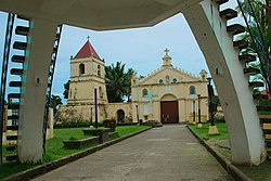
Balangiga
| Balangiga | |||
|---|---|---|---|
 | |||
| Land |  Filippinene Filippinene | ||
| Status | kommune | ||
| Postnummer | 6812 | ||
| Retningsnummer | 55 | ||
| Areal | 190,05 km² | ||
| Befolkning | 14 341[1] (2020) | ||
| Bef.tetthet | 75,46 innb./km² | ||
| Antall husholdninger | 3 584 | ||
| Språk | Waray-waray, tagalog | ||
| Høyde o.h. | 31 meter | ||
| Nettside | www | ||
 Balangiga 11°06′33″N 125°23′12″Ø | |||
Balangiga på Commons | |||

Balangiga er en kommune i provinsen Eastern Samar på Filippinene. Under folketellingen i 2000 kom man til et befolkningstall på 10 662 i 2 131 husstander.
Barangayer
Balangiga er inndelt i 13 barangayer per 30. september 2019.[2]
- Bacjao
- Cag-olango
- Cansumangcay
- Guinmaayohan
- Barangay Poblacion I
- Barangay Poblacion II
- Barangay Poblacion III
- Barangay Poblacion IV
- Barangay Poblacion V
- Barangay Poblacion VI
- San Miguel
- Santa Rosa
- Maybunga
Referanser
Eksterne lenker
- 2000 Philippine Census Information


