Aaron Arrowsmith
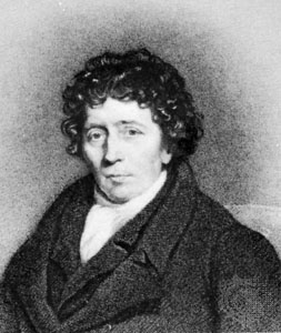
Aaron Arrowsmith (Winston, 17 juli 1750 - Londen 23 april 1823) was een Engelse cartograaf, graveur en uitgever.
Levensloop
Toen hij ongeveer twintig jaar oud was, verhuisde hij van Winston, County Durham naar Soho Square in Londen en trad in dienst van John Cary, de graveur en William Faden. Rond 1810 werd hij hydrograaf van de Prins van Wales en vervolgens in 1820 van de koning. In januari 1790 werd hij beroemd door zijn grote Chart of the world on Mercator's projection (8 bladen). Vier jaar later publiceerde hij nog een grote kaart van de wereld op de bolvormige projectie, met een begeleidend volume met uitleg. De kaarten van Noord-Amerika (1796) en Schotland (1807) zijn de meest gevierde van zijn vele latere producties.
In 1804 werden 63 kaarten, getekend door Arrowsmith en Samuel Lewis uit Philadelphia gepubliceerd in de nieuwe en elegante General Atlas Comprising all Discoveries to the Present Time. Latere edities van de atlas werden gepubliceerd in 1805, 1812 en 1819. De edities van 1804 en 1812 zijn gedigitaliseerd in de David Rumsey-kaartencollectie[1] Hij liet twee zonen na, Aaron en Samuel, van wie de oudste de samensteller was van de Eton Comparative Atlas, van een Bijbelse atlas en van verschillende geografiehandboeken. Aaron Arrowsmith de oudste was verantwoordelijk voor het organiseren van de kaartenbundel voor Rees' Cyclopædia, 1802-1918.
Gepubliceerde kaarten


- Chart of the world on Mercator's projection, exhibiting all the new discoveries to the present time: with the tracks of the most distinguished navigators since the year 1700, carefully collected from the best charts, maps, voyages, &c extant., 1790 (8 sheets)
- A Map Exhibiting All the New Discoveries in the Interior Parts of North America, 1 January 1795, with numerous other editions, including in 1796, 1802, 1811, 1814, 1818, 1819, and 1824. De 1802-versie van deze kaart werd nauwkeurig bestudeerd door Meriwether Lewis voorafgaand aan de Lewis en Clark-expeditie en de editie van 1811 werd bijgewerkt met de gepubliceerde informatie van die expeditie in de editie van 1814.[2][3]
- Chart of the Pacific Ocean Drawn from a great number of Printed and Ms. Journals..., 1798, 1820 edition (9 sheets)
- Africa To The Committee and Members of the British Association, 1802 (4 sheets), 1811 edition
- Chart of the West Indies And Spanish Dominions in North America, 1803 (4 sheets)
- Map of America, 1804, 1808 edition, 1811 edition[4]
- Chart of the East Indies Islands, Exhibiting the several Passages between the Indian and Pacific Oceans, 1800, 1809 edition, 1812 edition, 1824 edition
- A New Map of Mexico and Adjacent Provinces Compiled from Original Documents., 1810 (4 sheets)
- Map of Countries Round the North Pole, 1818
Bronnen, noten en/of referenties
- ↑ Zijn hele collectie wordt gehost in het David Rumsey Map Center dat op 19 april 2016 werd geopend in de Bing Wing of Green Library, Stanford University.] Het centrum bevat zeldzame kaarten en atlassen, naast interactieve schermen met hoge resolutie voor het bekijken van digitale cartografie. De website davidrumsey.com blijft een afzonderlijke openbare bron.
- ↑ A Map Exhibiting all the New Discoveries in the Interior Parts of North America. Inscribed by Permission to the Honorable Governor and Company of Adv. Gearchiveerd op 29 december 2018.
- ↑ Before Lewis & Clark – Lewis & Clark and the Revealing of America | Exhibitions (Library of Congress) (24 June 2003).
- ↑ Map of America by A. Arrowsmith, Hydrographer to H.R.H. The Prince of Wales. 1804. W. & G. Cooke, Sculp. London. Published 4th September 1804 by A. Arrowsmith No. 10 Soho Square ... Engraved by W. West, the Hills by H. Wilson (1811).


