New England
|
| |
|---|---|
| Motto: "An appeal to heaven" | |
 Emblem/Personifikasi: Brother Jonathan | |
  | |
| Statistik regional | |
| Komposisi |  Connecticut Connecticut Maine Maine Massachusetts Massachusetts New Hampshire New Hampshire Rhode Island Rhode Island Vermont Vermont |
| Demonim | New Englander, Yankee[2] |
| Area - Total | 71,991.8 sq mi (186,458.8 km²) |
| Population - Total - Density | 14,444,865 (2010 est.)[3] 198.2/sq mi (87.7/km²) |
| Gubernur | Dannel Malloy (D-CT) Paul LePage (R-ME) Deval Patrick (D-MA) Maggie Hassan (D-NH) Lincoln Chafee (D-RI) Peter Shumlin (D-VT) |
| Kota terbesar | Boston (pop. 617,594) |
| GDP | $813.0 billion (2011)[4] |
| HDI | 5.7 (1st) (2011) |
| Area Metropolitan Terbesar | Boston-Cambridge-Quincy (pop. 4,522,858) |


New England adalah wilayah yang berada di Amerika Serikat bagian timur laut. Ada 6 negara bagian di wilayah New England, yakni Maine, Vermont, New Hampshire, Massachusetts, Connecticut, dan Rhode Island.
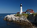
Galeri


Catatan kaki
- ^ "Yankeeland". The Random House Dictionary. Boston: Random House. 2013. Diakses tanggal 2013-09-05.
- ^ "Yankee". The American Heritage Dictionary. Boston: Houghton Mifflin Company. 2000. Diakses tanggal 2011-03-28.
- ^ "State & County QuickFacts". US Census Bureau. Diarsipkan dari versi asli tanggal 2012-10-16. Diakses tanggal 2008-07-24.
- ^ "Interactive Data: GDP by State". Bureau of Economic Analysis. Diarsipkan dari versi asli tanggal 2014-10-22. Diakses tanggal 2013-04-24.
Referensi
- New York: Atlas of Historical County Boundaries; John H. Long, Editor; Compiled by Kathryn Ford Thorne; A Project of the Dr. William M. Scholl Center for Family and Community History; The new Berry Library; Simon & Schuster; 1993.
- U.S. Census Bureau. "Census Regions and Divisions of the United States"PDF (1.06 MB). Retrieved May 11, 2005
Bacaan lanjut
- Hall, Donald, Burt Feintuch, and David H. Watters, eds. Encyclopedia of New England (Yale U.P. 2005), 1596 pp; the major scholarly resource to the geography, history and culture of the region. ISBN 0-300-10027-2
- Bartlett, Ray et al. New England Trips. ISBN 1-74179-728-4
- Berman, Eleanor. Eyewitness Travel Guides New England. ISBN 0-7566-2697-8
- Chenoweth, James. Oddity Odyssey: A Journey Through New England's Colorful Past. Holt, 1996. Humorous travel guide. ISBN 0-8050-3671-7
- Muse, Vance. The Smithsonian Guide to Historic America: Northern New England. Stewart, Tabori & Chang, 1998. A photographic guide to historic sites in New England. ISBN 1-55670-635-9
- Riess, Jana. The Spiritual Traveler Boston and New England: A Guide to Sacred Sites and Peaceful Places, HiddenSpring ISBN 1-58768-008-4
- Sletcher, Michael. New England: The Greenwood Encyclopedia of American Regional Cultures (2004)
- Wiencek, Henry. The Smithsonian Guide to Historic America: Southern New England. Stewart, Tabori & Chang, 1998. A photographic guide to historic sites in New England. ISBN 1-55670-633-2
Pranala luar
| Cari tahu mengenai New England pada proyek-proyek Wikimedia lainnya: | |
| Definisi dan terjemahan dari Wiktionary | |
| Gambar dan media dari Commons | |
| Berita dari Wikinews | |
| Kutipan dari Wikiquote | |
| Teks sumber dari Wikisource | |
| Buku dari Wikibuku | |
| Panduan wisata di New England dari Wikivoyage | |
- Political
- New England Governors Conference
- Historic
- Historic New England
- Minuteman National Park Homepage - American Revolution battle site
- Maps
- Historic USGS Maps of New England & NY Diarsipkan 2013-03-05 di Wayback Machine.
- Map of New England. From the 1871 Atlas of Massachusetts by Walling and Gray.
- Culture
- New England Music Archive
- Online Discussion Groups
- The Northeast States Forum @ Delphiforums
- Media
- New England Americana
 |  Ontario Ontario |  Quebec Quebec |  New Brunswick New Brunswick | |
 New York New York |  | Atlantic Ocean | ||
| ||||
 | ||||
 New Jersey New Jersey | Long Island Sound • Block Island Sound | Cape Cod Martha's Vineyard • Nantucket Island |

Koordinat: 44°12′20.00″N 70°18′23.13″W / 44.2055556°N 70.3064250°W / 44.2055556; -70.3064250
- l
- b
- s


