Zhong County
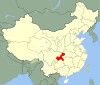
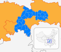
County in Chongqing, People's Republic of China
Zhongxian 30°18′00″N 108°02′15″E / 30.2999°N 108.0375°E / 30.2999; 108.0375 | |
|---|---|
| Country | People's Republic of China |
| Municipality | Chongqing |
| Area | |
| • Total | 2,184 km2 (843 sq mi) |
| Population (2010) | |
| • Total | 751,400 |
| • Density | 340/km2 (890/sq mi) |
| Time zone | UTC+8 (China Standard) |
Zhong County or Zhongxian (simplified Chinese: 忠县; traditional Chinese: 忠縣; pinyin: Zhōng Xiàn) is a county of Chongqing Municipality, China.
The Shibaozhai Temple, which is endangered by the rising waters caused by the Three Gorges Dam, is located there.
Zhong County has two Yangtze River crossings: the Zhongxian Yangtze River Bridge and Zhongzhou Yangtze River Bridge.
History
Linjiang County (临江县) was established under Ba Commandery (巴郡) in the Han dynasty. In Western Wei, Lin Prefecture (临州, Linzhou) was established, with Linjiang as its seat. In the Tang dynasty, it was renamed Zhong Prefecture (忠州, Zhongzhou, literally "loyal prefecture"). In 1913, Zhongzhou was replaced by Zhong County.[1]
Climate
| Climate data for Zhongxian (1997–2020 normals, extremes 1981–2010) | |||||||||||||
|---|---|---|---|---|---|---|---|---|---|---|---|---|---|
| Month | Jan | Feb | Mar | Apr | May | Jun | Jul | Aug | Sep | Oct | Nov | Dec | Year |
| Record high °C (°F) | 17.6 (63.7) | 25.3 (77.5) | 33.3 (91.9) | 36.8 (98.2) | 35.6 (96.1) | 38.3 (100.9) | 40.1 (104.2) | 42.6 (108.7) | 42.7 (108.9) | 36.3 (97.3) | 29.3 (84.7) | 17.5 (63.5) | 42.7 (108.9) |
| Mean daily maximum °C (°F) | 9.7 (49.5) | 12.8 (55.0) | 18.1 (64.6) | 23.5 (74.3) | 26.5 (79.7) | 29.2 (84.6) | 33.6 (92.5) | 33.9 (93.0) | 28.9 (84.0) | 22.1 (71.8) | 16.8 (62.2) | 10.7 (51.3) | 22.2 (71.9) |
| Daily mean °C (°F) | 7.3 (45.1) | 9.5 (49.1) | 13.7 (56.7) | 18.5 (65.3) | 21.8 (71.2) | 24.7 (76.5) | 28.4 (83.1) | 28.2 (82.8) | 24.2 (75.6) | 18.6 (65.5) | 13.8 (56.8) | 8.6 (47.5) | 18.1 (64.6) |
| Mean daily minimum °C (°F) | 5.6 (42.1) | 7.2 (45.0) | 10.5 (50.9) | 15.0 (59.0) | 18.5 (65.3) | 21.6 (70.9) | 24.6 (76.3) | 24.1 (75.4) | 20.9 (69.6) | 16.4 (61.5) | 11.9 (53.4) | 7.1 (44.8) | 15.3 (59.5) |
| Record low °C (°F) | −0.8 (30.6) | 0.5 (32.9) | 3.3 (37.9) | 5.6 (42.1) | 11.9 (53.4) | 15.3 (59.5) | 19.9 (67.8) | 18.2 (64.8) | 14.4 (57.9) | 9.4 (48.9) | 3.9 (39.0) | −0.5 (31.1) | −0.8 (30.6) |
| Average precipitation mm (inches) | 18.6 (0.73) | 21.1 (0.83) | 55.4 (2.18) | 114.3 (4.50) | 172.5 (6.79) | 182.6 (7.19) | 148.4 (5.84) | 133.1 (5.24) | 132.6 (5.22) | 110.3 (4.34) | 62.9 (2.48) | 23.9 (0.94) | 1,175.7 (46.28) |
| Average precipitation days (≥ 0.1 mm) | 9.7 | 8.9 | 12.2 | 14.9 | 16.3 | 15.5 | 11.2 | 11.3 | 12.1 | 16.0 | 12.6 | 11.3 | 152 |
| Average snowy days | 0.4 | 0 | 0 | 0 | 0 | 0 | 0 | 0 | 0 | 0 | 0 | 0.1 | 0.5 |
| Average relative humidity (%) | 84 | 80 | 77 | 79 | 81 | 83 | 77 | 73 | 78 | 86 | 87 | 87 | 81 |
| Mean monthly sunshine hours | 26.7 | 41.1 | 84.9 | 114.7 | 116.7 | 117.3 | 198.8 | 207.5 | 125.0 | 70.5 | 47.9 | 25.0 | 1,176.1 |
| Percent possible sunshine | 14 | 16 | 23 | 29 | 28 | 28 | 42 | 48 | 36 | 24 | 23 | 17 | 27 |
| Source: China Meteorological Administration[2][3] | |||||||||||||
References
- ^ "忠县县情". Zhong County Government. Retrieved 20 February 2019.
- ^ 中国气象数据网 – WeatherBk Data (in Simplified Chinese). China Meteorological Administration. Retrieved 28 April 2023.
- ^ 中国气象数据网 (in Simplified Chinese). China Meteorological Administration. Retrieved 28 April 2023.
External links
Wikimedia Commons has media related to Zhong County.
- Official website of Zhong County
- v
- t
- e

- Baiheliang Underwater Museum
- Ciqikou
- Dazu Rock Carvings
- Diaoyu Fortress
- Fengdu Ghost City
- Foreigners' Street
- Furong Cave
- People's Great Hall
- Red Rock Village Museum
- Science and Technology Museum
- Snowy Jade Cave
- Stilwell Museum
- Three Gorges Museum
- Three Natural Bridges
- Wulong Karst
- Zoo
- Twelve Views of Chongqing
 | This Chongqing location article is a stub. You can help Wikipedia by expanding it. |
- v
- t
- e


