Tegernheim
Municipality in Bavaria, Germany

Coat of arms
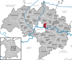
Location of Tegernheim within Regensburg district
(2020–26) Max Kollmannsberger[1] (FW)
(2022-12-31)[2]
93105
Tegernheim (Northern Bavarian: Dächaham) is a municipality in the district of Regensburg in Bavaria in Germany. The Danube flows through the cadastrial area of the village.
References
- ^ Liste der ersten Bürgermeister/Oberbürgermeister in kreisangehörigen Gemeinden, Bayerisches Landesamt für Statistik, 15 July 2021.
- ^ Genesis Online-Datenbank des Bayerischen Landesamtes für Statistik Tabelle 12411-003r Fortschreibung des Bevölkerungsstandes: Gemeinden, Stichtag (Einwohnerzahlen auf Grundlage des Zensus 2011).
- v
- t
- e
Towns and municipalities in Regensburg district
- Alteglofsheim
- Altenthann
- Aufhausen
- Bach an der Donau
- Barbing
- Beratzhausen
- Bernhardswald
- Brennberg
- Brunn
- Deuerling
- Donaustauf
- Duggendorf
- Hagelstadt
- Hemau
- Holzheim am Forst
- Kallmünz
- Köfering
- Laaber
- Lappersdorf
- Mintraching
- Mötzing
- Neutraubling
- Nittendorf
- Obertraubling
- Pentling
- Pettendorf
- Pfakofen
- Pfatter
- Pielenhofen
- Regenstauf
- Riekofen
- Schierling
- Sinzing
- Sünching
- Tegernheim
- Thalmassing
- Wenzenbach
- Wiesent
- Wolfsegg
- Wörth an der Donau
- Zeitlarn

Authority control databases | |
|---|---|
| International |
|
| National |
|
 | This Regensburg district location article is a stub. You can help Wikipedia by expanding it. |
- v
- t
- e


