Tanah Grogot
District in East Kalimantan, Indonesia
Kecamatan in East Kalimantan, Indonesia
01°54′08″S 116°11′21″E / 1.90222°S 116.18917°E / -1.90222; 116.18917 Indonesia
 (2020)
76251
Tanah Grogot is a district (kecamatan) and the capital of Paser Regency, East Kalimantan, Indonesia. It shares a border with Kuaro in the north, Pasir Belengkong in the south. In the year 2020, its total population is 76,344.[2]
On December 29, 1959, Tanah Grogot was inaugurated as the capital of Paser Regency by the law No. 27 of 1959.
Geography
Tanah Grogot is located on the southern part of Paser Regency, eastern side of Borneo. Its average elevation is 5 meters above the sea level.[3]
Climate
Tanah Grogot has a Tropical Rainforest Climate (Af). It gets the most amount of rainfall in March, with an average precipitation of 305 mm; and the least rainfall in August, with an average precipitation of 92 mm.
| Climate data for Tanah Grogot | |||||||||||||
|---|---|---|---|---|---|---|---|---|---|---|---|---|---|
| Month | Jan | Feb | Mar | Apr | May | Jun | Jul | Aug | Sep | Oct | Nov | Dec | Year |
| Mean daily maximum °C (°F) | 29.4 (84.9) | 29.5 (85.1) | 29.5 (85.1) | 29.5 (85.1) | 29.4 (84.9) | 28.9 (84.0) | 28.8 (83.8) | 29.5 (85.1) | 30.3 (86.5) | 30.5 (86.9) | 29.8 (85.6) | 29.5 (85.1) | 29.6 (85.2) |
| Daily mean °C (°F) | 25.8 (78.4) | 25.9 (78.6) | 25.9 (78.6) | 26.1 (79.0) | 26.2 (79.2) | 25.8 (78.4) | 25.6 (78.1) | 26 (79) | 26.5 (79.7) | 26.6 (79.9) | 26.2 (79.2) | 26 (79) | 26.1 (78.9) |
| Mean daily minimum °C (°F) | 23.6 (74.5) | 23.6 (74.5) | 23.7 (74.7) | 23.9 (75.0) | 24.1 (75.4) | 23.7 (74.7) | 23.4 (74.1) | 23.5 (74.3) | 23.7 (74.7) | 23.8 (74.8) | 23.8 (74.8) | 23.8 (74.8) | 23.7 (74.7) |
| Average rainfall mm (inches) | 280 (11.0) | 257 (10.1) | 305 (12.0) | 285 (11.2) | 213 (8.4) | 176 (6.9) | 138 (5.4) | 92 (3.6) | 102 (4.0) | 159 (6.3) | 229 (9.0) | 269 (10.6) | 2,505 (98.5) |
| Source: Climate-Data.org[4] | |||||||||||||
Administrative division
Tanah Grogot is divided into the following 15 villages and 1 subdistrict:[2]
| Name | Type | Area (km2) | Population (2020) |
|---|---|---|---|
| Janju | Village | 40.08 | 2,497 |
| Sempulang | Village | 8.20 | 1,826 |
| Tepian Batang | Village | 25.97 | 5,809 |
| Tanah Grogot | Subdistrict | 10.36 | 30,713 |
| Tanah Periuk | Village | 6.74 | 3,731 |
| Pepara | Village | 5.69 | 715 |
| Sungai Tuak | Village | 7.31 | 1,764 |
| Rantau Panjang | Village | 42.44 | 1,242 |
| Jone | Village | 46.78 | 7,125 |
| Padang Pangrapat | Village | 14.60 | 3,697 |
| Muara Pasir | Village | 83.41 | 3,212 |
| Perepat | Village | N/A | 452 |
| Pulau Rantau | Village | 44.00 | 761 |
| Sungai Langir | Village | N/A | 355 |
| Tapis | Village | N/A | 4,561 |
| Senaken | Village | N/A | 7,884 |
Demographics

In 2020, there are a total of 76,344 inhabitants within the district.[2] About 97.19% of the population are Muslims, 2.05% are Protestant Christians, 0.64% are Catholic Christians, and the rest 0.12% belong to other religions (Hinduism, Buddhism, etc.) or non-religious.[5]
Galleries
-
 Shaleha Princess Park
 -
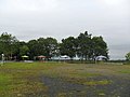 Amber Nature Park
 -
 Kandilo Plaza
 -
 TMP Daya Taka


References
- ^ "Berita | Portal Resmi Kabupaten Paser". paserkab.go.id. Retrieved 2023-04-25.
- ^ a b c Kecamatan Tanah Grogot Dalam Angka 2021 [Tanah Grogot District in Figures 2021] (in Indonesian). 2021-09-24. Retrieved 2023-04-25.
- ^ "Tanah Grogot topographic map, elevation, terrain". Topographic maps. Retrieved 2023-04-25.
- ^ "Tanah Grogot climate: Temperature Tanah Grogot & Weather By Month - Climate-Data.org". en.climate-data.org. Retrieved 2023-04-25.
- ^ "Batas Kecamatan: TANAH GROGOT". gis.dukcapil.kemendagri.go.id. Retrieved 2023-04-26.


