Stahovica
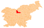
Place in Upper Carniola, Slovenia
46°16′16.76″N 14°36′24.31″E / 46.2713222°N 14.6067528°E / 46.2713222; 14.6067528 Slovenia
 (2002)
Stahovica (pronounced [staˈxoːʋitsa]) is a settlement that stretches along the road leading into the upper Kamnik Bistrica Valley in the Municipality of Kamnik in the Upper Carniola region of Slovenia.
References
- ^ Statistical Office of the Republic of Slovenia
External links
- Stahovica on Geopedia
- v
- t
- e
Municipality of Kamnik
Administrative seat: Kamnik
- Big Pasture Plateau
- Kamnik Bistrica Valley
- Kamnik Parish Church
- Little Castle
- Menina Pasture Plateau
- Nevljica
- Snovik Spa
- St. Primus' Church
- Tuhinj Valley
- Tunjice Natural Health Resort
- Volčji Potok Arboretum
- Zaprice Castle


