St. Mullin's Lower
Barony in County Carlow, Ireland
Barony in Leinster, Ireland
St. Mullin's Lower Tigh Moling Íochtarach (Irish) | |
|---|---|
Barony | |
 | |
| Country | Ireland |
| Province | Leinster |
| County | Carlow |
| Area | |
| • Land | 88.7 km2 (34.2 sq mi) |
St. Mullin's Lower (Irish: Tigh Moling Íochtarach) is a barony in County Carlow, Ireland.
Etymology
St. Mullin's Lower barony takes its name from the village of St. Mullin's (Irish: Tigh Moling).[1]
Location
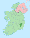
St. Mullin's Lower is found in south County Carlow, east of the River Barrow and west of the Blackstairs Mountains.
St. Mullin's Lower barony is bordered to the north by Idrone East, County Carlow; to the east and south by Bantry, County Wexford; to the southwest by Ida, County Kilkenny; and to the west by Gowran, County Kilkenny.
History
The ancient land of the Ui Drona was cantered here in the 8th century.[2]
List of settlements
Below is a list of settlements in St. Mullin's Lower:
- Ballymurphy
- Graiguenamanagh (southern part)
References
- v
- t
- e
Places in County Carlow
townlands
- Carlow
- Forth
- Idrone East
- Idrone West
- Rathvilly
- St. Mullin's Lower
- St. Mullin's Upper
- List of townlands in County Carlow
- Category: Mountains and hills of County Carlow
- Category: Rivers of County Carlow
- Category: Geography of County Carlow


