Sang-e-Masha
Place in Ghazni Province, Afghanistan
Sang-e-Masha سنگ ماشه Sangi Masha | |
|---|---|
 | |
| 33°8′38″N 67°26′41″E / 33.14389°N 67.44472°E / 33.14389; 67.44472 | |
| Country |  Afghanistan Afghanistan |
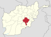
| Province | Ghazni Province |
| District | Jaghori District |
| Elevation | 7,982 ft (2,433 m) |
| Time zone | UTC+4:30 |
Sang-e-Masha also spelled Sangi Masha (Dari: سنگ ماشه), is the administrative center of Jaghori District in Ghazni Province,Afghanistan.[1]
See also
- Jaghori District
- Ghazni Province
References
- ^ "Sangi Masha on the map, Afghanistan, location". ms.toponavi.com. Retrieved 2018-04-06.
- v
- t
- e
Ghazni Province
Capital: Ghazni
- Ab Band
- Almaytu
- Andar
- Anguri
- Binisang
- Dado
- Du Abi
- Espandi 'Olya
- Gulbawri
- Haji Khel
- Janda
- Jermatu
- Kakrak Valley
- Khogyani
- Khwaja Umari
- Loman
- Malistan
- Mir Adina
- Miray
- Muqur
- Nani
- Nawa
- Pana
- Qarabagh
- Qolyaqol
- Qyaq Valley
- Ramak
- Sang-e-Masha
- Sangar
- Sarab
- Sardeh Band
- Shaki Valley
- Tamaki
- Turgan Valley
- Zargari
 | This Ghazni Province, Afghanistan location article is a stub. You can help Wikipedia by expanding it. |
- v
- t
- e


