San Sebastian, Samar
Municipality in Samar, Philippines
Municipality in Eastern Visayas, Philippines

Flag

Seal
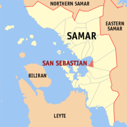
Map of Samar with San Sebastian highlighted
List
- • Rebecca S. Mabulay
- • Laleine N. Babon
- • Marites B. Saria
- • Nila B. Halog
- • Elizabeth B. Cerdeña
- • Leonilo M. Cabutin
- • April Joy A. Operario
- • Danico G. delos Reyes
- DILG Masterlist of Officials
(2020 census)[3]
27.76
6709
086015000
Tagalog
San Sebastian, officially the Municipality of San Sebastian (Waray: Bungto han San Sebastian; Tagalog: Bayan ng San Sebastian), is a 6th class municipality in the province of Samar, Philippines. According to the 2020 census, it has a population of 8,704 people.[3]
San Sebastian was absorbed into the town of Wright (Paranas) during the American occupation. In 1950, the neighborhoods of San Sebastian, Jitaasan, Dolores, Camanjagay, Bontod, Campidasa, Campiyak, Maslog, Balogo, Maropangpang, Binongtoan, and Bolwan were combined and re-established as a single town.[5]
History
The town of San Sebastian was known before as "Balugo," (the original and ancient name) considering that it was situated at the mouth of Balugo River. Balugo was a visita and it was annexed to Paranas. It was later renamed San Sebastian by Fray Domingo Ruiz, O.F.M. after his birthplace (a coastal city in Spain) who was then assigned in Balugo. Fr. Ruiz made initial efforts and recommendations that San Sebastian from its status as visita should be elevated and made into pueblo under the spiritual care of the cura paroco of Catbalogan.
Between 1894 and 1895, San Sebastian was given the status as pueblo and an independent parish separated from its mother town, Paranas. During the outbreak of the Philippine Revolution, San Sebastian was again affixed as a barrio of Paranas. Later with the enactment of Republic Act No. 543 by the Philippine Congress once again San Sebastian became an independent municipality.
Geography
Barangays
San Sebastian is politically subdivided into 14 barangays. Each barangay consists of puroks and some have sitios.
- Poblacion Barangay 1
- Poblacion Barangay 2
- Poblacion Barangay 3
- Poblacion Barangay 4
- Balogo
- Bontod
- Camanhagay
- Campiyak
- Dolores
- Hita-asan I
- Inobongan
- Cabaywa
- Canduyucan
- Hita-asan II
Climate
| Climate data for San Sebastian, Samar | |||||||||||||
|---|---|---|---|---|---|---|---|---|---|---|---|---|---|
| Month | Jan | Feb | Mar | Apr | May | Jun | Jul | Aug | Sep | Oct | Nov | Dec | Year |
| Mean daily maximum °C (°F) | 27 (81) | 28 (82) | 28 (82) | 30 (86) | 30 (86) | 30 (86) | 29 (84) | 29 (84) | 29 (84) | 29 (84) | 28 (82) | 28 (82) | 29 (84) |
| Mean daily minimum °C (°F) | 22 (72) | 22 (72) | 22 (72) | 23 (73) | 24 (75) | 24 (75) | 24 (75) | 24 (75) | 24 (75) | 24 (75) | 23 (73) | 23 (73) | 23 (74) |
| Average precipitation mm (inches) | 114 (4.5) | 81 (3.2) | 94 (3.7) | 81 (3.2) | 119 (4.7) | 192 (7.6) | 186 (7.3) | 158 (6.2) | 167 (6.6) | 185 (7.3) | 202 (8.0) | 176 (6.9) | 1,755 (69.2) |
| Average rainy days | 18.6 | 14.7 | 16.8 | 17.8 | 22.3 | 25.9 | 27.5 | 26.2 | 26.6 | 27.0 | 24.6 | 22.3 | 270.3 |
| Source: Meteoblue[6] | |||||||||||||
Demographics
| Year | Pop. | ±% p.a. |
|---|---|---|
| 1903 | 2,767 | — |
| 1960 | 3,645 | +0.48% |
| 1970 | 4,267 | +1.59% |
| 1975 | 4,441 | +0.80% |
| 1980 | 4,606 | +0.73% |
| 1990 | 5,732 | +2.21% |
| 1995 | 6,381 | +2.03% |
| 2000 | 6,779 | +1.31% |
| 2007 | 7,365 | +1.15% |
| 2010 | 7,708 | +1.67% |
| 2015 | 8,057 | +0.85% |
| 2020 | 8,704 | +1.53% |
| Source: Philippine Statistics Authority [7][8][9][10] | ||
Economy
Poverty Incidence of San Sebastian
10 20 30 40 50 2006 49.00 2009 42.96 2012 40.75 2015 41.00 2018 27.76 2021 26.91 Source: Philippine Statistics Authority[11][12][13][14][15][16][17][18] |
References
- ^ Municipality of San Sebastian | (DILG)
- ^ "2015 Census of Population, Report No. 3 – Population, Land Area, and Population Density" (PDF). Philippine Statistics Authority. Quezon City, Philippines. August 2016. ISSN 0117-1453. Archived (PDF) from the original on May 25, 2021. Retrieved July 16, 2021.
- ^ a b Census of Population (2020). "Region VIII (Eastern Visayas)". Total Population by Province, City, Municipality and Barangay. Philippine Statistics Authority. Retrieved 8 July 2021.
- ^ "PSA Releases the 2018 Municipal and City Level Poverty Estimates". Philippine Statistics Authority. 15 December 2021. Retrieved 22 January 2022.
- ^ "An act re-creating the municipality of San Sebastian, province of Samar". LawPH.com. Retrieved 2011-04-09.
- ^ "San Sebastian: Average Temperatures and Rainfall". Meteoblue. Retrieved 29 February 2020.
- ^ Census of Population (2015). "Region VIII (Eastern Visayas)". Total Population by Province, City, Municipality and Barangay. Philippine Statistics Authority. Retrieved 20 June 2016.
- ^ Census of Population and Housing (2010). "Region VIII (Eastern Visayas)" (PDF). Total Population by Province, City, Municipality and Barangay. National Statistics Office. Retrieved 29 June 2016.
- ^ Censuses of Population (1903–2007). "Region VIII (Eastern Visayas)". Table 1. Population Enumerated in Various Censuses by Province/Highly Urbanized City: 1903 to 2007. National Statistics Office.
{{cite encyclopedia}}: CS1 maint: numeric names: authors list (link) - ^ "Province of Samar (Western Samar)". Municipality Population Data. Local Water Utilities Administration Research Division. Retrieved 17 December 2016.
- ^ "Poverty incidence (PI):". Philippine Statistics Authority. Retrieved December 28, 2020.
- ^ "Estimation of Local Poverty in the Philippines" (PDF). Philippine Statistics Authority. 29 November 2005.
- ^ "2003 City and Municipal Level Poverty Estimates" (PDF). Philippine Statistics Authority. 23 March 2009.
- ^ "City and Municipal Level Poverty Estimates; 2006 and 2009" (PDF). Philippine Statistics Authority. 3 August 2012.
- ^ "2012 Municipal and City Level Poverty Estimates" (PDF). Philippine Statistics Authority. 31 May 2016.
- ^ "Municipal and City Level Small Area Poverty Estimates; 2009, 2012 and 2015". Philippine Statistics Authority. 10 July 2019.
- ^ "PSA Releases the 2018 Municipal and City Level Poverty Estimates". Philippine Statistics Authority. 15 December 2021. Retrieved 22 January 2022.
- ^ "PSA Releases the 2021 City and Municipal Level Poverty Estimates". Philippine Statistics Authority. 2 April 2024. Retrieved 28 April 2024.
External links
- San Sebastian Profile at PhilAtlas.com
- Philippine Standard Geographic Code
- Philippine Census Information
- Local Governance Performance Management System
Places adjacent to San Sebastian, Samar | ||||||||||||||||
|---|---|---|---|---|---|---|---|---|---|---|---|---|---|---|---|---|
| ||||||||||||||||


Authority control databases | |
|---|---|
| International |
|
| National |
|
 | This article about a location in Eastern Visayas region is a stub. You can help Wikipedia by expanding it. |
- v
- t
- e


