Saldenburg
You can help expand this article with text translated from the corresponding article in German. (March 2009) Click [show] for important translation instructions.
- View a machine-translated version of the German article.
- Machine translation, like DeepL or Google Translate, is a useful starting point for translations, but translators must revise errors as necessary and confirm that the translation is accurate, rather than simply copy-pasting machine-translated text into the English Wikipedia.
- Do not translate text that appears unreliable or low-quality. If possible, verify the text with references provided in the foreign-language article.
- You must provide copyright attribution in the edit summary accompanying your translation by providing an interlanguage link to the source of your translation. A model attribution edit summary is
Content in this edit is translated from the existing German Wikipedia article at [[:de:Saldenburg]]; see its history for attribution. - You may also add the template
{{Translated|de|Saldenburg}}to the talk page. - For more guidance, see Wikipedia:Translation.
Municipality in Bavaria, Germany

Coat of arms
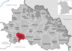
Location of Saldenburg within Freyung-Grafenau district
(2022-12-31)[2]
94163
Saldenburg is a municipality in the district of Freyung-Grafenau in Bavaria in Germany.
The municipality comprises the following 30 villages and locations:
|
|
|
|
References
- ^ Liste der ersten Bürgermeister/Oberbürgermeister in kreisangehörigen Gemeinden, Bayerisches Landesamt für Statistik, 15 July 2021.
- ^ Genesis Online-Datenbank des Bayerischen Landesamtes für Statistik Tabelle 12411-003r Fortschreibung des Bevölkerungsstandes: Gemeinden, Stichtag (Einwohnerzahlen auf Grundlage des Zensus 2011).
Wikimedia Commons has media related to Saldenburg.
- v
- t
- e
Towns and municipalities in Freyung-Grafenau
- Eppenschlag
- Freyung
- Fürsteneck
- Grafenau
- Grainet
- Haidmühle
- Hinterschmiding
- Hohenau
- Innernzell
- Jandelsbrunn
- Mauth
- Neureichenau
- Neuschönau
- Perlesreut
- Philippsreut
- Ringelai
- Röhrnbach
- Saldenburg
- Sankt Oswald-Riedlhütte
- Schöfweg
- Schönberg
- Spiegelau
- Thurmansbang
- Waldkirchen
- Zenting

Authority control databases | |
|---|---|
| International |
|
| National |
|
 | This Freyung-Grafenau location article is a stub. You can help Wikipedia by expanding it. |
- v
- t
- e


