Sairé
Municipality in Pernambuco, Brazil
Municipality in Pernambuco, Brazil
Sairé | |
|---|---|
Municipality | |
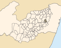 Location of Sairé within Pernambuco. | |
| Country | Brazil |
| State | Pernambuco |
| Region | Agreste Pernambucano |
| Area | |
| • Total | 195.46 km2 (75.47 sq mi) |
| Elevation | 663 m (2,175 ft) |
| Population (2020) | |
| • Total | 9,764 |
| Time zone | UTC-3 (BRT) |
| • Summer (DST) | UTC-2 (BRST) |

Sairé is a municipality located in the state of Pernambuco, Brazil. Located at 110.7 km away from Recife, capital of the state of Pernambuco. Has an estimated (IBGE 2020) population of 9,764 inhabitants.[1]
Geography
- State - Pernambuco
- Region - Agreste Pernambucano
- Boundaries - Bezerros (N); Bonito and Barra de Guabiraba (S); Gravatá (E); Camocim de São Félix (W).
- Area - 195.46 km2
- Elevation - 663 m
- Hydrography - Ipojuca and Sirinhaém rivers
- Vegetation - Subcaducifólia and hipoxerófila
- Climate - Tropical hot and humid
- Annual average temperature - 24.0 c
- Distance to Recife - 110.7 km
Economy
The main economic activities in Sairé are based in agribusiness, especially tomatoes, tangerines, passion fruits; and livestock such as cattle, sheep and poultry.
Economic indicators
| Population[2] | GDP x(1000 R$).[3] | GDP pc (R$) | PE |
|---|---|---|---|
| 14.194 | 48.553 | 3.542 | 0.08% |
Economy by Sector 2006
| Primary sector | Secondary sector | Service sector |
|---|---|---|
| 21.24% | 9.69% | 69.07% |
Health indicators
| HDI (2000) | Hospitals (2007) | Hospitals beds (2007) | Children's Mortality every 1000 (2005) |
|---|---|---|---|
| 0.598 | 1 | 20 | 27 |
References
- v
- t
- e

Capital: Recife
Agreste Pernambucano
| Alto Capibaribe | |
|---|---|
| Brejo Pernambucano | |
| Garanhuns | |
| Médio Capibaribe | |
| Vale do Ipanema | |
| Vale do Ipojuca |

Mata Pernambucana
| Mata Meridional Pernambucana | |
|---|---|
| Mata Setentrional Pernambucana | |
| Vitoria de Santo Antão |
Metropolitana de Recife
| Itamaracá | |
|---|---|
| Recife | |
| Porto de Suape | |
| Fernando de Noronha |
Sao Francisco Pernambucano
| Itaparica | |
|---|---|
| Petrolina |
Sertão Pernambucano
| Araripina | |
|---|---|
| Pajeú | |
| Salgueiro | |
| Sertão do Moxotó |
8°20′S 35°39′W / 8.333°S 35.650°W / -8.333; -35.650
 | This Pernambuco, Brazil location article is a stub. You can help Wikipedia by expanding it. |
- v
- t
- e


