Prall's Island
Island in the Arthur Kill in New York and New Jersey
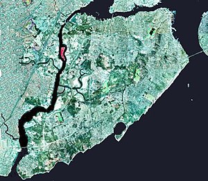

Prall's Island is an uninhabited island in the Arthur Kill between Staten Island, New York, and Linden, New Jersey, in the United States. The 89-acre (0.36 km2) island is one of the minor islands that are part of the borough of Staten Island in New York City.
The island is named for a descendant or descendants of early Staten Island settler Arendt Jansen Prall Van Naarden (c. 1647–1725) (in Dutch, Praal), probably his grandson Abraham Prall (1706–1775), a local farmer.[1] It was originally known as Dongan's Island, after New York Governor Thomas Dongan (1634–1715), who took the office in 1688. The name was later corrupted to Duncan's Island. Prall's Island did not take hold until the late 19th century. Around 1910, the water between Staten Island and the island was known as Prall's River but was eventually returned to Arthur Kill. The island is now owned by the City of New York and is maintained by New York City Department of Parks and Recreation as a bird sanctuary.[2]
See also
References
![]() Media related to Prall's Island at Wikimedia Commons
Media related to Prall's Island at Wikimedia Commons
- NYC Audubon Harbor Herons Project
- v
- t
- e
Neighborhoods in the New York City borough of Staten Island
(Community District 1)
- Arlington
- northern Castleton Corners
- Brighton Heights
- Clifton
- Concord
- Elm Park
- Fort Wadsworth
- northern Graniteville
- Grymes Hill
- Livingston
- Mariners Harbor
- northern Meiers Corners
- New Brighton
- Old Place
- Park Hill
- Port Ivory
- Port Richmond
- Randall Manor
- Rosebank
- Saint George
- Shore Acres
- Silver Lake
- Stapleton
- Stapleton Heights
- Sunnyside
- Tompkinsville
- Ward Hill
- West New Brighton
- Westerleigh

(Community District 2)
- Arrochar
- Bloomfield
- Bulls Head
- southern Castleton Corners
- Chelsea
- Dongan Hills
- Egbertville
- Emerson Hill
- southern Graniteville
- Grant City
- Grasmere
- Heartland Village
- Lighthouse Hill
- Manor Heights
- southern Meiers Corners
- Midland Beach
- New Dorp
- New Springville
- Oakwood
- Ocean Breeze
- Old Town
- Richmondtown
- South Beach
- Teleport
- Todt Hill
- Travis
- southern Willowbrook
(Community District 3)
- Community boards: 1
- 2
- 3
- Joint interest areas:
- 95
| |||||
|---|---|---|---|---|---|
| Major islands |  | ||||
| Pelham Islands |
| ||||
| New York Bay |
| ||||
| Jamaica Bay | |||||
| |||||
| |||||
| North River (Hudson River) | |||||
Former islands shown in italics | |||||

40°36′32″N 74°12′06″W / 40.60889°N 74.20167°W / 40.60889; -74.20167
 | This article about a location on Staten Island, New York is a stub. You can help Wikipedia by expanding it. |
- v
- t
- e


