Niekerk, Westerkwartier
Village in Groningen, Netherlands
53°13′N 6°21′E / 53.217°N 6.350°E / 53.217; 6.350 Netherlands
 Groningen
 Westerkwartier
 (2021)[1]
9822
Niekerk is a village in Westerkwartier municipality also in the Dutch province of Groningen. It had a population of around 1,365 in 2021.[1]
History
The village was first mentioned in 1392 as to der Nyerkerke, and means "new church". Nie- ("new") has been added to distinguish between Oldekerk.[2] Niekerk is a road village which developed on a sandy ridge in a raised bog. During the Late Middle Ages, it started to overshadow neighbouring Oldekerk.[3]
The Reformed church dates from around 1200. The tower was added in the 13th century. Between 1964 and 1967, it was restored, the plaster was removed and nave was returned to its original shape.[3]
Niekerk was home to 440 people in 1840.[4] It used to be part of the municipality of Oldekerk. In 1990, it became part of Grootegast and was merged into Westerkwartier in 2019.[4]
Gallery
-
 Former town hall
 -
 House in Niekerk
 -
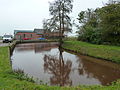 Harbour with former pumping station
 -
 School master's house


References
- ^ a b c "Kerncijfers wijken en buurten 2021". Central Bureau of Statistics. Retrieved 7 March 2022.
- ^ "Niekerk - (geografische naam)". Etymologiebank (in Dutch). Retrieved 9 April 2022.
- ^ a b Ronald Stenvert & Redmer Alma (1998). "Niekerk" (in Dutch). Zwolle: Waanders. ISBN 90 400 9258 3. Retrieved 9 April 2022.
- ^ a b "Niekerk (Westerkwartier)". Plaatsengids (in Dutch). Retrieved 9 April 2022.
External links
![]() Media related to Niekerk (Westerkwartier) at Wikimedia Commons
Media related to Niekerk (Westerkwartier) at Wikimedia Commons
- v
- t
- e
Populated places in the municipality of Westerkwartier
- Aduard
- Boerakker
- Briltil
- Den Ham
- Den Horn
- De Wilp
- Doezum
- Enumatil
- Ezinge
- Feerwerd
- Garnwerd
- Grijpskerk
- Grootegast
- Jonkersvaart
- Kommerzijl
- Kornhorn
- Lauwerzijl
- Leek
- Lettelbert
- Lucaswolde
- Lutjegast
- Marum
- Midwolde
- Niebert
- Niehove
- Niekerk
- Niezijl
- Noordhorn
- Noordwijk
- Nuis
- Oldehove
- Oldekerk
- Oostwold
- Opende
- Pieterzijl
- Saaksum
- Sebaldeburen
- Tolbert
- Visvliet
- Zevenhuizen
- Zuidhorn
 | This Groningen location article is a stub. You can help Wikipedia by expanding it. |
- v
- t
- e


