Namulonge Airport
Airport in Namulonge, Uganda

Namulonge
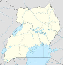
Location of the airport in Uganda
| Direction | Length | Surface | |
|---|---|---|---|
| m | ft | ||
| 13/31 | 580 | 1,903 | Unpaved |
Sources: Google Maps[1]
Namulonge Airport, also referred to as Namulonge Airstrip, is an airstrip serving the Namulonge Agronometeorology Station near the town of Namulonge in the Wakiso District of Uganda, 75 kilometres (47 mi) north of central Kampala.[2] The narrow runway is also used as a road and is surrounded by plowed fields of the agricultural research station.[1]
The station has an automated airport weather station (AWOS) system installed.[3] The "HUNA" ICAO airport code may be no longer active.[4]
See also
- Transport in Uganda
- List of airports in Uganda
References
External links
- OpenStreetMap - Namulonge
Portals:
 Uganda
 Aviation

- v
- t
- e
 Wakiso District
Capital: Wakiso
sub-counties
- Kyaddondo County
- Busiro County

- Akright City
- Abayita Ababiri
- Banda
- Banga
- Buddo
- Bulindo
- Buloba
- Entebbe
- Kabojja
- Kira
- Kigo
- Bweyogerere
- Kireka
- Kirinnya
- Namugongo
- Kasangati
- Katalemwa
- Kigulu
- Kyaliwajjala
- Mbalwa
- Mulawa
- Gayaza
- Gombe
- Luteete
- Nakweero
- Magere
- Matugga
- Wakiso
- Kakiri
- Kiwologoma
- Nansana
- Kajjansi
- Sentema
- Lubowa
- Lweeza
- Namulonge
- Naalya
- Najjera
- Namanve
- Nsangi
- Nsasa
- Kyengera
- Nabbingo
- Kawanda
- Kisubi
- Lugonjo
- Kitikifumba
- Kijabijo
- Kimwanyi
- Kitukutwe
- Masulita
- Maya
- Ssabagabo
- Wampeewo
- Zana
- Imperial Botanical Beach Hotel
- Imperial Resort Beach Hotel
- Imperial Golf View Hotel
- Lake Victoria Serena Resort
- Nexus Resorts Hotel
- Old Entebbe Town
- Entebbe Botanical Gardens
- State House Entebbe
- Lake Victoria
- Lubigi Wetland
- Kasubi Tombs
- Mandela National Stadium
- Kireka Kabaka's Palace
- Bulago Resort Island
- Ngamba Island
- Entebbe International Airport
- Basilica of the Uganda Martyrs, Namugongo
- Bukasa Inland Port
- Uganda Civil Aviation Authority
- Entebbe International Airport
- Kajjansi Airport
- Namulonge Airport
- Aerolink Uganda
- Air Serv Limited
- Uganda Airlines
- Tondeka Metro Bus Service
- Entebbe–Kampala Expressway
- Kampala–Entebbe Road
- Kampala Northern Bypass Highway
- Kampala Southern Bypass Highway
- Kampala–Jinja Highway
- Kampala–Jinja Expressway
- Kampala Southern Bypass Highway
- Gayaza–Ziroobwe Road
- Matugga–Kapeeka Road
- Namugongo Ring Road
- Kampala–Gayaza Road
- Kampala Outer Beltway
- Kampala–Bombo Expressway
- Kampala–Busunju Expressway
- Kampala–Mityana Road
- Kampala–Mpigi Expressway
- Kampala–Masaka Road
- Kampala–Hoima Road
- Kyaliwajjala–Kira–Kasangati–Matugga Road
- CoRSU Rehabilitation Hospital
- Entebbe Children's Surgical Hospital
- Kisubi Hospital
- Entebbe General Hospital
- Entebbe Military Hospital
- International Specialized Hospital of Uganda
- Makerere University Teaching Hospital
- Mpererwe Hospital
- Kasangati Health Centre IV
- Katabi UPDAF Health Centre III
- Uro Care Hospital
- Uganda National Medical Stores
- Gilbert Bukenya
- Christopher Evans Kaweesi
- Herman Kasekende
- Louis Kasekende
- Samson Kisekka
- Luwagga Kizito
- Apolo Nsibambi
- Glaydah Namukasa
- Martin Ondeko
- Julia Sebutinde
- Hakim Sendagire
- Rosemary Seninde
- Nelson Sewankambo
- Israel Kibirige Ssebunya
- Arthur Sserwanga
- Dennis Galabuzi Ssozi
- Rosemary Tumusiime
- Robert Kyagulanyi Ssentamu
  | This article about an airport in Uganda is a stub. You can help Wikipedia by expanding it. |
- v
- t
- e


