Mobye
Settlement in Shan State, Myanmar
Village tract in Shan State, Myanmar
Mobye Village Tract မိုးဗြဲအုပ်စု | |
|---|---|
Village tract | |
 | |
| 19°44′46″N 97°5′24″E / 19.74611°N 97.09000°E / 19.74611; 97.09000 | |
| Country |  Myanmar Myanmar |
| State |  Shan State Shan State |
| District | Taunggyi District |
| Township | Pekon Township |
| Area | |
| • Total | 66.66 sq mi (172.66 km2) |
| Elevation | 2,988 ft (910.7 m) |
| Population (2019) | 28,287 |
| Time zone | UTC+6:30 (MST) |
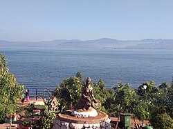
Mobye (Burmese: မိုးဗြဲ; also spelt Mobre or Moe Bye) is a village tract within Pekon Township, Shan State, Myanmar. It is located on the southern end of the Mobye Reservoir located south of Inle Lake and contains the lowest point within Pekon Township at 2,950 feet (900 m). The village of Mobye is located within the village tract along with 35 other villages in close proximity.
Geography
Mobye is located on the border with Kayah State, 10 miles northwest of its the Kayah capital Loikaw. The village tract is connected to Pekon, the township's pincipal town, and Loikaw through waterways, railways and a roadway.[1]
The Mobye Dam, located within the village, is built along the Pilu River (also called the Baluchaung River). Together with the Lawpita Dam, the dams power the Lawpita Power Plant system.[2] The Mobye dam began construction in 1969 with the first of the two hydropower stations along the Pilu River completing in 1974. During this period, 8000 people were forced to relocate away from the reservoir area.[3] The construction of the two dams in 1992 was conducted by the Myanmar Army and displaced over 12,000 people and created severe negative social and ecological impacts in the area.[2]
History
Mobye was formerly the capital of Mongpai, a Shan state. It belonged to the Central Division of the Southern Shan States.[4]
During the 2021 Myanmar civil war, Mobye was the site of several battles. Due to its proximity to Loikaw, Mobye was the site of skirmishes during the 2021 Battle of Loikaw. Battles between junta troops and the Mobye PDF along roads and villages leading to Loikaw.[5] Additionally, there were firefights in the village tract throughout the aftermath of the 2022 Battle of Loikaw.[6] During the course of Operation 1111, the Karenni Nationalities Defense Force seized control of the town during spillover clashes from fighting in Loikaw.[7]
Demographics
| Year | Mobye Village Tract | ±% |
|---|---|---|
| 2018 | 27,798 | — |
| 2019 | 28,287 | +1.8% |
| Source: [1] | ||
There are several ethnic groups within the area, including, Kayan, Shan, Bamar, Karenni and Intha people.[1]
References
- ^ a b c Myanmar Information Management Unit (September 2019). Pekon Myone Daethasaingyarachatlatmya ဖယ်ခုံမြို့နယ် ဒေသဆိုင်ရာအချက်လက်များ [Pekon Township Regional Information] (PDF) (Report). MIMU.
- ^ a b Karenni Development Research Group (2006). Dammed by Burma's Generals: The Karenni Experience with Hydropower Development - from Lawpita to the Salween. University of California, Berkeley. ISBN 9781899235964.
- ^ Middleton, Carl; Lamb, Vanessa. Hydropower politics and conflict on the Salween river (Report). Knowing the Salween River: Resource politics of a contested transboundary river. Vol. 27. p. 37.
- ^ Scott, James George; Hardiman, John Percy (1899). Gazetteer of Upper Burma and the Shan States. superintendent, Government printing, Burma.
- ^ "မိုးဗြဲ၊ လွိုင်ကော်နဲ့ ဒီမော့ဆို မြို့နယ်တွေမှာ တိုက်ပွဲဖြစ်ပွား". ဗွီအိုအေ (in Burmese). Retrieved 2023-04-19.
- ^ Irrawaddy, The (8 June 2022). "မိုးဗြဲသို့ တက်လာသည့် စစ်ကောင်စီစစ်ကြောင်း တိုက်ခိုက်ခံရပြီးနောက် ပြန်ဆုတ်သွား". ဧရာဝတီ. Retrieved 27 April 2023.
- ^ Wei, Brian (25 March 2024). "Myanmar's Junta is Nearing Its End in The Thai Border State of Karenni". The Irrawaddy.
- v
- t
- e
Capital: Taunggyi
| Kengtung District |
|
|---|---|
| Mong Hpayak District |
|
| Mong Hsat District |
|
| Tachileik District |
|


| Kyaukme District |
|
|---|---|
| Lashio District | |
| Laukkaing District | see Kokang Self-Administered Zone |
| Mu Se District |
|
| Hopang District | see Wa Self-Administered Division |
| Matman District | see Wa Self-Administered Division |
| Mongmit District | |
| Kokang Self-Administered Zone |
|
| Pa Laung Self-Administered Zone1 | |
| Wa Self-Administered Division |
|
| Langkho District |
|
|---|---|
| Loilen District |
|
| Taunggyi District |
|
| Danu Self-Administered Zone | |
| Pa-O Self-Administered Zone |
- Taunggyi
- Aungban
- Ayetharyar
- Chinshwehaw
- Hong Pai
- Hopang
- Hopong
- Hseni
- Hsi Hseng
- Hsipaw
- Kalaw
- Kengtung
- Kunhing
- Kunlong
- Kutkai
- Kyaukme
- Kyethi
- Lai-Hka
- Langkho
- Lashio
- Laukkaing
- Lawksawk
- Loilen
- Mabein
- Mantong
- Mawkmai
- Mong Hpayak
- Mong Hsat
- Mong Hsu
- Mong Khet
- Mong Kung
- Mong Nai
- Mong Pan
- Mong Ping
- Mong Ton
- Mong Yang
- Mong Yawng
- Mongko
- Mongmit
- Mongyai
- Muse
- Nanhkan
- Namhsan
- Namtu
- Nansang
- Nawnghkio
- Nyaungshwe
- Panglong
- Pekon
- Pinlaung
- Ponparkyin, Shan State, Myanmar
- Tachileik
- Tangyan
1 - also part of Kyaukme District; 2 - also part of Hopang District; 3 - also part of Matman District
 | This Shan State location article is a stub. You can help Wikipedia by expanding it. |
- v
- t
- e


