Maskerchugg River
River in Rhode Island, United States
The Maskerchugg River is a river in the U.S. state of Rhode Island. It flows approximately 4 miles (6.4 km).
Course
The river rises from an unnamed pond in Warwick near the intersection of Cowesett Road and Paddock Drive. From there, the river flows east along Cowesett Road, then turns southeast and flows past Interstate 95 to East Greenwich. The river then continues to its mouth at Greenwich Cove, on the north side of Potowomut Peninsula. Dark Entry Brook is the Maskerchugg River's only named tributary, though it has many unnamed streams that also feed it. There are four dams along the river's length.[1]
Crossings
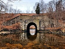
Below is a list of all crossings over the Maskerchugg River. The list starts at the headwaters and goes downstream.
- Warwick
- Cowesett Road (two crossings)
- Interstate 95
- East Greenwich
- Division Street (Route 401)
- Sylvan Drive
- Green Hill Way
- Kenyon Avenue
- Main Street (U.S. Route 1)
- Northeast Corridor rail line
See also
References
- Maps from the United States Geological Survey
- ^ Governor's Task Force on Dam Safety and Maintenance – Final Report, January 2001
- v
- t
- e
Rivers of Rhode Island by drainage system
| Point Judith Pond |
|
|---|
| Little Narragansett Bay (Pawcatuck River Watershed) |
|
|---|---|
| Thames River Watershed |
| Pettaquamscutt River Watershed | |
|---|---|
| Potowomut River Watershed |
|
| Providence River Watershed |
|
| Sakonnet River Watershed | |
| Warren River Watershed |
|
| Others |
|
41°40′54.7″N 71°28′55.2″W / 41.681861°N 71.482000°W / 41.681861; -71.482000
This article related to a river in Rhode Island is a stub. You can help Wikipedia by expanding it. |
- v
- t
- e


