This innovative grain elevator was built circa 1920 near the small community of Ingersoll. Unincorporated communities in Oklahoma do not have a formally organized municipal government. Rather, residents rely on the county government for services. State law allows unincorporated communities, under certain conditions, to incorporate or join another municipality
Many unincorporated communities were at one time incorporated but for various reasons no longer have a municipal government. Depopulation during the 1930s and 40s caused the loss of many communities and some no longer exist even as unincorporated communities. In Oklahoma, incorporated municipalities may petition for dissolution[1] [2]
Driving Cattle to Pasture near Bliss.Although unincorporated communities have no municipal governments, they may organize their own water districts [3] [4] [5] [6]
Many unincorporated communities (such as Boggy Depot, Tuskahoma, and Skullyville) played important roles in the development of Oklahoma and others, especially those with schools and post offices, continue to be important centers in rural Oklahoma.
"Oklahoma Municipal Government" from the Oklahoma Almanac published by the Oklahoma Department of Libraries is the source document for this list. Additional communities have been added using Wikipedia articles which cite authoritative sources. Geographic coordinates, if known, are provided for those place names which are unlikely to be communities.
List of unincorporated communities
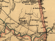
A Community County Comments Acme Grady 34°47′56″N 98°01′09″W / 34.79889°N 98.01917°W / 34.79889; -98.01917 Adams Texas Adamson Pittsburg Adel Pushmataha 34°47′56″N 98°01′09″W / 34.79889°N 98.01917°W / 34.79889; -98.01917 Agawan Grady Ahloso Pontotoc Ahpeatone Cotton 34°20′52″N 98°33′04″W / 34.34778°N 98.55111°W / 34.34778; -98.55111 Akins Sequoyah Albany Bryan Albert Caddo Alden Caddo 34°58′31″N 98°35′07″W / 34.97528°N 98.58528°W / 34.97528; -98.58528 Aledo Dewey Alfalfa Caddo Allison Bryan Alma Stephens Alpers Carter 34°29′33″N 97°23′14″W / 34.49250°N 97.38722°W / 34.49250; -97.38722 Alsuma Tulsa ‡ Altona Kingfisher 35°46′59″N 98°10′16″W / 35.78306°N 98.17111°W / 35.78306; -98.17111 † Alwinn Stephens Anchor Wagoner 35°50′08″N 95°24′11″W / 35.83556°N 95.40306°W / 35.83556; -95.40306 Antioch Garvin Apperson Osage Apple Choctaw 34°07′39″N 95°25′03″W / 34.12750°N 95.41750°W / 34.12750; -95.41750 Arlington Lincoln Arpelar Pittsburg Artillery Village Comanche † Atlee Jefferson 34°05′37″N 97°37′57″W / 34.09361°N 97.63250°W / 34.09361; -97.63250 † Aubrey Creek Avery Lincoln Avoca Pottawatomie Aydelotte Pottawatomie † Geographic or historic reference undetermined. ‡ Identified as abandoned by at least one source.
B Bunch, Oklahoma , sets in the background near Sallisaw Creek in the Cookson Hills . Community County Comments Babbs Kiowa Bache Pittsburg Bacone Muskogee Bailey Grady Baker Texas Baldhill Okmulgee 35°44′25″N 95°50′14″W / 35.74028°N 95.83722°W / 35.74028; -95.83722 Balko Beaver Ballard Adair Banner Canadian Banty Bryan Barber Cherokee 35°45′26″N 94°52′04″W / 35.75722°N 94.86778°W / 35.75722; -94.86778 † Barnes Logan (Locale-USGS) Baron Adair ‡ Bartlett Okmulgee Battiest McCurtain Baugh Pawnee Baum Carter Beachton McCurtain Beckett Stephens (Alternate name for Sunray, Oklahoma .) Bee Johnston Beland Muskogee Bell Adair Bellemont Pottawatomie Belva Woodward 36°29′56″N 98°58′30″W / 36.49889°N 98.97500°W / 36.49889; -98.97500 † Belvue Creek Belzoni Pushmataha 34°11′08″N 95°27′56″W / 34.18556°N 95.46556°W / 34.18556; -95.46556 Bengal Latimer Bentley Atoka Berlin Roger Mills Berwyn Carter (Present day Gene Autry, Oklahoma .) Bethel Comanche Bethel McCurtain ‡ Bidding Springs Adair (See Golda's Mill .) Big Cedar Le Flore (Stream-USGS) † Big Spring Hughes 35°10′27″N 96°14′50″W / 35.17417°N 96.24722°W / 35.17417; -96.24722 Binkley Lincoln (Railroad siding and switch.) Bison Garfield Blackgum Sequoyah Blanco Pittsburg Bliss Noble (Now known as Old Bliss, Oklahoma .) Blocker Pittsburg Blue Bryan Bluff Choctaw Boatman Mayes Boehler Atoka 34°10′15″N 95°53′01″W / 34.17083°N 95.88361°W / 34.17083; -95.88361 Boggy Depot Atoka † Bois D'Arc Kay (Stream-USGS.) Bokhoma McCurtain † Bond McIntosh Boone Caddo ‡ Boss McCurtain † Boulevard Cleveland Bowden Creek Bowlin Spring Craig Bowring Osage Boyd Beaver Box Sequoyah Braden Le Flore Brady Garvin 34°37′22″N 97°16′57″W / 34.62278°N 97.28250°W / 34.62278; -97.28250 Brent Sequoyah Briartown Muskogee Briggs Cherokee Brinkman Greer Britton Oklahoma (Incorporated part of Oklahoma City.) Brock Carter Brooken Haskell Brown Bryan Broxton Caddo Brush Hill McIntosh Brushy Sequoyah Bryant Okmulgee † Buffalo McCurtain † Buffalo Valley Latimer Bugtussle Pittsburg Bunch Adair Burmah Dewey Burneyville Love Burns Washita Burwell McCurtain 34°11′09″N 95°09′05″W / 34.18583°N 95.15139°W / 34.18583; -95.15139 Bushyhead Rogers Butner Seminole. † Geographic or historic reference undetermined. ‡ Identified as abandoned by at least one source.
C This abandoned W.S. Kelly gas station and general store in Cogar was used in a scene from the 1988 movie, Rainman Community County Comments Cade Bryan Cairo Coal 34°35′26″N 96°07′55″W / 34.59056°N 96.13194°W / 34.59056; -96.13194 Calhoun Le Flore Calida Pawnee 36°11′35″N 96°17′53″W / 36.19306°N 96.29806°W / 36.19306; -96.29806 † Cambria Latimer Cambridge Kiowa 35°04′22″N 99°12′19″W / 35.07278°N 99.20528°W / 35.07278; -99.20528 Camp Houston Woods Canadian Shores Pittsburg Caney Ridge Cherokee Capitol Hill Oklahoma (Incorporated as part of Oklahoma City.) Cardin Ottawa Carlton Blaine 36°00′52″N 98°30′55″W / 36.01444°N 98.51528°W / 36.01444; -98.51528 Carleton .) Carpenter Roger Mills Carson Hughes Carters Corner McIntosh Carters Landing Cherokee Cartersville Haskell Cartwright Bryan Casey Pawnee 36°16′57″N 96°40′27″W / 36.28250°N 96.67417°W / 36.28250; -96.67417 Castaneda Cimarron 36°52′52″N 102°31′17″W / 36.88111°N 102.52139°W / 36.88111; -102.52139 Catale Rogers 36°33′39″N 95°22′19″W / 36.56083°N 95.37194°W / 36.56083; -95.37194 Catesby Ellis Cayuga Delaware Cedar Crest Mayes † Cedar Lake Canadian Center Pontotoc † Center City Oklahoma † Center Point Atoka Centerview Pottawatomie Centralia Craig Ceres Noble ‡ Cerrogordo McCurtain (PO closed in 1958.) Cestos Dewey Chance Adair Charleston Harper (See abandoned communities -USGS.) Chase Muskogee (See Beland .) Cherry Tree Adair Chester Major Chewey Adair Cheyenne Valley Major Chigley Murray Childers Nowata Chilli Latimer Chilocco Kay (See Chilocco Indian School .) † Chisney Pottawatomie Chitwood Grady Chloeta Delaware Chockie Atoka Choska Wagoner Christie Adair Cimarron City Logan ‡ Cisco McCurtain (PO closed in 1916.) Citra Hughes Clarita Coal Clarksville Wagoner Clayton Lake Pushmataha (Reservoir-Clayton Lake (Oklahoma)-USGS) ‡ Clear Lake Beaver (PO closed in 1944.) Clebit McCurtain Clemscot Carter Cleora Delaware Clothier Cleveland Cloud Chief Washita Cloudy Pushmataha Clyde Grant Coalton Okmulgee Cobb Bryan Cogar Caddo Coleman Johnston Concho Canadian Connerville Johnston Conrad Cimarron (Railroad siding and switch.) Conser Le Flore Cookietown Cotton Cookson Cherokee Copeland Delaware Corbett Cleveland Corinne Pushmataha Corum Stephens Cottonwood Coal Cottonwood Sequoyah Council Oklahoma (See Council Grove.) Countyline Stephens/ Carter Courtney Love Cove Acres Comanche ‡ Cowden Washita 35°14′52″N 98°42′43″W / 35.24778°N 98.71194°W / 35.24778; -98.71194 Cox City Grady Craig McCurtain 34°02′18″N 94°37′44″W / 34.03833°N 94.62889°W / 34.03833; -94.62889 Craig Pittsburg 34°50′25″N 95°37′39″W / 34.84028°N 95.62750°W / 34.84028; -95.62750 ‡ Cravens Latimer (PO closed 1916.) Crawford Roger Mills Crekola Muskogee † Creosote Choctaw Creta Jackson 34°31′00″N 99°32′59″W / 34.51667°N 99.54972°W / 34.51667; -99.54972 Criner McClain Crusher Murray Crutcho Oklahoma Crystal Atoka Crystal Lakes Major Cumberland Marshall Curchece Pawnee Curtis Woodward † Geographic or historic reference undetermined. ‡ Identified as abandoned by at least one source.
D The Antelope Hill, a National Historic Place, lie just north of Durham . Community County Comments Daisy Atoka Dale Pottawatomie Damon Latimer Dane Major 36°13′01″N 98°37′10″W / 36.21694°N 98.61944°W / 36.21694; -98.61944 Darrow Blaine 36°05′53″N 98°23′18″W / 36.09806°N 98.38833°W / 36.09806; -98.38833 Darwin Pushmataha Dawson Tulsa (Incorporated as part of Tulsa.) Degnan Latimer 34°56′50″N 95°21′12″W / 34.94722°N 95.35333°W / 34.94722; -95.35333 Dela Pushmataha Delhi Beckham Dempsey Roger Mills 35°31′03″N 99°49′22″W / 35.51750°N 99.82278°W / 35.51750; -99.82278 Dennis Delaware Dewright Seminole 35°05′15″N 96°39′31″W / 35.08750°N 96.65861°W / 35.08750; -96.65861 Dighton Okmulgee Dillard Carter Dixon Seminole ‡ Doby Springs Harper Dodge Delaware Dotyville Ottawa Dow Pittsburg Doyle Stephens Drake Murray 34°23′52″N 96°57′03″W / 34.39778°N 96.95083°W / 34.39778; -96.95083 Driftwood Alfalfa Dripping Springs Carter Dripping Springs Delaware Drumb Latimer 34°55′47″N 95°28′52″W / 34.92972°N 95.48111°W / 34.92972; -95.48111 Dunbar Love Dunjee Park Oklahoma Durham Roger Mills Durwood Carter ‡ Identified as abandoned by at least one source.
E Community County Comments Eagle City Blaine Eagletown McCurtain Earl Johnston † Eastborough Wagoner East Duke Jackson (Variant name for town of Duke .) East Jesse Coal/ Pontotoc East Ninneka Grady (Variant name for town of Ninnekah .) Eastside Custer Eddy Kay 36°43′54″N 97°27′31″W / 36.73167°N 97.45861°W / 36.73167; -97.45861 Eden Payne 36.2028259, -97.0919822 Dissolved mid-century
Edgewater Park Comanche Edna Creek Eldon Cherokee † Elk Plaza Stephans Elmwood Beaver † Emerson Center Cotton Emet Johnston Empy Pawnee Enos Marshall Enterprise Haskell Enville Love Eram Okmulgee Estella Craig Ethel Pushmataha Etna Garfield (Railroad siding.) Etta Cherokee Eucha Delaware Eva Texas † Ewing Custer † Geographic or historic reference undetermined.
F Community County Comments Falconhead Love Falfa Latimer Fame McIntosh Farmers Hill McCurtain Farris Atoka Fay Dewey Featherston Pittsburg Felker McCurtain Felt Cimarron Fewell Pushmataha Fillmore Johnston Finley Pushmataha Fisher Tulsa Fittstown Pontotoc Fivemile Corner Cotton Fleetwood Jefferson 33°53′48″N 97°51′04″W / 33.89667°N 97.85111°W / 33.89667; -97.85111 Floris Beaver Flynn Oklahoma (Incorporated as part of Oklahoma City.) Foley Custer (Railroad siding and switch.) Folsom Johnston Forest Hill Le Flore Forney Choctaw Forrester Le Flore Fort Reno Canadian (See Fort Reno (Oklahoma) for the fort.) Four Corners (Locale—name of several in Oklahoma.) Fox Carter Franklin Cleveland Fransen Custer Frisco Pontotoc Frogville Choctaw Fugate Atoka
G Community County Comments Gaar Corner Pontotoc Gansel Noble (Railroad siding and switch.) Garden Grove Pottawatomie Garland Haskell Gay Choctaw † Georgetown Muskogee Gerlach Woodward (Railroad siding and switch.) Gibbon Grant 36°56′34″N 97°58′56″W / 36.94278°N 97.98222°W / 36.94278; -97.98222 Gibson Wagoner Gideon Cherokee Gilmore Le Flore Glendale Le Flore Glover McCurtain Golden McCurtain Goodland Choctaw Goodwater McCurtain Goodwin Ellis 36°11′48″N 99°56′06″W / 36.19667°N 99.93500°W / 36.19667; -99.93500 Gowen Latimer Grady Jefferson Graham Carter Grandview Heights Muskogee Grant Choctaw Gray Beaver Gray Horse Osage Greasy Adair Green Pastures Oklahoma Greenville Love Greenwood Pushmataha Griggs Cimarron Grimes Roger Mills Gulftown Okmulgee † Gyp Blaine (Historical community-USGS.) Gypsy Creek † Geographic or historic reference undetermined.
H Haywood, Oklahoma , in the coal mining district of Pittsburg County , was named for radical labor leader, Big Bill Haywood . Community County Comments Hale Tulsa (See abandoned communities -USGS.) Hammon Junction Roger Mills (Abandoned railroad siding and switch.) Hanson Sequoyah Happyland Pontotoc Harden City Pontotoc Hardy Kay Harjo Pottawatomie Harmon Ellis Harmony Star Rogers Harris McCurtain Harrison Sequoyah (See abandoned communities -Shirk.) Haw Creek Le Flore Hawley Grant Hazel Dell Pottawatomie 35°26′56″N 97°00′01″W / 35.44889°N 97.00028°W / 35.44889; -97.00028 Hayward Garfield Haywood Pittsburg Heman Woods 36°32′06″N 98°56′38″W / 36.53500°N 98.94389°W / 36.53500; -98.94389 Hennepin Garvin Herring Roger Mills 35°36′36″N 99°31′04″W / 35.61000°N 99.51778°W / 35.61000; -99.51778 Hess Jackson Hester Greer Hewitt Carter Hext Beckham Higgins Latimer 34°48′41″N 95°26′01″W / 34.81139°N 95.43361°W / 34.81139; -95.43361 Hill Le Flore Hilltop Hughes 34°56′05″N 96°10′54″W / 34.93472°N 96.18167°W / 34.93472; -96.18167 Hockerville Ottawa Hodgen Le Flore Hogshooter Washington ‡ Holley Creek McCurtain 33°58′41″N 94°49′00″W / 33.97806°N 94.81667°W / 33.97806; -94.81667 Hollow Craig 36°53′15″N 95°16′12″W / 36.88750°N 95.27000°W / 36.88750; -95.27000 Hollywood Corners Cleveland Homer Pontotoc Homestead Blaine Honobia Le Flore Hontubby Le Flore Hopeton Woods Hough Texas Houston Creek Hoyt Haskell Hulen Cotton Humphreys Jackson Hyde Park Muskogee ‡ Identified as abandoned by at least one source.
I Ingalls, Oklahoma , was the site of a famous shoot-out between U.S. Marshals and the Doolin-Dalton Gang depicted in this scene from the 1915 silent film, The Passing of the Oklahoma Outlaws Community County Comments Imo Garfield Independence Custer Indian Meadows Cherokee Ingalls Payne Ingersoll Alfalfa Iona Murray Iron Post Creek 35°43′35″N 96°24′20″W / 35.72639°N 96.40556°W / 35.72639; -96.40556 Iron Stob Corner McCurtain Irving Jefferson Isabella Major
J Community County Comments ‡ Jackson Bryan Jacktown Lincoln Jesse Pontotoc Jimtown Love ‡ Joburn Atoka † Joe Tulsa (NOTE: Joe Station in Tulsa, Co. no longer exists per USGS.) Jollyville Murray Joy Murry Jumbo Pushmataha. † Geographic or historic reference undetermined. ‡ Identified as abandoned by at least one source.
K L Community County Comments Lacey Kingfisher Lafayette Haskell Lake Tulsa (Incorporated place in Tulsa County.) Lake Creek Greer Lake Ellsworth Addition Comanche Lake Hiwasse Oklahoma Lake Humphreys Stephans (Reservoir—Lake Humphreys (Oklahoma).) Lakeside Bryan Lakeside Village Comanche Lake Station Tulsa (Historical-USGS.) Lake Valley Washita Lake West Bryan 33°53′45″N 95°53′08″W / 33.89583°N 95.88556°W / 33.89583; -95.88556 Lane Atoka Lark Marshall Last Chance Okfuskee Latta Pontotoc Leach Delaware Leader Pontotoc Lebanon Marshall Lecox Oklahoma (Railroad siding.) ‡ Lefeber Tulsa Lela Pawnee Lenna McIntosh Lenora Dewey Leonard Tulsa Lequire Haskell Lenox Le Flore Lewisville Haskell Liberty (Different communities in Bryan, Sequoyah, and Stephens counties). † Limestone Latimer † Limestone Rogers Limestone Gap Atoka Lincolnville Ottawa Little Seminole Little Axe Cleveland Little Chief Osage Little City Marshall Little Ponderosa Beaver Loder Oklahoma (Railroad siding-USGS.) Lodi Latimer 35°00′33″N 95°02′32″W / 35.00917°N 95.04222°W / 35.00917; -95.04222 Logan Beaver ‡ Lona Haskell 35°09′21″N 95°17′23″W / 35.15583°N 95.28972°W / 35.15583; -95.28972 Lone Oak Sequoyah Lone Tree Okmulgee Long Sequoyah Longtown Pittsburg Lookout Woods Lost City Cherokee Lovedale Harper (Railroad siding-Shirk.) Lovell Logan Loving Le Flore Lowrey Cherokee Lucien Noble ‡ Lugert Kiowa Lula Pontotoc Lutie Latimer † Lynn Addition Osage Lynn Lane Tulsa Lyons Adair † Geographic or historic reference undetermined. ‡ Identified as abandoned by at least one source.
M Salt, an important commodity in Indian Territory, was produced near the present community of McKey . Community County † MacArthur Park Comanche (Housing addition in Lawton.) McBride Marshall McCord Osage McKey Sequoyah McKiddyville Cleveland McKnight Harmon McLain Muskogee McMillan Marshall McWillie Alfalfa Madge Harmon Maguire Cleveland Manard Cherokee Maple Sequoyah Martin Muskogee Marty Jackson Mason Okfuskee † Matthew Choctaw Matoy Bryan Maxwell Pontotoc Mayfield Beckham † May Ridge Oklahoma Mazie Mayes † Medio Tulsa Meers Comanche Mehan Payne Mellette McIntosh Melvin Cherokee Meridian Stephens Merrick Lincoln Merritt Beckham Messer Choctaw Micawber Okfuskee Middleberg Grady Midlothian Lincoln Midway Atoka/ Coal Milfay Creek Miller Pushmataha Milo Carter Milton Le Flore Mingo Tulsa Monroe Le Flore † Montclair Addition Le Flore Moodys Cherokee Moon McCurtain Moorewood Custer Moseley Delaware Mound Grove McCurtain Mount Herman McCurtain Mount Zion McCurtain Mouser Texas Moyers Pushmataha Mudsand Choctaw † Mule Barn Pawnee Murphy Mayes Muse Le Flore † Geographic or historic reference undetermined.
N Community County Nani-chito McCurtain Narcissa Ottawa Nardin Kay Nashoba Pushmataha Natura Okmulgee Navina Logan Nebo Murray Needmore Cleveland Neff Le Flore Nelagony Osage Neodesha Wagoner Newalla Oklahoma New Cordell Washita (Official name of Cordell, Oklahoma .) New Liberty Beckham New Lima Seminole New Mannford Creek New Oberlin Choctaw Newport Carter † New Ringold McCurtain New Woodville Marshall (Variant name for Woodville -USGS.) Nicut Sequoyah Nida Johnston Niles Canadian Nobletown Seminole Noel Woods (Railroad siding.) Non Hughes Norris Latimer † Northeast Tulsa North McAlester Pittsburg † Northside Tulsa † North Valliant McCurtain † Northwest Oklahoma Nowhere Caddo (NOTE: Located at the SE end of Fort Cobb Reservoir, 8.9 km(5.5 mi) SSW of Albert and 22 km(14 mi) NW of Anadarko. U.S. Board on Geographic Names decisions, either decisions referenced after Phase I data compilation, or staff research on non-controversial names.-USGS.) Numa Grant Nuyaka Okmulgee † Geographic or historic reference undetermined.
O Community County Oak Grove Murray Oak Grove Pawnee Oak Grove Payne Oak Hill McCurtain Oakhurst Tulsa and Creek Oakman Pontotoc Oakridge Creek Oberlin Bryan Octavia Le Flore Oglesby Washington Oil Center Pontotoc Oil City Carter Okesa Osage Okfuskee Okfuskee Oleta Pushmataha Olive Creek Olney Coal Omega Kingfisher Onapa McIntosh Oneta Wagoner Oney Caddo Ord Choctaw Orienta Major † Orin Grant Orion Major Orr Love † Osage Kay Oscar Jefferson Oswalt Love Otoe Noble Overbrook Love Owanda Oklahoma † Geographic or historic reference undetermined.
P Q Community County Quail Creek Oklahoma (Incorporated as part of Oklahoma City) Qualls Cherokee † Quick Sequoyah Quinlan Woodward † Geographic or historic reference undetermined.
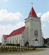
R S Sacred Heart, Oklahoma , the birthplace of author Tony Hillerman , was established in 1879 as a mission for the Pottawatomie Indians .T In this aerial view Tiawah nestles in the Tiawah Hills along State Highway 88 in Rogers County. U Community County Ulan Pittsburg. Ultima Thule McCurtain Unger Choctaw † Union Cleveland Union Kingfisher Union Tulsa Union Hill Pontotoc Union Valley Pontotoc † Uniroyal Carter Utica Bryan † Geographic or historic reference undetermined.
V Community County Vamoosa Seminole Vanoss Pontotoc Vernon McIntosh Victory Jackson Vinco Payne Vinson Harmon Virgil Choctaw Vista Pottawatomie Vivian McIntosh † Geographic or historic reference undetermined.
W Y Community County Yanush Latimer Yarnaby Bryan Yewed Alfalfa Yost Lake Payne (Lakeside community, called Yost, or Youst-Shirk.) Yuba Bryan
Z References Bibliography Oklahoma Department of Libraries. "Oklahoma Municipal Government". Oklahoma Almanac . (accessed February 11, 2007) Oklahoma Historical Society. Chronicles of Oklahoma . (accessed February 11, 2007) Oklahoma State Department of Education. "School Districts Database" (accessed February 11, 2007) Shirk, George H. Oklahoma Place Names . Norman: University of Oklahoma Press, 1987: ISBN 0-8061-2028-2 . Supreme Court of Oklahoma. "Oklahoma Statutes Citationized".Oklahoma State Courts Network (OSCN) (accessed February 11, 2007) United States Census Bureau Fact Finder . Fact Sheet search. (accessed February 11, 2007) United States Geological Survey. Geographic Names Information System . (accessed February 11, 2007) United States Postal Service. ZIP Code Lookup . (accessed February 11, 2007) Abandoned Oklahoma 


 Oklahoma portal


