Lebanon (CDP), Wisconsin
Census-designated place in Wisconsin, United States
43°15′19″N 88°37′36″W / 43.25528°N 88.62667°W / 43.25528; -88.62667 (2010)
53047
Lebanon is an unincorporated census-designated place located in the town of Lebanon, Dodge County, Wisconsin, United States. Lebanon is 6.5 miles (10.5 km) northeast of Watertown. Lebanon has a post office with ZIP code 53047.[2] As of the 2010 census, its population was 204.[3]
Images
-
 Lebanon Historical Museum
 -
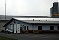 Fire Department


References
- ^ U.S. Geological Survey Geographic Names Information System: Lebanon (CDP), Wisconsin
- ^ ZIP Code Lookup
- ^ "U.S. Census website". U.S. Census Bureau. Retrieved April 13, 2011.
- v
- t
- e
Municipalities and communities of Dodge County, Wisconsin, United States
County seat: Juneau

- Ashippun
- Burnett
- Lebanon
- Rubicon
communities
- Alderley
- Astico
- Atwater
- Beaver Edge
- Clyman Junction
- Danville
- Delbern Acres
- East Waupun
- Farmersville
- Fox Lake Junction
- Herman Center
- Hochheim
- Huilsburg
- Knowles
- Leipsig
- LeRoy
- Lost Lake
- Lyndon Dale
- Minnesota Junction
- Nasbro
- Neda
- North Lowell
- Oak Grove
- Old Ashippun
- Old Lebanon
- Portland‡
- Richwood
- Rolling Prairie
- Saylesville
- South Beaver Dam
- South Randolph
- Sugar Island
- Sunset Beach
- Theresa Station
- Woodland
‡This populated place also has portions in an adjacent county or counties
- Wisconsin portal
- United States portal
 | This article about a location in Dodge County, Wisconsin is a stub. You can help Wikipedia by expanding it. |
- v
- t
- e


