Kohls Ranch, Arizona
CDP in Gila County, Arizona
Census-designated place in Arizona, United States
34°19′31″N 111°5′36″W / 34.32528°N 111.09333°W / 34.32528; -111.09333 (2020)
85541[2]

Kohls Ranch is a census-designated place (CDP) in Gila County, Arizona, United States. The population was 46 at the 2010 census.[3]
Geography
The CDP is located in northern Gila County at the southern foot of the Mogollon Rim, in the valley of the upper reaches of Tonto Creek. Arizona State Route 260 forms the northern edge of the CDP, running west 16 miles (26 km) to Payson and east 73 miles (117 km) to Show Low. According to the United States Census Bureau, the Kohls Ranch CDP has a total area of 1.17 square miles (3.03 km2), all land.[3]
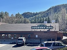
In the eastern part of the CDP is Tonto Creek Camp (formerly Camp Tontozona, the training camp for the Arizona State University football team). There are several cabins and a bar in the vicinity, as well as two Tonto National Forest campgrounds. Kohl's Ranch Lodge is a resort operated by Diamond Resorts.

| Census | Pop. | Note | %± |
|---|---|---|---|
| 2010 | 46 | — | |
| 2020 | 30 | −34.8% | |
| U.S. Decennial Census[4] | |||
Transportation
Mountain Valley Shuttle stops in Kohl's Ranch on its Phoenix-Show Low route.[5]
References
- ^ "2020 U.S. Gazetteer Files". United States Census Bureau. Retrieved October 29, 2021.
- ^ "Kohls Ranch AZ ZIP Code". zipdatamaps.com. 2023. Retrieved May 3, 2023.
- ^ a b "Geographic Identifiers: 2010 Demographic Profile Data (G001): Kohls Ranch CDP, Arizona". U.S. Census Bureau, American Factfinder. Retrieved November 1, 2016.[dead link]
- ^ "Census of Population and Housing". Census.gov. Retrieved June 4, 2016.
- ^ "Route Schedule/Stops". Archived from the original on January 27, 2020. Retrieved January 27, 2020.
- v
- t
- e
Municipalities and communities of Gila County, Arizona, United States
County seat: Globe

- Bear Flat
- Beaver Valley
- Canyon Day
- Carrizo
- Cedar Creek
- Central Heights-Midland City
- Christopher Creek
- Claypool
- Copper Hill
- Cutter
- Deer Creek
- Dripping Springs
- East Globe
- East Verde Estates
- El Capitan
- Flowing Springs
- Freedom Acres
- Geronimo Estates
- Gisela
- Haigler Creek
- Hunter Creek
- Icehouse Canyon
- Jakes Corner
- Kohls Ranch
- Mead Ranch
- Mesa del Caballo
- Oxbow Estates
- Peridot‡
- Pinal
- Pine
- Rock House
- Roosevelt
- Roosevelt Estates
- Round Valley
- Rye
- San Carlos
- Six Shooter Canyon
- Strawberry
- Tonto Basin
- Tonto Village
- Top-of-the-World‡
- Washington Park
- Wheatfields
- Whispering Pines
- Young
places
‡This populated place also has portions in an adjacent county or counties
- Arizona portal
- United States portal
| Authority control databases |
|
|---|


