Kochkor District
District in Naryn Region, Kyrgyzstan
Kochkor Кочкор району | |
|---|---|
District | |
 | |
| Country | Kyrgyzstan |
| Region | Naryn Region |
| Area | |
| • Total | 5,868 km2 (2,266 sq mi) |
| Population (2021) | |
| • Total | 67,363 |
| • Density | 11/km2 (30/sq mi) |
| Time zone | UTC+6 |
Kochkor (Kyrgyz: Кочкор району) is a district of Naryn Region in northern-central Kyrgyzstan. The administrative seat lies at Kochkor.[1] Its area is 5,868 km2 (2,266 sq mi),[2] and its resident population was 67,363 in 2021.[3]
Population
| Year | Pop. | ±% p.a. |
|---|---|---|
| 1970 | 39,798 | — |
| 1979 | 47,206 | +1.91% |
| 1989 | 51,523 | +0.88% |
| 1999 | 53,089 | +0.30% |
| 2009 | 58,267 | +0.94% |
| 2021 | 67,363 | +1.22% |
| Note: resident population; Sources:[2][3] | ||
Populated places
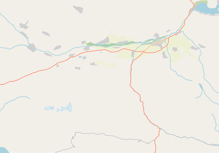
In total, Kochkor District includes 35 settlements in 11 rural communities (ayyl aymagy). Each rural community comprises one or several villages. The rural communities and settlements in the Kochkor District are as follows:[1][4]
- Ak-Kyya (seat: Kara-Suu; incl. Jangy-Jol)
- Cholpon (seat: Cholpon; incl. Ara-Köl, Osoviakhim, Tuz, Epkin, Ak-Chiy, Oro-Bashy, Tarmal-Saz and Uzun-Bulak)
- Kara-Suu (seat: Mantysh; incl. Ak-Talaa, Kara-Moynok, Kyzyl-Döbö and Ortok)
- Kochkor (seat: Kochkor; incl. Bolshevik and Tengdik)
- Kök-Jar (seat: Kök-Jar)
- Kosh-Döbö (seat: Kara-Saz; incl. Kara-Künggöy)
- Kum-Döbö (seat: Kum-Döbö; incl. Ak-Jar, Buguchu and Shamshy)
- Sary-Bulak (seat: Ak-Kyya; incl. Sary-Bulak)
- Semiz-Bel (seat: Kara-Too; incl. Arsy, Semiz-Bel and Chekildek)
- Song-Kul (seat: Tölök)
- Talaa-Bulak (seat: Döng-Alysh; incl. Komsomol)

Jangy-
Jol
Jol
Kara-
Moynok
Moynok

Bolshevik
Kara-
Künggöy
Künggöy

Ak-Kyya
Sary-Bulak
Kara-Too
Arsy
Semiz-Bel
Chekildek
Komsomol
Ara-
Köl
Köl
Osoviakhim
Tuz
Ak-Chiy
Oro-Bashy
Tarmal-
Saz
Saz
Uzun-Bulak
class=notpageimage|
Settlements of the Kochkor DistrictReferences
- ^ a b "Classification system of territorial units of the Kyrgyz Republic" (in Kyrgyz). National Statistics Committee of the Kyrgyz Republic. May 2021. pp. 36–37.
- ^ a b "2009 population and housing census of the Kyrgyz Republic: Naryn Region" (PDF) (in Russian). National Statistics Committee of the Kyrgyz Republic. 2010. pp. 12, 15.
- ^ a b "Population of regions, districts, towns, urban-type settlements, rural communities and villages of Kyrgyz Republic" (XLS) (in Russian). National Statistics Committee of the Kyrgyz Republic. 2021. Archived from the original on 10 November 2021.
- ^ List of Rural Communities of Kyrgyzstan Archived 2010-02-09 at the Wayback Machine
- v
- t
- e
 Districts (Raions) of Kyrgyzstan
| Bishkek City | |
|---|---|
| Chüy Region | |
| Issyk-Kul Region | |
| Naryn Region |
|
| Talas Region |

| Osh City |
|
|---|---|
| Batken Region | |
| Jalal-Abad Region | |
| Osh Region |
Places adjacent to Kochkor District | ||||||||||||||||
|---|---|---|---|---|---|---|---|---|---|---|---|---|---|---|---|---|
| ||||||||||||||||


42°13′N 75°45′E / 42.217°N 75.750°E / 42.217; 75.750


