Kikorongo
Place in Western Region, Uganda
00°00′00″S 29°59′55″E / -0.00000°N 29.99861°E / -0.00000; 29.99861 Uganda
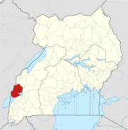
Kikorongo, also Kikorongo Junctiom, is a settlement in Kasese District, in the Western Region of Uganda.
Location
The town is located on the Fort Portal–Kasese–Mpondwe Road, about 25 kilometres (16 mi) south of Kasese.[1] This is about 38 kilometres (24 mi) east of Mpondwe, the town at the international border with DR Congo.[2] The coordinates of Kikorongo are: 0°00'00.0"N, 29°59'55.0"E (Latitude:0.000005; Longitude:29.998618).[3] As one can deduce from the latitude, the settlement sits directly at the Equator.
Points of interest
The Fort Portal–Kasese–Mpondwe Road joins the Kikorongo–Ishaka Road at Kikorongo.[4]
See also
- Katunguru
- Fort Portal–Kasese–Mpondwe Road
References
- ^ GFC (21 May 2016). "Distance between Kasese Airport, Kasese, Western Region, Uganda and Kikorongo Junction, Fort Portal–Mpondwe Road, Kasese, Western Region, Uganda". Globefeeed.com (GFC). Retrieved 21 May 2016.
- ^ GFC (21 May 2016). "Distance between Kikorongo Junction, Fort Portal-Mpondwe Road, Kasese, Western Region, Uganda and Mpondwe lhubiriha Market, Kasese, Western Region, Uganda". Globefeed.com (GFC). Retrieved 21 May 2016.
- ^ Google (21 May 2016). "Location of Kikorongo, Kasese District, Uganda" (Map). Google Maps. Google. Retrieved 21 May 2016.
- ^ Google (21 May 2016). "Junction of Fort Portal–Kasese–Mpondwe Road With Kikorongo–Ishaka Road at Kikorongo" (Map). Google Maps. Google. Retrieved 21 May 2016.
External links
- Website of Kasese District Local Government
- v
- t
- e

Capital: Kasese
- Barclays Bank of Uganda
- Centenary Bank
- Equity Bank Uganda Limited
- Stanbic Bank Uganda Limited
- PostBank Uganda
- Pride Microfinance Limited
- Hima Cement Limited
- Hotel Margarita
- Kilembe Mines
- Kilembe Cobalt Company Limited
- Bugoye Power Station
- Lubilia Hydroelectric Power Station
- Mubuku I Power Station
- Mubuku II Power Station
- Mubuku III Power Station
- Nkusi Hydroelectric Power Station
- Nyamwamba Hydroelectric Power Station
- Rwimi Hydroelectric Power Station
- Nkenda–Fort Portal–Hoima High Voltage Power Line
- Nkenda–Mpondwe–Beni High Voltage Power Line
- Mbarara–Nkenda High Voltage Power Line
- Rwenzori Mountains
- Rwenzori National Park
- Queen Elizabeth National Park
- Lake Edward
- Lake George
- Kazinga Channel
- Kasese Central Market
- Roman Catholic Diocese of Kasese
00°00′00″N 29°59′55″E / 0.00000°N 29.99861°E / 0.00000; 29.99861


