Ioway Reservation
Indian reservation in United States, Iowa Tribe of Kansas and Nebraska
Iowa Reservation | |
|---|---|
Indian reservation | |
 City of White Cloud, 1974 | |
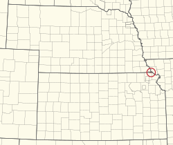 Location in Kansas and Nebraska | |
| Tribe | Iowa Tribe of Kansas and Nebraska |
| Country | United States |
| States | Kansas Nebraska |
| Counties | Brown Doniphan Richardson |
| Headquarters | White Cloud |
| Government | |
| • Body | Executive Committee |
| • Chairman | Timothy Rhodd |
| • Vice-Chairman | Alan Kelley |
| • Secretary | Anthony Fee |
| Area | |
| • Total | 12,000 acres (5,000 ha) |
| Population (2017)[2] | |
| • Total | 162 |
| • Density | 8.6/sq mi (3.3/km2) |
| Website | iowatribeofkansasandnebraska.com |
The Iowa Reservation of the Iowa Tribe of Kansas and Nebraska straddles the borders of southeast Richardson County in southeastern Nebraska and Brown and Doniphan counties in northeastern Kansas. Tribal headquarters are west of White Cloud, Kansas. The reservation was defined in a treaty from March 1861.[3] As of 2023, the tribe operates Casino White Cloud on the reservation.
History
The Iowa (or Ioway or Báxoje, their endonym) Tribe[4] originated in the Great Lakes region.[5] They migrated south and west into Missouri, but were relocated to Kansas under the provisions of the Platte Purchase of 1836. Subsequent treaties in 1854 and 1861 further reduced the Iowa land holdings to the "Diminished Reserve." A band of Iowas left the reservation for Indian Territory beginning in 1878.[5] They became the Iowa Tribe of Oklahoma. The bands that stayed became the Iowa Tribe of Kansas and Nebraska.
Today, the Iowa reservation consists of 12,000 acres (49 km2) that are almost evenly divided between the states of Kansas and Nebraska. The reservation includes parts of Brown counties in Kansas and Richardson County in Nebraska.
Size
Located along the Missouri River, the reservation was once approximately 2,100-acre (8.5 km2) reservation includes 280 acres (1.1 km2) owned by the Tribe and 210.06 acres (0.8501 km2) in tribal member allotments. There were 947.63 acres (3.8349 km2) owned by the Tribe in Kansas, with an additional 181.01 acres (0.7325 km2) in tribal member allotments. In 1995 Bureau of Indian Affairs indicated that were 1,618.7 acres (6.551 km2) of Iowa tribal lands in trust status.[6] Today the tribe reports the Iowa Tribe owns 2,707 acres (10.95 km2) within the reservation.[citation needed]
Activities
The tribe farms 1,077 acres (4.36 km2), with portions of the remaining acres balanced between in pastures and woods. There is also a haying operation that supports 150 cattle. The tribe also owns and operates Casino White Cloud and a service station, and employs 186 people. As a sovereign nation the reservation has its own police and fire department, tribal court, health clinic, community health representatives, a senior citizen center, and meal site for seniors with a delivery program. The tribe sponsors a Fourth of July rodeo, a demolition derby in August, and the Iowa Tribe Powwow each September.[7]
See also
- Native American tribes in Nebraska
- Native American tribes in Kansas (category)
- Ioway Tribal National Park
References
- ^ "Executive Committee". Retrieved 2019-07-24.
- ^ 2013-2017 American Community Survey 5-Year Estimates. "My Tribal Area". United States Census Bureau.
{{cite web}}: CS1 maint: numeric names: authors list (link) - ^ United States Department of the Interior Office of Indian Affairs. (1937) "Constitution and by-laws for the Iowa Tribe of Indians of the Iowa Reservation in Nebraska and Kansas.", United States Printing Office. Retrieved 12/1/08.
- ^ We are the Ioway, Wikidata Q122233976
- ^ a b May, John D. Iowa. Archived 2011-08-05 at the Wayback Machine Oklahoma Historical Society's Encyclopedia of Oklahoma History & Culture. 2009 (24 Feb 2009)
- ^ "Ioways today", Ioway Cultural Institute. Retrieved 12/1/08.
- ^ "Iowa tribe of Kansas and Nebraska" Archived 2009-02-21 at the Wayback Machine, Lewis and Clark in Kansas. Retrieved 12/1/08.
External links
- Reservation tract map from the US Census.

| |
|---|---|
| Historic and present tribes | |
| Present languages | |
| Present reservations | |
| Present tribal colleges and universities | |
| Historic figures | |
| Historic events | |
| Historic reservations | |
| Historic communities |
|
| Historic sacred places |
|
| Other historic places |
|
| Precontact peoples | |
| Precontact communities |
|
| Other precontact places |
|
| Other topics | |

Municipalities and communities of Brown County, Kansas, United States | ||
|---|---|---|
County seat: Hiawatha | ||
| Cities |  | |
| Unincorporated communities | ||
| Indian reservations |
| |
| Townships | ||
| Footnotes | †This community is designated a Census-Designated Place (CDP) by the United States Census Bureau. ‡This community also has portions in an adjacent county or counties. | |
| ||
Municipalities and communities of Doniphan County, Kansas, United States | ||
|---|---|---|
County seat: Troy | ||
| Cities |  | |
| Unincorporated communities | ||
| Ghost towns | ||
| Indian reservations |
| |
| Townships | ||
| Footnotes | †This community is designated a Census-Designated Place (CDP) by the United States Census Bureau. ‡This community also has portions in an adjacent county or counties. | |
| ||
Municipalities and communities of Richardson County, Nebraska, United States | ||
|---|---|---|
County seat: Falls City | ||
| Cities |  | |
| Villages | ||
| Unincorporated communities | ||
| Indian reservations |
| |
| Footnotes | ‡This populated place also has portions in an adjacent county or counties | |
| ||
39°59′41″N 95°23′11″W / 39.99472°N 95.38639°W / 39.99472; -95.38639


