Heukewalde
Municipality in Thuringia, Germany

Coat of arms
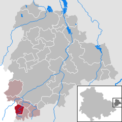
Location of Heukewalde within Altenburger Land district
(2022–28) Maik Piewak[1]
(2022-12-31)[2]
04626
Heukewalde is a German municipality in the Thuringian Landkreis of Altenburger Land. It belongs to the Verwaltungsgemeinschaft of Oberes Sprottental.
Geography
Neighboring Municipalities
Communities near Heukewalde include: Jonaswalde, Posterstein, and Vollmershain in the Landkreis of Altenburger Land; as well as Rückersdorf und Paitzdorf in the Landkreis of Greiz.
History
Heukewalde was first mentioned in writing on December 9, 1152. From 1826 to 1920, it belonged to Saxe-Altenburg.
Mayors
Bernhard Göpel, mayor from 1892 to 1917.[citation needed]
External links
- (in German) A Heukewalde Chronicle (coat of arms)
Wikimedia Commons has media related to Heukewalde.
References
- ^ Gewählte Bürgermeister - aktuelle Landesübersicht, Freistaat Thüringen, accessed 10 November 2022.
- ^ "Bevölkerung der Gemeinden, erfüllenden Gemeinden und Verwaltungsgemeinschaften in Thüringen Gebietsstand: 31.12.2022" (in German). Thüringer Landesamt für Statistik. June 2023.
- v
- t
- e
Towns and municipalities in Altenburger Land
- Altenburg
- Dobitschen
- Fockendorf
- Gerstenberg
- Göhren
- Göllnitz
- Göpfersdorf
- Gößnitz
- Haselbach
- Heukewalde
- Heyersdorf
- Jonaswalde
- Kriebitzsch
- Langenleuba-Niederhain
- Löbichau
- Lödla
- Lucka
- Mehna
- Meuselwitz
- Monstab
- Nobitz
- Ponitz
- Posterstein
- Rositz
- Schmölln
- Starkenberg
- Thonhausen
- Treben
- Vollmershain
- Windischleuba

Authority control databases | |
|---|---|
| International |
|
| National |
|
 | This Altenburger Land location article is a stub. You can help Wikipedia by expanding it. |
- v
- t
- e


