Hattula
You can help expand this article with text translated from the corresponding article in Finnish. (June 2023) Click [show] for important translation instructions.
- Machine translation, like DeepL or Google Translate, is a useful starting point for translations, but translators must revise errors as necessary and confirm that the translation is accurate, rather than simply copy-pasting machine-translated text into the English Wikipedia.
- Do not translate text that appears unreliable or low-quality. If possible, verify the text with references provided in the foreign-language article.
- You must provide copyright attribution in the edit summary accompanying your translation by providing an interlanguage link to the source of your translation. A model attribution edit summary is
Content in this edit is translated from the existing Finnish Wikipedia article at [[:fi:Hattula]]; see its history for attribution. - You may also add the template
{{Translated|fi|Hattula}}to the talk page. - For more guidance, see Wikipedia:Translation.
Municipality in Kanta-Häme, Finland

Coat of arms
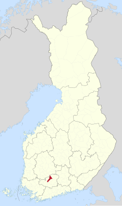
Location of Hattula in Finland
 Finland
 Kanta-Häme
 (2018-01-01)[1]
(2023-12-31)[2]
Hattula (Finnish: [ˈhɑtːulɑ]) is a municipality of Finland. It is part of the Tavastia Proper region and until 2010 it was located in the province of Southern Finland. Hattula is almost completely surrounded by Hämeenlinna, only in the north it shares the border with Valkeakoski and Pälkäne on the Pirkanmaa region side.
The municipality has a population of 9,371 (31 December 2023)[2] and covers an area of 427.39 square kilometres (165.02 sq mi) of which 69.55 km2 (26.85 sq mi) is water.[1] The population density is 26.19 inhabitants per square kilometre (67.8/sq mi). Its seat is in Parola.
The municipality is unilingually Finnish.
A central element of the landscape in Hattula is lake Vanajavesi by which most of the oldest settlements in the area are concentrated. A notable monument is the Holy Cross Church in Hattula.
The main attractions of Hattula are based on the long history of the municipality as a church pilgrimage site and the location of the Parolannummi garrison. The Armoured Brigade operates in the Parola garrison. Also close to the garrison are the Armour Museum, presenting the history of Finnish armoured and anti-tank troops, and the Paragon Lion sculpture by Andreas Fornander. The Lion of Parola is a statue of a lion holding a ball in his paw, commemorating the visit of Emperor Alexander II of Russia to Parolannummi on July 29, 1863. The same theme is repeated in the flag of the Finnish army's Armour School. A monument of more than five meters is located on the southern edge of the garrison training ground.
There are three Evangelical Lutheran churches in the municipality: the medieval Church of the Holy Cross, the new Hattula church built in the 1850s and the Tyrväntö church built in the late 18th and early 19th centuries in Suotaala. In addition to these, the Pentecostal Church's Home Church also operates in the center of the municipality.
The long manor culture in Hattula is represented by the manors of Ahlbacka, Ellilä, Metsänkylä, Lepaa,[5] Lahdentaka, Suontaka and Vesunti. In addition to the Iron Age Tenhola Castle Mountain, earlier settlement in the area is also evidenced by numerous archaeological finds. The historic Hämeen Härkätie (connecting road 2855) also passes the track in the Hattula area in the villages of Kivijoki and Kouvala.
Astronomer Anders Planman was born in Hattula.[6] He was one of the first persons to make systematical astronomical observations in Finland.
See also
References
- ^ a b "Area of Finnish Municipalities 1.1.2018" (PDF). National Land Survey of Finland. Retrieved 30 January 2018.
- ^ a b c "Population growth biggest in nearly 70 years". Population structure. Statistics Finland. 26 April 2024. ISSN 1797-5395. Retrieved 29 April 2024.
- ^ "Population according to age (1-year) and sex by area and the regional division of each statistical reference year, 2003–2020". StatFin. Statistics Finland. Retrieved 2 May 2021.
- ^ a b "Luettelo kuntien ja seurakuntien tuloveroprosenteista vuonna 2023". Tax Administration of Finland. 14 November 2022. Retrieved 7 May 2023.
- ^ "Lepaan puutarhaopisto toimii keskiaikaisessa kartanossa", Kansanuutiset 7 August 2013. Retrieved 18 December 2019
- ^ "Planman, Anders (1724-1803)" (in Finnish). Kansallisbiografia. Retrieved 23 December 2023.
External links
![]() Media related to Hattula at Wikimedia Commons
Media related to Hattula at Wikimedia Commons
- Municipality of Hattula – Official website
Places adjacent to Hattula | ||||||||||||||||
|---|---|---|---|---|---|---|---|---|---|---|---|---|---|---|---|---|
| ||||||||||||||||


- v
- t
- e

Authority control databases | |
|---|---|
| International |
|
| National |
|
| Geographic |
|
| Other |
|
 | This Southern Finland location article is a stub. You can help Wikipedia by expanding it. |
- v
- t
- e


