Frenchport, Arkansas
Unincorporated community in Arkansas, United States
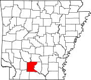
33°28′16″N 92°46′41″W / 33.47111°N 92.77806°W / 33.47111; -92.77806Frenchport is an unincorporated community in Ouachita County, Arkansas, United States. Frenchport is located on local roads 8.4 miles (13.5 km) south-southeast of Camden.[2] The Capt. John T. Burkett House, which is listed on the National Register of Historic Places, is located near Frenchport.[3]
References
- ^ "Frenchport". Geographic Names Information System. United States Geological Survey, United States Department of the Interior.
- ^ Ouachita County, Arkansas General Highway Map (PDF) (Map). Arkansas State Highway and Transportation Department. 2008. Archived from the original (PDF) on September 23, 2015. Retrieved December 1, 2012.
- ^ "National Register Information System". National Register of Historic Places. National Park Service. July 9, 2010.
- v
- t
- e
Municipalities and communities of Ouachita County, Arkansas, United States
County seat: Camden
communities
- Amy
- Cullendale
- Frenchport
- Rendezvous
- Tates Bluff
‡This populated place also has portions in an adjacent county or counties
- Arkansas portal
- United States portal
 | This article about a location in Ouachita County, Arkansas is a stub. You can help Wikipedia by expanding it. |
- v
- t
- e


