Fairweather Range
58°54′26″N 137°31′36″W / 58.90722°N 137.52667°W / 58.90722; -137.52667Dimensions Area 9,936 km2 (3,836 sq mi) Geography Countries United States and Canada States/Provinces Alaska and British Columbia Parent range Saint Elias Mountains 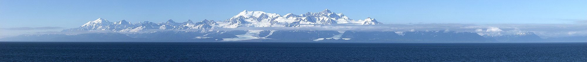 A panorama of the Fairweather Range from the Pacific Ocean. Mts. Crillon, Dagelet, and La Perouse centered.
The Fairweather Range is the unofficial name for a mountain range located in the U.S. state of Alaska and the Canadian province of British Columbia. It is the southernmost range of the Saint Elias Mountains. The northernmost section of the range is situated in Tatshenshini-Alsek Provincial Park while the southernmost section resides in Glacier Bay National Park,[1] in the Hoonah-Angoon Census Area.[2] In between it goes through the southeastern corner of Yakutat Borough. Peaks of this range include Mount Fairweather (the highest point in British Columbia) and Mount Quincy Adams 4,150 m (13,615 ft).
The range is home to the Fairweather Fault, an active geologic transform fault of the larger Queen Charlotte Fault along the boundary between the Pacific and North American plates.
Mountains
- Mount Abbe
- Mount Cooper
- Mount Crillon
- Mount Dagelet
- Mount Eliza
- Mount Fairweather
- Mount Forde
- Mount La Perouse
- Mount Lodge
- Mount Orville
- Mount Quincy Adams
- Mount Root
- Mount Salisbury
- Mount Tlingit
- Mount Turner
- Mount Watson
- Mount Wilbur
Panorama

See also
- Alsek Ranges - mountain range to the east
- Centennial Range - mountain range to the northwest
References
External links
- "Fairweather Ranges". BC Geographical Names.
- v
- t
- e
 | This article about a location in the Hoonah-Angoon Census Area, Alaska is a stub. You can help Wikipedia by expanding it. |
- v
- t
- e
 | This article about a location in the City and Borough of Yakutat, Alaska is a stub. You can help Wikipedia by expanding it. |
- v
- t
- e


