Bethel Township, Bladen County, North Carolina
Township in North Carolina, United States
Bethel Township, Bladen County, North Carolina | |
|---|---|
Township | |
 Location of Bethel Township in Bladen County | |
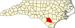 Location of Bladen County in North Carolina | |
| Country | United States |
| State | North Carolina |
| County | Bladen |
| Area | |
| • Total | 42.00 sq mi (112.22 km2) |
| Highest elevation [2] (south of Dublin, North Carolina) | 150 ft (50 m) |
| Lowest elevation [2] (Bakers Creek) | 43 ft (13 m) |
| Population (2010) | |
| • Total | 4,467[3] |
| • Density | 106.35/sq mi (41.06/km2) |
| Time zone | UTC-4 (EST) |
| • Summer (DST) | UTC-5 (EDT) |
| Area codes | 910, 472 |
Bethel Township, population 4,467, is one of fifteen townships in Bladen County, North Carolina. Bethel Township is 43.33 square miles (112.2 km2)[1] in size and is located in western Bladen County. The Town of Dublin is within Bethel Township.
Geography
The west side of Bethel Township is drained by Black Swamp, Reedy Meadow Swamp, and Bear Ford Swamp which drain to the Lumber River. The east side is drained by Bakers Creek, a tributary of the Cape Fear River.
References
- ^ a b "NC OneMap". www.nconemap.gov. State of North Carolina. Retrieved September 13, 2020.
- ^ a b "The National Map - Service Endpoints". viewer.nationalmap.gov. US Geological Survey. Archived from the original on October 16, 2020. Retrieved September 13, 2020.
- ^ "US Census Bureau". data.census.gov. US Census Bureau. Retrieved September 13, 2020.
- v
- t
- e
Municipalities and communities of Bladen County, North Carolina, United States
County seat: Elizabethtown
- Bladenboro
- Clarkton
- Dublin
- East Arcadia
- Elizabethtown
- Tar Heel
- White Lake

communities
- North Carolina portal
- United States portal
34°39′29″N 78°44′34″W / 34.65797°N 78.74276°W / 34.65797; -78.74276
This article about a location in Bladen County, North Carolina is a stub. You can help Wikipedia by expanding it. |
- v
- t
- e


