Arabia quadrangle
Map of Mars
15°00′N 337°30′W / 15°N 337.5°W / 15; -337.5
The Arabia quadrangle is one of a series of 30 quadrangle maps of Mars used by the United States Geological Survey (USGS) Astrogeology Research Program. The Arabia quadrangle is also referred to as MC-12 (Mars Chart-12).[1]
The quadrangle contains part of the classic area of Mars known as Arabia. It also contains a part of Terra Sabaea and a small part of Meridiani Planum. It lies on the boundary between the young northern plains and the old southern highlands. The quadrangle covers the area from 315° to 360° west longitude and 0° to 30° north latitude.
Description
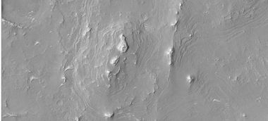
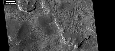
The surface of the Arabia quadrangle appears to be very old because it has a high density of craters, but it is not near as high in elevation as typical old surfaces. On Mars the oldest areas contain the most craters; the oldest period is called Noachian after the quadrangle Noachis.[2] The Arabia area contains many buttes and ridges. Some believe that during certain climate changes an ice-dust layer was deposited; later, parts were eroded to form buttes.[3] Some outflow channels are found in Arabia, namely Naktong Vallis, Locras Valles, Indus Vallis, Scamander Vallis, and Cusus Valles.[4]
Layers
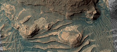
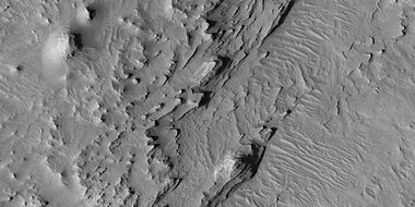
Many places in Arabia are shaped into layers.[5] The layers can be a few meters thick or tens of meters thick. Recent research on these layers by scientists at California Institute of Technology (Caltech) suggest that ancient climate change on Mars caused by regular variation in the planet's tilt, or obliquity may have caused the patterns in the layers. On Earth, similar changes (astronomical forcing) of climate results in ice-age cycles.
A recent study of layers in craters in western Arabia revealed much about the history of the layers. Although the craters in this study are just outside the boundary for the Arabia quadrangle the findings would probably apply to the Arabia quadrangle as well. The thickness of each layer may average less than 4 meters in one crater, but 20 meters in another. The pattern of layers measured in Becquerel crater, suggests that each layer was formed over a period of about 100,000 years. Moreover, every 10 layers were bundled together into larger units. The 10-layer pattern is repeated at least 10 times. So every 10-layer pattern took one-million years to form.
The tilt of the Earth's axis changes by only a little more than 2 degrees; it is stabilized by the relatively large mass of the Moon. In contrast Mars's tilt varies by tens of degrees. When the tilt (or obliquity) is low, the poles are the coldest places on the planet, while the equator is the warmest—as on Earth. This causes gases in the atmosphere, like water and carbon dioxide, to migrate pole ward, where they freeze. When the obliquity is higher, the poles receive more sunlight, causing those materials to migrate away. When carbon dioxide moves from the poles, the atmospheric pressure increases, maybe causing a difference in the ability of winds to transport and deposit sand. Also, with more water in the atmosphere sand grains may stick and cement together to form layers. This study of the thickness of layers was done using stereo topographic maps obtained by processing data from the high-resolution camera onboard NASA's Mars Reconnaissance Orbiter.[6]
Recent research leads scientists to believe that some of the craters in Arabia may have held huge lakes. Cassini Crater and Tikonravov Crater probably once were full of water since their rims seem to have been breached by water. Both inflow and outflow channels have been observed on their rims. Each of these lakes would have contained more water than Earth's Lake Baikal, our largest freshwater lake by volume. The watersheds for lakes in Arabia seem to be too small to gather enough water by precipitation alone; therefore it is thought that much of their water came from groundwater.[7]
Another group of researchers proposed groundwater with dissolved minerals came to the surface, in and later around craters, and helped to form layers by adding minerals (especially sulfate) and cementing sediments. Upon close examination, Arabia layers appear to have a slight tilt. This tilt supports formation with the action of a rising water table. A water table generally follows the topography. Since the layers slope slightly down toward the northwest, the layers may have been created by groundwater, rather than a single large sea that has been suggested.
This hypothesis is supported by a groundwater model and by sulfates discovered in a wide area.[8][9] At first, by examining surface materials with the Opportunity rover, scientists discovered that groundwater had repeatedly risen and deposited sulfates.[10][11][12][13][14] Later studies with instruments on board the Mars Reconnaissance Orbiter showed that the same kinds of materials exist in a large area that included Arabia.[15]

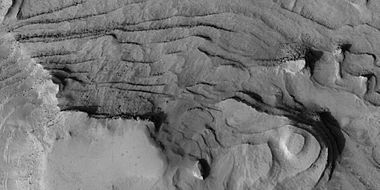
Layers and faults in Arabia quadrangle--HiRISE Picture of the Day (September 25, 2021)
-
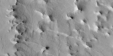
 Layers some with overhang
 -
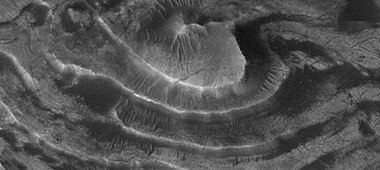
 Layers and layered mounds. Each layer records some sort of change and water may have been involved.
 -
 Layers. Dark parts are basalt sand that has settled on horizontal surfaces.
 -
 Close, color view of layers. Light brown is from dust falling from sky. Dark parts are basalt sand that has settled on horizontal surfaces.
 -
 Layers in Monument Valley. These are accepted as being formed, at least in part, by water deposition. Since Mars contains similar layers, water remains as a major cause of layering on Mars.
 -
 Layers in Gill crater, as seen by HiRISE under HiWish program
 -
 Close-up of layers in Gill crater, as seen by HiRISE under HiWish program
 -
 Close-up of layers on edge of a mesa in Gill crater, as seen by HiRISE under HiWish program
 -
 Layers under cap rock of a pedestal crater, as seen by HiRISE under HiWish program. Pedestal crater is within the much larger Tikhonravov Crater.
 -
 Layers under cap rock of a pedestal crater, as seen by HiRISE under HiWish program. Pedestal crater is within the much larger Tikhonravov Crater.
 -
 Close-up of some layers under cap rock of a pedestal crater, as seen by HiRISE under HiWish program
 -
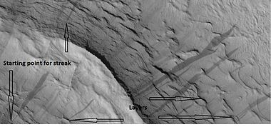
 Close-up of some layers under cap rock of a pedestal crater and a dark slope streak, as seen by HiRISE under HiWish program
 -
 Layers in a butte in Arabia, as seen by HiRISE under HiWish program
 -
 Layers in Arabia, as seen by HiRISE under HiWish program
 -
 Wide view of layers, as seen by HiRISE under HiWish program
 -
 Close view of layers, as seen by HiRISE under HiWish program
 -
 Close view of layers, as seen by HiRISE under HiWish program. At least one layer is light-toned which may indicated hydrated minerals.
 -
 Close view of layers, as seen by HiRISE under HiWish program
 -
 Wide view of layers, as seen by HiRISE under HiWish program
 -
 Close view of layers from previous image, as seen by HiRISE under HiWish program
 -
 Close view of layers from previous image, as seen by HiRISE under HiWish program
 -
 Close view of layers from a previous image, as seen by HiRISE under HiWish program
 -
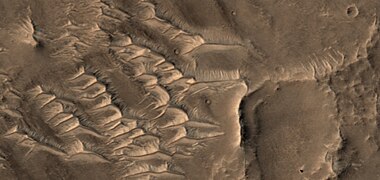
 Wide view of layered mesas and buttes, as seen by HiRISE under HiWish program
 -
 Close view of layered butte, as seen by HiRISE under HiWish program
 -
 Layered butte, as seen by HiRISE under HiWish program
 -
 Layered butte, as seen by HiRISE under HiWish program
 -
 Close view of layers and dunes, as seen by HiRISE under HiWish program. Light-toned material may contain hydrated minerals.


-
 Wide view of layers in crater, as seen by HiRISE under HiWish program. Parts of this image are enlarged in other images that follow.
 -
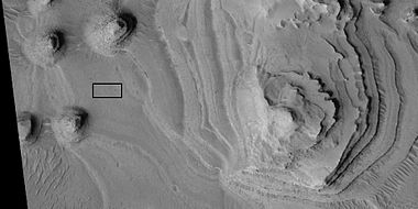
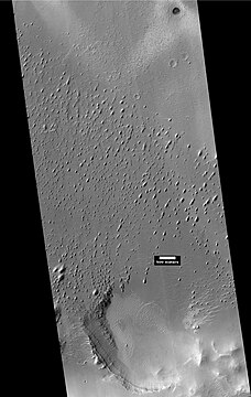
 Close view of layers, as seen by HiRISE under HiWish program. Box shows the size of a football field.
 -
 Close view of layers, as seen by HiRISE under HiWish program. Box shows the size of a football field.
 -
 Close view of layers, as seen by HiRISE under HiWish program
 -
 Close view of layers, as seen by HiRISE under HiWish program. Box shows the size of a football field.
 -
 Close view of layers, as seen by HiRISE under HiWish program
 -
 Close view of layers, as seen by HiRISE under HiWish program
 -
 Close view of layers, as seen by HiRISE under HiWish program
 -
 Close view of layers, as seen by HiRISE under HiWish program
 -
 Close view of layers, as seen by HiRISE under HiWish program
 -
 Layers and buttes, as seen by HiRISE under HiWish program
 -
 Layers as seen by HiRISE. Picture is about 1 km across.
 -
 Layers, as seen by HiRISE. Picture is about 1 Km across.
 -
 Close view of layers with a pyramid shape on top. Picture taken with HiRISE.


Light-toned materials
Certain areas of Mars show ground that has a much lighter-tone than most other areas. Much of the surface of Mars is dark because of extensive flows of the dark lave rock basalt. Studies with spectroscopes from orbit have shown that many light-toned areas contain hydrated minerals, and/or clay minerals.[16][17][18][19] That means that water was once there in order to produce these substances. In short, light-toned materials are markers for the past presence of water.
-
 Wide view of light-toned surfaces, as seen by HiRISE under HiWish program
 -
 Close view of light-toned surfaces, as seen by HiRISE under HiWish program
 -
 Wide view of region showing some places with light-toned materials, as seen by HiRISE under HiWish program


Craters
Impact craters generally have a rim with ejecta around them, in contrast volcanic craters usually do not have a rim or ejecta deposits. As craters get larger (greater than 10 km in diameter) they usually have a central peak.[20] The peak is caused by a rebound of the crater floor following the impact.[21] Sometimes craters display layers. Since the collision that produces a crater is like a powerful explosion, rocks from deep underground are tossed unto the surface. Hence, craters can show us what lies deep under the surface.
Some craters in Arabia are classified as pedestal craters. A pedestal crater is a crater with its ejecta sitting above the surrounding terrain and thereby forming a raised platform. They form when an impact crater ejects material which forms an erosion resistant layer, thus protecting the immediate area from erosion. As a result of this hard covering, the crater and its ejecta become elevated, as erosion removes the softer material beyond the ejecta.[22] Some pedestals have been accurately measured to be hundreds of meters above the surrounding area. This means that hundreds of meters of material were eroded away. Pedestal craters were first observed during the Mariner missions.[22][23][24]
Researchers believe over 200 new craters are formed each year on Mars, based on study of years of HiRISE images.[25][26]
-
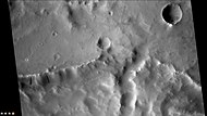
 Pedestal craters and layers in Tikonravev Crater in Arabia, as seen by Mars Global Surveyor (MGS) with the Mars Orbiter Camera, under the MOC Public Targeting Program. Layers may form from volcanoes, the wind, or by deposition under water. Some researchers believe this crater once held a massive lake.
 -
 Pedestal craters form when the ejecta from impacts protect the underlying material from erosion. As a result of this process, craters appear perched above their surroundings.
 -
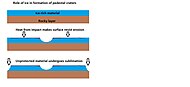 Drawing shows a later idea of how some pedestal craters form. In this way of thinking, an impacting projectile goes into an ice-rich layer—but no further. Heat and wind from the impact hardens the surface against erosion. This hardening can be accomplished by the melting of ice which produces a salt/mineral solution thereby cementing the surface.
 -
 Pedestal crater within Tikonravov Crater, as seen by HiRISE under HiWish program
 -
 Close view of layers along edge of pedestal crater from previous image, as seen by HiRISE under HiWish program
 -
 Close view of layers along edge of pedestal crater from previous image, as seen by HiRISE under HiWish program. Some dark slope streaks are visible.
 -
 Pasteur Crater Floor, as seen by HiRISE. The scale bar is 1,000 meters long
 -
 Henry Crater Mound, as seen by HiRISE. The scale bar is 500 meters long.
 -
 Mounds in craters like Henry are formed by the erosion of layers that were deposited after the impact.
 -
 Crater in the middle of Cassini, as seen by HiRISE. Layers may have been deposited under water since it is believed that Cassini once held a giant lake.
 -
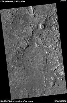
![HiRISE images showing discovery of a new crater with HiWish program. A study of the dark areas around new craters like this revealed that dark patches fade by global atmospheric dust deposition and are more likely to occur at higher-latitude sites, lower-elevation sites, and at sites with smaller central craters. Changing back to the surrounding albedo takes on average 15 martian years.[27]](//upload.wikimedia.org/wikipedia/commons/thumb/5/5a/29565_2075newcratercomposite.jpg/190px-29565_2075newcratercomposite.jpg) HiRISE images showing discovery of a new crater with HiWish program. A study of the dark areas around new craters like this revealed that dark patches fade by global atmospheric dust deposition and are more likely to occur at higher-latitude sites, lower-elevation sites, and at sites with smaller central craters. Changing back to the surrounding albedo takes on average 15 martian years.[27]
HiRISE images showing discovery of a new crater with HiWish program. A study of the dark areas around new craters like this revealed that dark patches fade by global atmospheric dust deposition and are more likely to occur at higher-latitude sites, lower-elevation sites, and at sites with smaller central craters. Changing back to the surrounding albedo takes on average 15 martian years.[27] -
 New crater, as seen by HiRISE under HiWish program. The new crater indicated with the white arrow is about 10 yards across and was probably created by the collision with an object the size of a large watermelon. This crater did not appear in earlier images of the same region.
 -
 Eastern edge of Janssen Crater, as seen by CTX camera (on Mars Reconnaissance Orbiter)
 -
 Layers and dark slope streaks in northeastern edge of Janssen Crater, as seen by CTX camera (on Mars Reconnaissance Orbiter). Note: this is an enlargement of the previous image of Janssen Crater.
 -
 Maggini Crater, as seen by CTX camera (on Mars Reconnaissance Orbiter)
 -
 Teisserenc de Bort Crater, as seen by CTX camera (on Mars Reconnaissance Orbiter)
 -
 Northern wall of Teisserenc de Bort Crater showing dark slope streaks, as seen by CTX camera (on Mars Reconnaissance Orbiter). Note this is an enlargement of the previous image.
 -
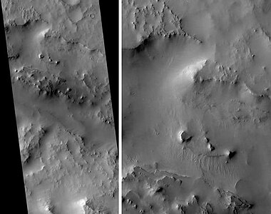
 Crater, as seen by HiRISE under HiWish program. Ejecta seems to have partially eroded away.
 -
 Close, color view of crater ejecta, as seen by HiRISE under HiWish program. Benches around mounds my mark a former water level. The hot ejecta may have melted ice in the ground forming small channels.
 -
 Brain terrain on floor of crater, as seen by HiRISE under HiWish program


![HiRISE images showing discovery of a new crater with HiWish program. A study of the dark areas around new craters like this revealed that dark patches fade by global atmospheric dust deposition and are more likely to occur at higher-latitude sites, lower-elevation sites, and at sites with smaller central craters. Changing back to the surrounding albedo takes on average 15 martian years.[27]](http://upload.wikimedia.org/wikipedia/commons/thumb/5/5a/29565_2075newcratercomposite.jpg/190px-29565_2075newcratercomposite.jpg)


Possible methane
One study with the Planetary Fourier Spectrometer in the Mars Express spacecraft found possible methane in three areas of Mars, one of which was in Arabia. One possible source of methane is from the metabolism of living bacteria.[28] However, a recent study indicates that to match the observations of methane, there must be something that quickly destroys the gas, otherwise it would be spread all through the atmosphere instead of being concentrated in just a few locations. There may be something in the soil that oxidizes the gas before it has a chance to spread. If this is so, that same chemical would destroy organic compounds, thus life would be very difficult on Mars.[29][30]
Deformation bands
The Mars Reconnaissance Orbiter showed deformation bands in Capen Crater, located in the Arabia quadrangle. Deformation bands are small faults with very small displacements.[31] They often proceed large faults. They develop in porous rocks, like sandstone. They can restrict and/or change the flow of fluids like water and oil. They are common in the Colorado Plateau.[32] Good examples form in the Entrada Sandstone in the San Rafael Swell in Utah.[33] The bands represent failure by localized frictional sliding.[34][35] The bands on Mars are a few meters wide and up to a few kilometers long. They are caused by the compression or stretching of underground layers. Erosion of overlying layers make them visible at the surface. Capen Crater was unnamed before the discovery of deformation bands. It was named for Charles Capen, who studied Mars at JPL's Table Mountain Observatory in California and at Lowell Observatory in Arizona.[36]
-
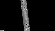
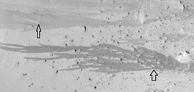
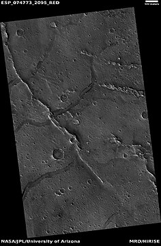
 The group of lines running up and down in the image are believed to be deformation bands. They can be thought of as small faults.

Geological history
Recent studies, reported in the journal Icarus, have suggested that the area underwent several phases in its formation:
- A large basin, maybe from an impact, was produced early in Martian history. It was so early that Mars still had a magnetic field generated by movements in a liquid core. Present day Arabia possesses a remnant magnetism from that ancient era.
- Sediments flowed into the basin. Water entered the basin.
- Because Tharsis, on the other side of Mars, became so massive, the area around Arabia was pushed out. As it bulged upward, there was increased erosion which exposed old layers. When portions of a planet that can be subject to erosion rise, there is greatly increased erosion; Earth's Grand Canyon became very deep because it was eroded into a high plateau.
- Over the following 4 billion years, the area was modified by various geological processes. Central peaks and ejecta shapes indicate that parts of Arabia are still water enriched.[37][38][39]
Dark slope streaks
Streaks are common on Mars. They occur on steep slopes of craters, troughs, and valleys. The streaks are dark at first. They get lighter with age.[40] Sometimes they start in a tiny spot, then spread out and go for hundreds of meters. They have been seen to travel around obstacles, like boulders.[41] It is believed that they are avalanches of bright dust that expose a darker underlying layer. However, several ideas have been advanced to explain them. Some involve water or even the growth of organisms.[42][43][44] Streaks appear in areas covered with dust. Much of the Martian surface is covered with dust. Fine dust settles out of the atmosphere covering everything. We know a lot about this dust because the solar panels of the Mars Rovers get covered with dust, thus reducing the electrical energy. The power of the Rovers has been restored many times by the wind, in the form of dust devils, cleaning the panels and boosting the power. So, we know that dust settles from the atmosphere then returns over and over.[45] Dust storms are frequent, especially when the spring season begins in the southern hemisphere. At that time, Mars is 40% closer to the Sun. The orbit of Mars is much more elliptical then the Earth's. That is the difference between the farthest point from the Sun and the closest point to the Sun is very great for Mars, but only a slight amount for the Earth. Also, every few years, the entire planet is engulfed in global dust storms. When NASA's Mariner 9 craft arrived there, nothing could be seen through the dust storm.[21][46] Other global dust storms have also been observed, since that time.
Research, published in January 2012 in Icarus, found that dark streaks were initiated by airblasts from meteorites traveling at supersonic speeds. The team of scientists was led by Kaylan Burleigh, an undergraduate at the University of Arizona. After counting some 65,000 dark streaks around the impact site of a group of five new craters, patterns emerged. The number of streaks was greatest closer to the impact site. So, the impact somehow probably caused the streaks. Also, the distribution of the streaks formed a pattern with two wings extending from the impact site. The curved wings resembled scimitars, curved knives. This pattern suggests that an interaction of airblasts from the group of meteorites shook dust loose enough to start dust avalanches that formed the many dark streaks. At first it was thought that the shaking of the ground from the impact caused the dust avalanches, but if that was the case the dark streaks would have been arranged symmetrically around the impacts, rather than being concentrated into curved shapes.[47][48]
-
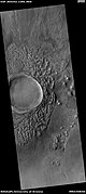
 Tikonravev Crater Floor, as seen by Mars Global Surveyor, under the MOC Public Targeting Program. Click on image to see dark slope streaks and layers.
 -
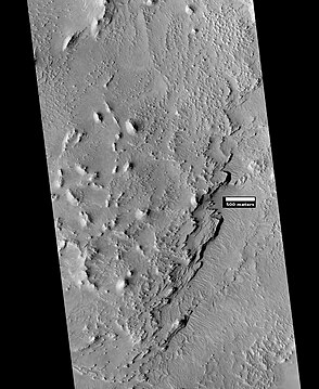
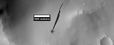
 Tikhonravov Basin Streaks and layers, as seen by HiRISE. Scale bar is 500 meters long.
 -
 Dark slope streaks near the top of a pedestal crater, as seen by HiRISE under the HiWish program
 -
 Dark slope streaks and layers near a pedestal crater, as seen by HiRISE under the HiWish program
 -
 Dark slope streaks, as seen by HiRISE under the HiWish program
 -
 Examples of dark slope streaks, as seen by HiRISE under the HiWish program
 -
 Dark slope streaks along the edge of a pedestal crater, as seen by HiRISE under the HiWish program
 -
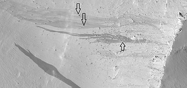 Dark slope streaks, as seen by HiRISE under the HiWish program. Arrows show how boulders affected the shape of the streaks.
 -
 Dark slope streaks, as seen by HiRISE under the HiWish program. Arrows show how boulders affected the shape of the streaks.
 -
 Dark slope streaks on a crater's walls, as seen by HiRISE under the HiWish program


Dark slope streaks can be caused by nearby impacts, as seen in the following HiRISE image of a new small impact that set off a slope streak.
-
 New streak that was caused by a recent impact that created a small crater, as seen by HiRISE

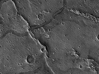
Linear ridge networks
Linear ridge networks are found in various places on Mars in and around craters.[49] Ridges often appear as mostly straight segments that intersect in a lattice-like manner. They are hundreds of meters long, tens of meters high, and several meters wide. It is thought that impacts created fractures in the surface, these fractures later acted as channels for fluids. Fluids cemented the structures. With the passage of time, surrounding material was eroded away, thereby leaving hard ridges behind. Since the ridges occur in locations with clay, these formations could serve as a marker for clay which requires water for its formation.[50][51][52] Water here could have supported past life in these locations. Clay may also preserve fossils or other traces of past life.
-
 Possible dike, as seen by HiRISE under HiWish program
 -
 Linear ridge network, as seen by HiRISE under HiWish program. Dark line is not part of the picture. Data was not gathered for that area.
 -
 Enlargement of previous image of linear ridge network, as seen by HiRISE under HiWish program
 -
 Dikes in Arabia, as seen by HiRISE, under the HiWish program. These straight features may indicate where valuable ore deposits may be found by future colonists. Scale bar is 500 meters. They may be part of linear ridges, hence related to impact craters.
 -
 Close-up of a complex group of ridges. The ridges may be the remains of old streams and/or linear ridge networks. Image taken by HiRISE under the HiWish program.
 -
 Small, straight ridges. Image taken by HiRISE under the HiWish program.
 -
 Wide view of ridges and layers, as seen by HiRISE under HiWish program
 -
 Streaks, ridges and layers, as seen by HiRISE under HiWish program. Box shows the size of a football field.
 -
 Ridges and layers, as seen by HiRISE under HiWish program
 -
 Ridges and layers, as seen by HiRISE under HiWish program


-
 Wide view of groups of ridges, as seen by HiRISE under HiWish program
 -
 Close view of groups of ridges, as seen by HiRISE under HiWish program
 -
 Close view of ridges and possible faults that are visible as straight lines, as seen by HiRISE under HiWish program. Arrow points to a narrow trough that lines up with a ridge.
 -
 Short triangular ridges, as seen by HiRISE under HiWish program. These may be some sort of dune feature combined with a ridge.
 -
 Ridges, some with pyramid shapes. These may be due to sand piling up against ridges.


Other landscape features
-
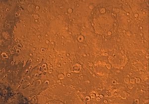
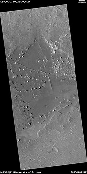
 Map of Arabia quadrangle with major craters
 -
 Naktong Vallis, as seen by HiRISE
 -
 Indus Vallis, as seen by HiRISE
 -
 Boulders and their tracks from rolling down a slope, as seen by HiRISE under HiWish program. Arrows show two boulders at the end of their tracks.
 -
 Surface cracks, as seen by HiRISE under the HiWish program. Ice-rich ground will produce cracks. Cracks will eventually get larger and larger as ice in the ground leaves due to the process of sublimation in the thin atmosphere of Mars.
 -
 Ridge cutting across another larger ridge, as seen by HiRISE under HiWish program
 -
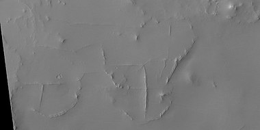
 Polygon shapes, as seen by HiRISE. Dark sand has filled in cracks in the rock.
 -
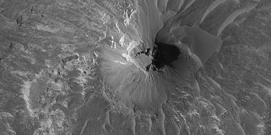
 Pyramid shape created naturally
 -
 Wide view of yardangs in Arabia quadrangle
 -
 Close view of yardangs. These features are shaped by the wind.
 -
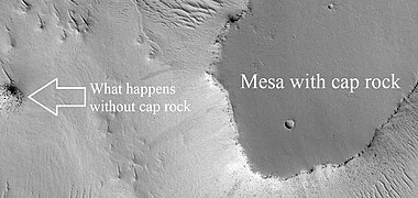 Mesa with cap rock and pile of rocks from an eroded mesa
 -
 The ridge is in top of channel; therefore, it was formed after the channel.
 -
 The ridge is in top of channel; therefore, it was formed after the channel.


Other Mars quadrangles

0°N 180°W / 0°N 180°W / 0; -180
0°N 0°W / 0°N -0°E / 0; -0
90°N 0°W / 90°N -0°E / 90; -0
MC-12
Arabia
()
- view
- talk
Interactive Mars map

(See also: Mars Rovers map and Mars Memorial map) (view • discuss)
See also
References
- ^ Davies, M.E.; Batson, R.M.; Wu, S.S.C. "Geodesy and Cartography" in Kieffer, H.H.; Jakosky, B.M.; Snyder, C.W.; Matthews, M.S., Eds. Mars. University of Arizona Press: Tucson, 1992.
- ^ Dohm J.; et al. (2007). "Possible ancient giant basin and related water enrichment in the Arabia Terra province, Mars". Icarus. 190 (1): 74–92. Bibcode:2007Icar..190...74D. doi:10.1016/j.icarus.2007.03.006.
- ^ Fassett C., Head III (2007). "Layered mantling deposits in northeast Arabia Terra, Mars: Noachian-Hesperian sedimentation, erosion, and terrain inversion". Journal of Geophysical Research. 112 (E8): 2875. Bibcode:2007JGRE..112.8002F. doi:10.1029/2006je002875.
- ^ U.S. Department of the Interior U.S. Geological Survey, Topographic Map of the Eastern Region of Mars M 15M 0/270 2AT, 1991
- ^ Grotzinger, J. and R. Milliken (eds.) 2012. Sedimentary Geology of Mars. SEPM
- ^ "Sorry - You Seem to Have Lost Your Way - SpaceRef". Archived from the original on 12 September 2012.
- ^ Fassett, C. and J. Head III. 2008. Valley network-fed, open-basin lakes on Mars: Distribution and implications for Noachian surface and subsurface hydrology. Icarus: 198. 39–56.
- ^ Andrews-Hanna J. C., Phillips R. J., Zuber M. T. (2007). "Meridiani Planum and the global hydrology of Mars". Nature. 446 (7132): 163–166. Bibcode:2007Natur.446..163A. doi:10.1038/nature05594. PMID 17344848. S2CID 4428510.
{{cite journal}}: CS1 maint: multiple names: authors list (link) - ^ Andrews-Hanna J. C., Zuber M. T., Arvidson R. E., Wiseman S. M. (2010). "Early Mars hydrology: Meridiani playa deposits and the sedimentary record of Arabia Terra". J. Geophys. Res. 115 (E6): E06002. Bibcode:2010JGRE..115.6002A. doi:10.1029/2009JE003485. hdl:1721.1/74246.
{{cite journal}}: CS1 maint: multiple names: authors list (link) - ^ "Opportunity Rover Finds Strong Evidence Meridiani Planum Was Wet". Archived from the original on 14 June 2006. Retrieved 8 July 2006.
- ^ Grotzinger J. P.; et al. (2005). "Stratigraphy and sedimentology of a dry to wet eolian depositional system, Burns formation, Meridiani Planum, Mars, Earth Planet". Sci. Lett. 240 (1): 11–72. Bibcode:2005E&PSL.240...11G. doi:10.1016/j.epsl.2005.09.039.
- ^ McLennan S. M.; et al. (2005). "Provenance and diagenesis of the evaporitebearing Burns formation, Meridiani Planum, Mars". Earth Planet. Sci. Lett. 240 (1): 95–121. Bibcode:2005E&PSL.240...95M. doi:10.1016/j.epsl.2005.09.041.
- ^ Squyres S. W., Knoll A. H. (2005). "Sedimentary rocks at Meridiani Planum: Origin, diagenesis, and implications for life on Mars, Earth Planet". Sci. Lett. 240 (1): 1–10. Bibcode:2005E&PSL.240....1S. doi:10.1016/j.epsl.2005.09.038.
- ^ Squyres S. W.; et al. (2006). "Two years at Meridiani Planum: Results from the Opportunity rover" (PDF). Science. 313 (5792): 1403–1407. Bibcode:2006Sci...313.1403S. doi:10.1126/science.1130890. PMID 16959999. S2CID 17643218.
- ^ M. Wiseman, J. C. Andrews-Hanna, R. E. Arvidson3, J. F. Mustard, K. J. Zabrusky DISTRIBUTION OF HYDRATED SULFATES ACROSS ARABIA TERRA USING CRISM DATA: IMPLICATIONS FOR MARTIAN HYDROLOGY. 42nd Lunar and Planetary Science Conference (2011) 2133.pdf
- ^ Weitz, C. et al. 2017. LIGHT-TONED MATERIALS OF MELAS CHASMA: EVIDENCE FOR THEIR FORMATION ON MARS. Lunar and Planetary Science XLVIII (2017) 2794.pdf
- ^ Weitz C.; et al. (2015). "Mixtures of clays and sulfates within deposits in western Melas Chasma, Mars". Icarus. 251: 291–314. Bibcode:2015Icar..251..291W. doi:10.1016/j.icarus.2014.04.009.
- ^ Weitz C (2016). "Stratigraphy and formation of clays, sulfates, and hydrated silica within a depression in Coprates Catena, Mars". Journal of Geophysical Research: Planets. 121 (5): 805–835. Bibcode:2016JGRE..121..805W. doi:10.1002/2015JE004954.
- ^ Bishop J.; et al. (2013). "What the ancient phyllosilicates at Mawrth Vallis can tell us about possible habitability on early Mars". Planetary and Space Science. 86: 130–149. Bibcode:2013P&SS...86..130B. doi:10.1016/j.pss.2013.05.006.
- ^ "Stones, Wind, and Ice: A Guide to Martian Impact Craters". Lpi.usra.edu. Retrieved 29 August 2011.
- ^ a b Hugh H. Kieffer (1992). Mars. University of Arizona Press. ISBN 978-0-8165-1257-7. Retrieved 7 March 2011.
- ^ a b http://hirise.lpl.eduPSP_008508_1870[permanent dead link]
- ^ Bleacher, J. and S. Sakimoto. Pedestal Craters, A Tool For Interpreting Geological Histories and Estimating Erosion Rates. LPSC
- ^ [1] Archived 18 January 2010 at the Wayback Machine
- ^ "Pow! Mars Hit by Space Rocks 200 Times a Year". Space.com. 20 May 2013.
- ^ "Brand New Impact Crater Shows up on Mars". 5 February 2014.
- ^ Daubar, I., C. Dundas, S. Byrne, P. Geissler, G. Bart, A. McEwen, P. Russell, M. Chojnacki, M. Golombek 2016. Changes in blast zone albedo patterns around new martian impact craters. Icarus: 267, 86-105.
- ^ Allen, C., D. Oehler, and E. Venechuk. Prospecting for Methane in Arabia Terra, Mars – First Results. Lunar and Planetary Science XXXVII (2006). 1193.pdf-1193.pdf.
- ^ "Reconciling Methane Variations on Mars | SpaceRef – Your Space Reference". Spaceref.com:80. 6 August 2009. Retrieved 29 August 2011.
- ^ "Mystery on Mars: Why Methane Fades Away So Fast". Space.com. 20 September 2010. Retrieved 29 August 2011.
- ^ DOI.org[dead link]
- ^ "Structural geology on the Colorado Plateau". Folk.uib.no. Archived from the original on 24 July 2011. Retrieved 29 August 2011.
- ^ Schultz, R. 2009. Fractures and Deformation Bands in Rock: A Field Guide and Journey into Geologic Fracture Mechanics. Oxford University Press
- ^ "Mars Reconnaissance Orbiter: Multimedia". Mars.jpl.nasa.gov. Retrieved 29 August 2011.
- ^ Schultz, R. and R. Siddharthan. 2005. A general framework for the occurrence and faulting of deformation bands in porous granular rocks. Tectonophysics: 411. 1–18.
- ^ [2][dead link]
- ^ Hartmann, W. 2003. A Traveler's Guide to Mars. Workman Publishing. NY NY.
- ^ Dohm, J. et al. 2007. Possible ancient giant basin and related water enrichment in the Arabia Terra province, Mars. Icarus: 190. 74–92.
- ^ Edgett, K. and M. Malin. 2002. Martian sedimentary rock stratigraphy: Outcrops and interbedded craters of northwest Sinus Meridiani and southwest Arabia Terra. Geophysical Research Letters: 29. 32.
- ^ Schorghofer N; et al. (2007). "Three decades of slope streak activity on Mars". Icarus. 191 (1): 132–140. Bibcode:2007Icar..191..132S. doi:10.1016/j.icarus.2007.04.026.
- ^ [3][dead link]
- ^ "spcae.com". spcae.com. Archived from the original on 21 February 2015. Retrieved 28 March 2011.
- ^ [4][dead link]
- ^ [5][dead link]
- ^ "Mars Spirit Rover Gets Energy Boost From Cleaner Solar Panels". Sciencedaily.com. 19 February 2009. Retrieved 28 March 2011.
- ^ Moore, Patrick (2 June 1990). Atlas of the Solar System. Crescent Books. ISBN 978-0-517-00192-9.
- ^ Burleigh Kaylan J., Melosh Henry J., Tornabene Livio L., Ivanov Boris, McEwen Alfred S., Daubar Ingrid J. (2012). "Impact air blast triggers dust avalanches on Mars". Icarus. 217 (1): 194. Bibcode:2012Icar..217..194B. doi:10.1016/j.icarus.2011.10.026.
{{cite journal}}: CS1 maint: multiple names: authors list (link) - ^ "Red Planet Report | What's new with Mars".
- ^ Head, J., J. Mustard. 2006. Breccia dikes and crater-related faults in impact craters on Mars: Erosion and exposure on the floor of a crater 75 km in diameter at the dichotomy boundary, Meteorit. Planet Science: 41, 1675-1690.
- ^ Mangold; et al. (2007). "Mineralogy of the Nili Fossae region with OMEGA/Mars Express data: 2. Aqueous alteration of the crust" (PDF). J. Geophys. Res. 112 (E8): E08S04. Bibcode:2007JGRE..112.8S04M. doi:10.1029/2006JE002835. S2CID 15188454.
- ^ Mustard et al., 2007. Mineralogy of the Nili Fossae region with OMEGA/Mars Express data: 1. Ancient impact melt in the Isidis Basin and implications for the transition from the Noachian to Hesperian, J. Geophys. Res., 112.
- ^ Mustard; et al. (2009). "Composition, Morphology, and Stratigraphy of Noachian Crust around the Isidis Basin". J. Geophys. Res. 114 (7): E00D12. Bibcode:2009JGRE..114.0D12M. doi:10.1029/2009JE003349. S2CID 17913229.
- ^ Morton, Oliver (2002). Mapping Mars: Science, Imagination, and the Birth of a World. New York: Picador USA. p. 98. ISBN 0-312-24551-3.
- ^ "Online Atlas of Mars". Ralphaeschliman.com. Retrieved 16 December 2012.
- ^ "PIA03467: The MGS MOC Wide Angle Map of Mars". Photojournal. NASA / Jet Propulsion Laboratory. 16 February 2002. Retrieved 16 December 2012.
External links
Wikimedia Commons has media related to Arabia quadrangle.


Portal:
 Solar System


