Árneshreppur
Municipality in Westfjords, Iceland

Coat of arms
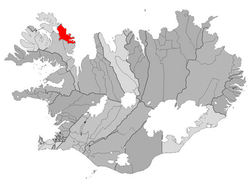
Location of Árneshreppur
524
Árneshreppur (Icelandic pronunciation: [ˈaurˌnɛsˌr̥ɛhpʏr̥] ⓘ) is an Icelandic municipality, located in the Westfjords peninsula of northwestern Iceland.[1]
The village Djúpavík at the Reykjarfjörður [ˈreiːcarˌfjœrðʏr̥] is situated in the municipality. Other villages are Gjögur [ˈcœːɣʏr̥], Norðurfjörður [ˈnɔrðʏrˌfjœrðʏr̥] and Krossnes [ˈkʰrɔsːˌnɛːs]. The area is served by Gjögur Airport.
References
- ^ "Árneshreppur", Iceland Review. Accessed 14 June 2016.
- v
- t
- e
Municipalities of Iceland
- Garðabær
- Hafnarfjarðarkaupstaður
- Kjósarhreppur
- Kópavogsbær
- Mosfellsbær
- Reykjavíkurborg
- Seltjarnarneskaupstaður
- Grindavíkurbær
- Reykjanesbær
- Suðurnesjabær
- Sveitarfélagið Vogar
- Húnabyggð
- Húnaþing vestra
- Skagabyggð
- Sveitarfélagið Skagafjörður
- Sveitarfélagið Skagaströnd
| Authority control databases |
|
|---|
 | This Iceland location article is a stub. You can help Wikipedia by expanding it. |
- v
- t
- e


