Trumbull (Connecticut)
| Trumbull | |||
|---|---|---|---|
Lage in Connecticut | |||
| Basisdaten | |||
| Gründung: | 1639 | ||
| Staat: | Vereinigte Staaten | ||
| Bundesstaat: | Connecticut | ||
| County: | Fairfield County | ||
| Koordinaten: | 41° 14′ N, 73° 13′ W41.233055555556-73.21833333333381Koordinaten: 41° 14′ N, 73° 13′ W | ||
| Zeitzone: | Eastern (UTC−5/−4) | ||
| Einwohner: | 36.827 (Stand: 2020) | ||
| Haushalte: | 11.914 (Stand: 2020) | ||
| Fläche: | 60,9 km² (ca. 24 mi²) davon 60,3 km² (ca. 23 mi²) Land | ||
| Bevölkerungsdichte: | 611 Einwohner je km² | ||
| Höhe: | 81 m | ||
| Postleitzahl: | 06611 | ||
| Vorwahl: | +1 203 | ||
| FIPS: | 09-77200 | ||
| GNIS-ID: | 0213518 | ||
| Website: | www.trumbull-ct.gov | ||
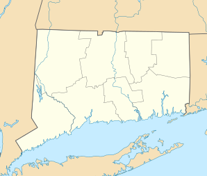

Trumbull ist eine Stadt im Fairfield County im US-amerikanischen Bundesstaat Connecticut. Das U.S. Census Bureau hat bei der Volkszählung 2020 eine Einwohnerzahl von 36.827[1] ermittelt. Die geografischen Koordinaten sind: 41,26° Nord, 73,21° West. Das Stadtgebiet hat eine Größe von 60,9 km².
Söhne und Töchter der Stadt
- Benjamin Silliman (1779–1864), Chemiker
- Eugene S. Booth (1850–1931), Missionar der American Dutch Reformed Church
- Jonathan Greenblatt (* 1970), Unternehmer, politischer Lobbyist und Propagandist
- Chris Soule (* 1973), Skeletonfahrer
- Chris Drury (* 1976), Eishockeyspieler und -funktionär
Weblinks
Commons: Trumbull (Connecticut) – Sammlung von Bildern, Videos und Audiodateien
- Offizieller Internetauftritt der Stadt Trumbull
Einzelnachweise
- ↑ Explore Census Data Trumbull town, Fairfield County, Connecticut. Abgerufen am 11. November 2022.
County Seat: Bridgeport
| Cities | Bridgeport • Danbury • Norwalk • Shelton • Stamford | |
| Towns | Bethel • Brookfield • Darien • Easton • Fairfield • Greenwich • Monroe • New Canaan • New Fairfield • Newtown • Redding • Ridgefield • Sherman • Stratford • Trumbull • Weston • Westport • Wilton | |
| CDPs | Ball Pond • Bethel • Bigelow Corners • Bogus Hill • Botsford • Branchville • Brookfield Center • Byram • Candlewood Isle • Candlewood Knolls • Candlewood Lake Club • ‡ Candlewood Orchards • Candlewood Shores • Cannondale • Coleytown • Compo • Cos Cob • Daniels Farm • Darien Downtown • Dodgingtown • East Village • Fairfield University • Georgetown • Glenville • Greens Farms • Greenwich • Hawleyville • Indian Field • Inglenook • Kellogg Point • Knollcrest • Lakes East • Lakes West • Lakeside Woods • Long Hill • Lordship • Mamanasco Lake • Mill Plain • Murray • New Canaan • Noroton • Noroton Heights • Old Greenwich • Old Hill • Oronoque • Pemberwick • Plattsville • Poplar Plains • Redding Center • Ridgebury • Ridgefield • Riverside • Rock Ridge • Route 7 Gateway • Sacred Heart University • Sail Harbor • Sandy Hook • Saugatuck • Sherman • South Wilton • Southport • Staples • Stepney • Stratford Downtown • Tashua • Taylor Corners • Tokeneke • Topstone • Trumbull Center • West Mountain • Weston • Westport Village • Wilton Center | |
| Unincorporated Communities | Aspetuck • Greenfield Hill • Hattertown • Mianus • Mill Plain • Nichols • Silvermine | |
| Borough | Newtown | |
| Geisterstadt | Little Danbury |


